IMAGES
of America
LONG BEACHS
LOS CERRITOS
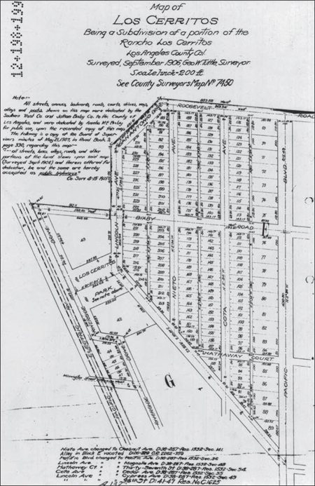
LOS CERRITOS SUBDIVISION MAP, 1906. Jotham Bixby created the Los Cerritos neighborhood in 1906 by subdividing a portion of the Rancho Los Cerritos. This survey, made by George W. Tuttle, shows the boundaries extended from Roosevelt Boulevard on the north to the intersection of Pacific Avenue and Thirty-sixth Street on the south. Cota Street on the map is today called Cedar Avenue; Nieto Street is now called Chestnut Avenue. Country Club Drive is shown on this map as Lincoln Avenue. All streets and parks were dedicated by the Southern Trust Company and Jotham Bixby Company for public use. (Courtesy of Rancho Los Cerritos.)
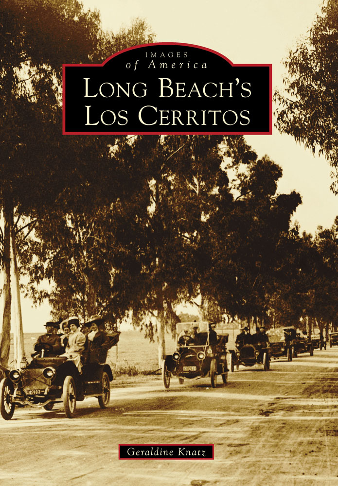
ON THE COVER: GOING TO LONG BEACH. This is a 1910 photograph of American Avenue (now Long Beach Boulevard) between Wardlow and San Antonio Roads. (Courtesy of the Long Beach Historical Society.)
IMAGES
of America
LONG BEACHS
LOS CERRITOS
Geraldine Knatz

Copyright 2014 by Geraldine Knatz
ISBN 978-1-4671-3129-2
Ebook ISBN 9781439642917
Published by Arcadia Publishing
Charleston, South Carolina
Library of Congress Control Number: 2013947215
For all general information, please contact Arcadia Publishing:
Telephone 843-853-2070
Fax 843-853-0044
E-mail
For customer service and orders:
Toll-Free 1-888-313-2665
Visit us on the Internet at www.arcadiapublishing.com
To the support and continued growth of our neighborhood treasure, the Rancho Los Cerritos, and to my family, John, Patrick, and J.R. Mulvey.
CONTENTS
ACKNOWLEDGMENTS
Ellen Calomiris and Steve Iverson of Rancho Los Cerritos provided a great amount of assistance, including reviewing drafts of the book and searching out and scanning photographs. I also want to thank the Long Beach Historical Society, especially Julie Bartolotto, Tim Friden, and Ashley Franks-McGill, for assistance in finding photographs. I am particularly indebted to members of the Vignes family, who gladly shared information, especially Ellen Collins, who had enough faith in me to send me her original photographs for scanning. Margaret Wilkinson Mahannah has lovingly preserved a history of her years at Los Cerritos and shared her collection with me. James G. Craig Jr. assisted in identifying photographs and connecting me with old-timers from the neighborhood. My husband Johns photographic skills were instrumental is getting good photographs of homes featured in this book. The Neighbors of Los Cerritos, a loose collection of residents dedicated to making the rancho known to all neighborhood residents, was part of the inspiration for the creation of this book. Begun by Patrick Murphy in 2004, the group hosts events to introduce the rancho to Los Cerritos residents. In 2006, the Neighbors organized a centennial celebration for the Los Cerritos neighborhood. Neighbors were urged to share old photographs. To ensure that the efforts and photographs collected were made available to the widest audience, this book has been prepared. All author royalties will accrue to the Rancho Los Cerritos, whose continued support is vital for our community. Finally, Loretta Berner, a local historian who grew up on the McGill, Smith, Malhardt bean ranch, was the first person I interviewed about Los Cerritos history. She happily shared the results of her previous research with me. She wanted the history of this neighborhood to be preserved and a book written, and she passed that desire on to me. Images provided by the Rancho Los Cerritos Historic Site are labeled RLC; those from the Historical Society of Long Beach are labeled HSLB; images from Virginia Country Club are labeled VCC; and those from Los Cerritos School are identified by LCS.
Unless otherwise noted, all photographs are courtesy of the author.
INTRODUCTION
Los Cerritos is a vibrant, primarily residential community in northern Long Beach. The name Los Cerritos means little hills, reflecting the geography of Signal Hill and the small hills of the surrounding areas, such as Bixby Knolls. Los Cerritos began as a 27,000-acre rancho, operated primarily as a single cattle ranch. It evolved over time into ranches separately operated as part of the rancho. Smaller ranches were sold to create the Los Cerritos Colony; ultimately, land was subdivided into residential lots.
In 1784, Gov. Pedro Fages awarded a large land grant to Manuel Perez Nieto, a leather-jacket soldier who arrived in Alta California around 1771. Nietos grant stretched between the coastline and the main road leading from Los Angeles to San Diego, and between the Santa Ana and San Gabriel Rivers. When Nieto died, his land was divided into six parcels. Nietos daughter Manuela Nieto de Cota received 27,000 acres, which became known as the Rancho Los Cerritos. The Cotas built the first adobe structures on the land, known as the Cerritos. No evidence of this adobe currently exists. In 1843, the land was sold to John Temple, a transplanted Easterner who had business operations in Los Angeles. At its peak, Temple pastured 15,000 cattle, 7,000 sheep, and 3,000 horses. The export of hides through the port at San Pedro made Temple a rich man. In the 1860s, however, severe drought caused thousands of cattle to die, and Temple never restocked.
In 1866, Flint, Bixby & Company purchased the 27,000-acre rancho from John Temple for $20,000, about 75 cents an acre. Jotham Bixby became the manager and, three years later, he purchased half ownership of the rancho, organizing the firm of J. Bixby and Company. Living at the rancho for 15 years, Bixby raised his family along with 30,000 head of sheep.
As the sheep operation scaled down, Bixby focused his attention on subdividing his property. Much of the land of the Rancho Los Cerritos was divided into small farms or sold. Some farms were leased to tenants and used to grow grains or operate dairies under the direct supervision of Jotham or his son George H. Bixby. In 1890, George Bixby built a large home that became the center of the ranch management, which today is at 11 La Linda Drive. When Jotham Bixby moved his family from the rancho in 1881, he rented it to William Boyle, who ran a dairy for about 10 years. Boyle left the adobe in 1906, and Oscar King took over the dairy.
Jotham Bixby supported the California Immigrant Union, an organization formed by the San Francisco Chamber of Commerce to promote bringing immigrants and Easterners to California to settle the land. The purpose of the union was to facilitate the subdivision of large land holdings for these new California residents. By 1870, land values in Los Angeles County were $7 per acre and rising, and in 1878, Jotham Bixby began selling off portions of the rancho, including 1,400 acres that became the Wilmington Colony. The Cerritos Colony was part of the Wilmington Colony or, as it was sometimes called, the Wilmington Colony Tract. Bixby made sales to a number of individuals, and these individual sales of small ranches comprised the Cerritos Colony. Many of the buyers were Southern Methodists or members of the Holiness Church. Originally called the Southern Methodist Colony before being renamed the Cerritos Colony, the land was situated three miles east of Wilmington, with Willow Street and Perris Road, now known as Santa Fe Avenue, as its major thoroughfares. In 1867, a major flood caused the San Gabriel River to alter its course and cut through the central part of the rancho, and the low land along the river sprouted willow trees. Because of all the willow trees in the area, the Cerritos Colony was often called The Willows.
Next page

