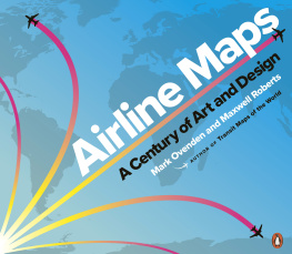
Mark Ovenden - Airline Maps: A Century of Art and Design
Here you can read online Mark Ovenden - Airline Maps: A Century of Art and Design full text of the book (entire story) in english for free. Download pdf and epub, get meaning, cover and reviews about this ebook. year: 2019, publisher: Penguin Books, genre: Home and family. Description of the work, (preface) as well as reviews are available. Best literature library LitArk.com created for fans of good reading and offers a wide selection of genres:
Romance novel
Science fiction
Adventure
Detective
Science
History
Home and family
Prose
Art
Politics
Computer
Non-fiction
Religion
Business
Children
Humor
Choose a favorite category and find really read worthwhile books. Enjoy immersion in the world of imagination, feel the emotions of the characters or learn something new for yourself, make an fascinating discovery.

- Book:Airline Maps: A Century of Art and Design
- Author:
- Publisher:Penguin Books
- Genre:
- Year:2019
- Rating:4 / 5
- Favourites:Add to favourites
- Your mark:
Airline Maps: A Century of Art and Design: summary, description and annotation
We offer to read an annotation, description, summary or preface (depends on what the author of the book "Airline Maps: A Century of Art and Design" wrote himself). If you haven't found the necessary information about the book — write in the comments, we will try to find it.
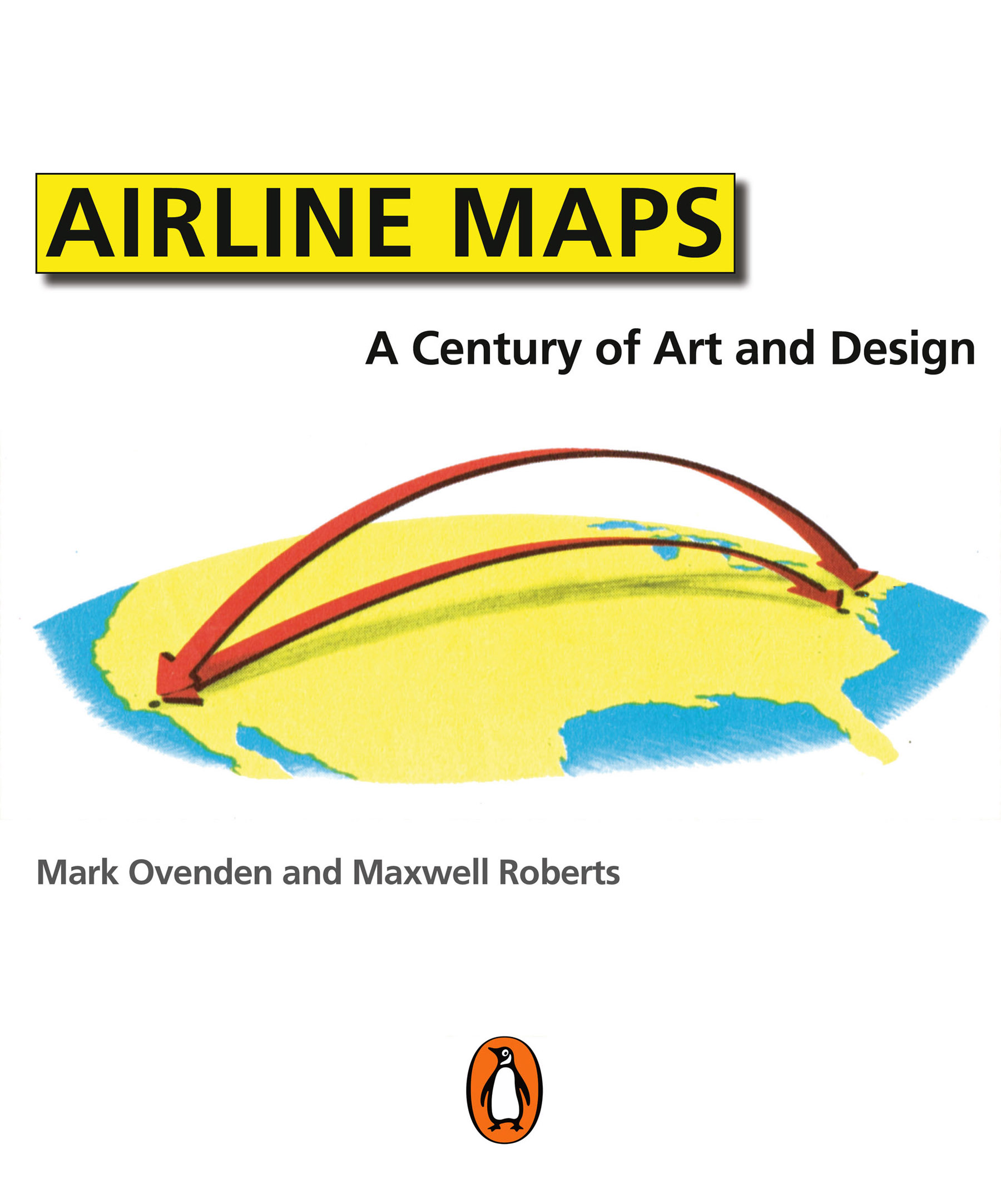
In this gorgeously illustrated collection of airline route maps, Mark Ovenden and Maxwell Roberts look to the skies and transport readers to another time. Hundreds of images span a century of passenger flight, from the rudimentary trajectory of routes to the most intricately detailed birds-eye views of the land to be flown over. Advertisements for the first scheduled commercial passenger flights featured only a few destinations, with stunning views of the countryside and graphics of biplanes. As aviation took off, speed and mileage were trumpeted on bold posters featuring busy routes. Major airlines produced highly stylized illustrations of their global presence, establishing now-classic brands. With trendy and forward-looking designs, cartographers celebrated the coming together of different cultures and made the earth look ever smaller.
Eventually, fleets got bigger and routes multiplied, and graphic designers have found creative new ways to display huge amounts of information. Airline hubs bring their own cultural mark and advertise their plentiful destination options. Innovative maps depict our busy world with webs of overlapping routes and networks of low-cost city-to-city hopping. But though flying has become more commonplace, Ovenden and Roberts remind us that early air travel was a glamorous affair for good reason. Airline Maps is a celebration of graphic design, cartographic skills and clever marketing, and a visual feast that reminds us to enjoy the journey as much as the destination.
Mark Ovenden: author's other books
Who wrote Airline Maps: A Century of Art and Design? Find out the surname, the name of the author of the book and a list of all author's works by series.


Airline Maps: A Century of Art and Design — read online for free the complete book (whole text) full work
Below is the text of the book, divided by pages. System saving the place of the last page read, allows you to conveniently read the book "Airline Maps: A Century of Art and Design" online for free, without having to search again every time where you left off. Put a bookmark, and you can go to the page where you finished reading at any time.
Font size:
Interval:
Bookmark:
Habib Aidroos, Bill Allen, Freja Annamatz, Helen Barnes, Clasonda Armstrong-Grandison, Mike Ashworth, Gklavas Athanasios, Eytan Atias, Cameron Booth, Natalya Borisovskaya, Matthew Brellis, Christian Van Buggenhout, Pat Chessell, Mark Cox, David Crotty, Jim Davies, Martin Dodge, Paula Donaghy, Bradford Drazen, Parker Field, Gayna Fitzgerald, Marie Force, Stephen Gay, Jonathan Gesmundo, Debashis Golder, Sietske De Groot, Phil Harper, Tom Heitzman, Consuelo Arias Hernndez, Kate Igoe, Inka Ikonen, Neda Jaafari, Dick Janson, Rohandra John, Jon Kallwejt, Christina Kobel, Daniel Kusrow, Bjorn Larsson, Alexandra Martins, Chris McCloud, Holly Mitchell, Lra Margrt Mller, Pramila Banymandhub Nowbuth, Gerard OShea, Denis Parenteau, Gordana Pavlovic, Laurence Penney, Olivier Gilles Rebours, George Ritchie, Andrea Rodriguez, Linnette Romero, Carolyn Russo, Christian Rysler, Chris Saynor, Hannah Searle, Rob Shepherd, Valentina Taddeo, Nuttavika Tamthai, Michael Walton, Barry Weekley, Karl Wuethrich.
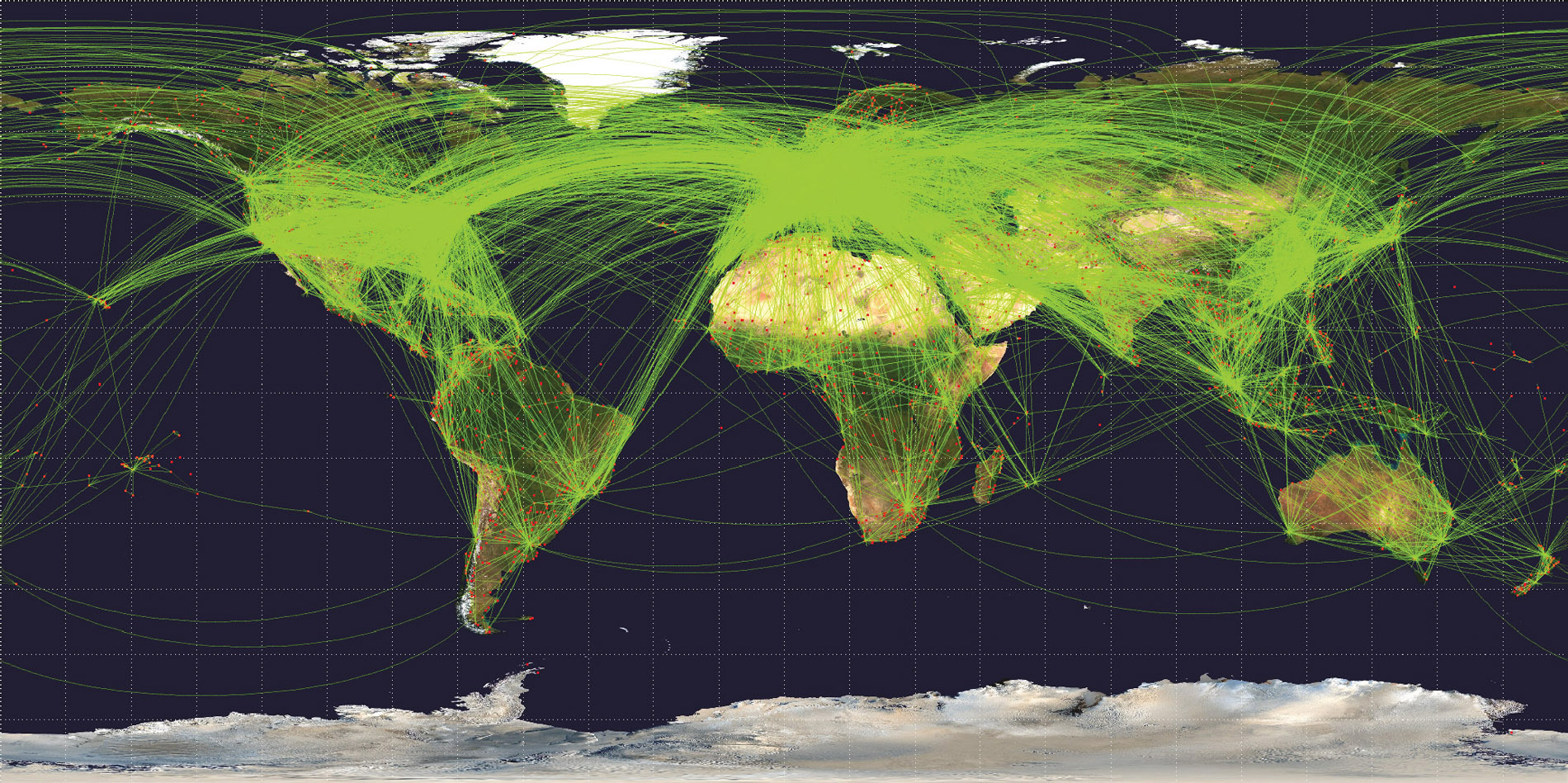 These aircraft tracks from December 2016, recorded by openflights.org in a twenty-four hour period, are so numerous over the United States, Europe, and parts of China that they appear to obliterate the land beneath.
PENGUIN BOOKS
UK | USA | Canada | Ireland | Australia
India | New Zealand | South Africa
Penguin Books is part of the Penguin Random House group of companies whose addresses can be found at global.penguinrandomhouse.com.
First published in the United States of America by Penguin Books 2019
First published in Great Britain by Particular Books 2019
Copyright Mark Ovenden and Maxwell J. Roberts, 2019
The moral right of the authors has been asserted
Designed by Mark Ovenden
ISBN: 978-0-141-99311-9
This ebook is copyright material and must not be copied, reproduced, transferred, distributed, leased, licensed or publicly performed or used in any way except as specifically permitted in writing by the publishers, as allowed under the terms and conditions under which it was purchased or as strictly permitted by applicable copyright law. Any unauthorized distribution or use of this text may be a direct infringement of the authors and publishers rights and those responsible may be liable in law accordingly.
The majority of maps have been sourced from the collections of the authors, British Airways Speedbird Centre (with thanks to Jim Davies), and www.timetableimages.com (with thanks to Bjorn Larsson). Images have been reproduced with the kind permission of the airlines who produced them (or their designers). Credits for specific images are listed below. Extensive effort was made to contact all other copyright holders. The authors are also indebted to the following for their contributions to this book:
Multiple images: Aeroflot, : Icelandair.

Mark Ovenden
Author, broadcaster, consultant, lecturer
A new branch of cartography took off with the dawn of civil aviation a century ago. Airline maps were completely different from what came before, such as navigational maps used by pilots or even railroad route maps for train riders. Airline passengers did not need to know many specific details about their journey. All they were involved with were the airlines departure and arrival cities. To those with a fear of flying, perhaps the lack of detail was a clever psychological trick to entice them onto the fastest-moving machine ever invented.
Such a laissez-faire attitude to geographical accuracy gave rise to great experimentation, as the pages in this book testify. The very concept of whizzing rapidly from one side of the world to the other provided artists and marketers with inspiration. During the infancy of aviation, service maps were able to display in an instant both the proximity of the colonies and the viability of the new-fangled airlines over any surface-based transportation (especially the great oceangoing liners). Maps played a part in glamorizing flight and making it feel practical, and as networks matured, they were a valuable weapon in beating the competition.
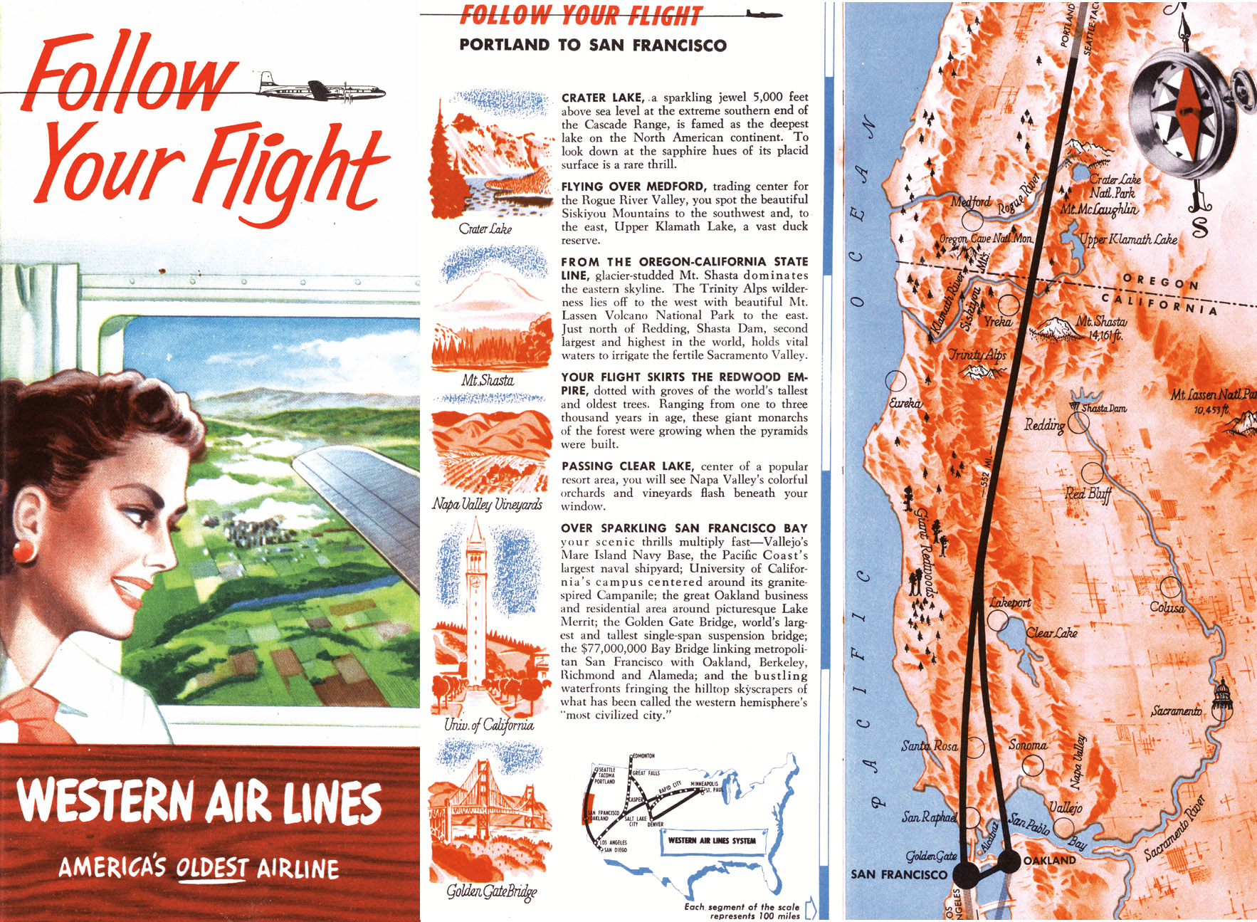 Western Air Lines 1953 guide Follow Your Flight.
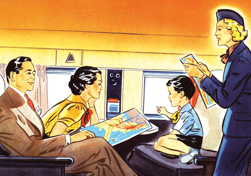 Passengers consult a 1939 American Airlines brochure.
Yet airlines did provide window-seat travelers with aids to assess what they were passing over, as shown in the image to the left, and in the twenty-first century the live map on a seat-back screen or even on a handheld device, shown below, is evolving rapidly. So much so that, in recent years, the tendency of airline websites has been to offer a point-to-point drop-down menu with the route laid over something like Google Earth, depriving users of the ability to browse the airlines wider offering of destinations on a well-designed map. Luckily for the collectors and students of modern industrial design, corporate identity, and cartography, printed paper maps live on. Keep hold of the next one: it could be collectible.
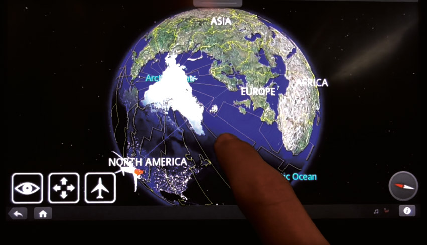 New scalable seat-back screens by flightpath3d.com have live route maps with night and flight deck views.
Maxwell J. Roberts
Lecturer; owner of tubemapcentral.com
When we were planning this book, we knew that there would be no shortage of material to include. Our research included surveys of museums, archives, collectors fairs, and enthusiast websites. The more we searched, the more we unearthed. We were astonished by the sheer quantity of airline service maps created worldwide, for publicity posters, in-flight magazines, timetables, and newspaper/magazine advertisements.
Are there more designs of airline maps than railway maps? It is hard to know for sure. Every London Underground station has a network map on every platform, consulted daily by bemused travelers, and millions of copies are printed annually to be taken away and studied at leisure. How many people have ever used an airline map to plan a journey? So much cartography going to waste, so why do airlines bother with maps at all?
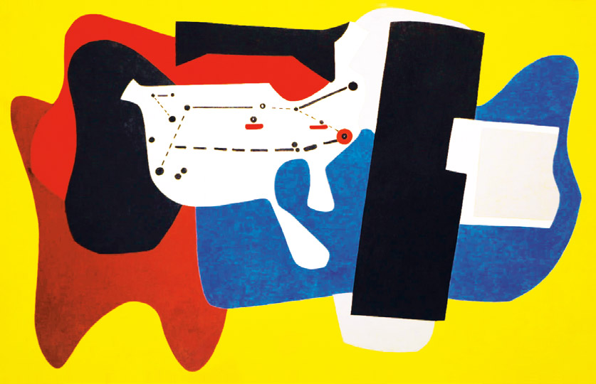 By 1936, airline maps were understood enough to be turned into abstract art by Arshile Gorky.
Because maps dont just show people the way. In the early days of flight, they showed that the impossible was now achievable, and that trips across the world that previously took weeks could now be covered in days. As technology became more reliable, and airline empires expanded, so the maps staked claims on territory, promising regular flights to all manner of exotic destinations. Fly with uswere bigger, faster (and safer?) than anyone else; travel on a business trip to save time and money, or take a vacation somewhere you never imagined possible. With these messages to convey, it is not surprising that maps became associated with exciting imagery, and as technology, business fortunes, design techniques, and fashions changed, so did the appearance of airline maps. This book tells, in its own way, the story of twentieth-century graphic design.
Next pageFont size:
Interval:
Bookmark:
Similar books «Airline Maps: A Century of Art and Design»
Look at similar books to Airline Maps: A Century of Art and Design. We have selected literature similar in name and meaning in the hope of providing readers with more options to find new, interesting, not yet read works.
Discussion, reviews of the book Airline Maps: A Century of Art and Design and just readers' own opinions. Leave your comments, write what you think about the work, its meaning or the main characters. Specify what exactly you liked and what you didn't like, and why you think so.