IMAGES
of America
PLATEAU VALLEY
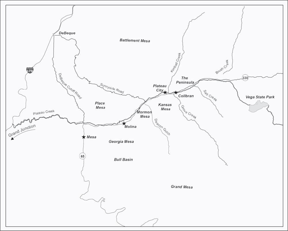
MAP OF PLATEAU VALLEY. This map shows the relative locations of the communities and natural features discussed in this book. (Authors collection.)
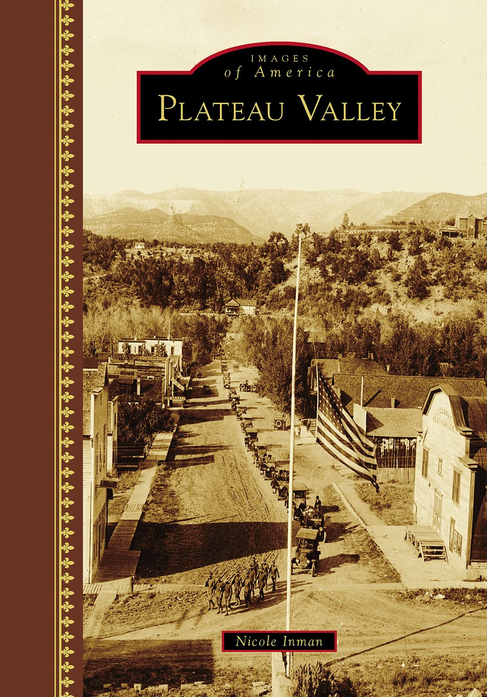
ON THE COVER: Charles Herbert Crane Funeral. Charles Herbert Crane died on October 8, 1918. He was a seaman on the USS Massachusetts and had just returned from a voyage when he contracted Spanish influenza. He died one week later of pneumonia at age 22 and received full military honors. The military escort consisted of a firing squad, a bugler, and a sergeant in charge. (Griffith family collection.)
IMAGES
of America
PLATEAU VALLEY
Nicole Inman

Copyright 2016 by Nicole Inman
ISBN 978-1-4671-1545-2
Ebook ISBN 9781439656914
Published by Arcadia Publishing
Charleston, South Carolina
Library of Congress Control Number: 2016933270
For all general information, please contact Arcadia Publishing:
Telephone 843-853-2070
Fax 843-853-0044
E-mail
For customer service and orders:
Toll-Free 1-888-313-2665
Visit us on the Internet at www.arcadiapublishing.com
This book is lovingly dedicated to my great-grandmother Ethelle Silliman Raymond, my grandfather William Bill Raymond, and my mother, Jerri Inman, who all instilled in me a love of history.
CONTENTS
ACKNOWLEDGMENTS
First and foremost, I owe my mother, Jerri Inman, a tremendous debt of gratitude. Without her help and motivation, this book would not have been possible. My deepest thanks go also to Sylvia Spangler, Anise Kelley, and Hazel Place with the Plateau Valley Historical Preservation Society. Additional thanks go to Erin Schmitz with the Museum of the West, Lloyd Files Research Library, for her help and assistance. Several families gave generously from their collections, including Terry Griffith, Rudy and Arita Charlesworth, and Scott Walck, a generous contributor who passed away during the writing of this book. Finally, to all the others who shared their time, stories, and enthusiasm for the preservation of history, thank you.
INTRODUCTION
Plateau Valley is nestled in the shadow of the Grand Mesa, the largest flat-topped mountain in the world. The summit reaches 10,000 feet in elevation over an area that covers 800 square miles and towers more than a mile over the surrounding Gunnison and Colorado River valleys. Battlement Mesa, a smaller mesa standing at 9,000 feet in elevation, forms the northern wall of the valley.
Plateau Creek is a 50-mile-long tributary of the Colorado River. The headwaters are in northeastern Mesa County, in the Grand Mesa National Forest. The creek passes north of Vega State Park and enters Plateau Valley at Collbran, Colorado. From there, it flows west to the junction of State Highway 330 and State Highway 65, the Grand Mesa Scenic and Historical Byway. It then enters Plateau Canyon, a narrow 12-mile-long canyon of sheer rock walls.
The climate in Plateau Valley is mild, with moderate snowfall and comfortable temperatures. Summer recreation includes hunting, camping, fishing, and hiking. Winter recreation includes cross-country skiing, snowmobiling, ice fishing, and downhill skiing. Livestock ranching is still the leading industry. Hunting abounds, with deer, elk, and turkey in plentiful supply. Seven species of troutrainbow, Colorado River cutthroat, Snake River cutthroat, brown, brook, splake, and Arctic Graylingcan be found year-round in more than 100 lakes and 25 streams. At lower elevations, lakes thaw by late April, with the lakes at the top of Grand Mesa opening up by the end of June.
Plateau Valley, with its fertile soils, has always been known for its high-quality grass and hay. In the early days, loose hay would be hauled to DeBeque, Colorado, for the livery stable and railroad trades. When horse-powered balers were brought to the valley, even more hay could be transported per load. It was in great demand outside of the valley as well as within, as it could be sold for cash or bartered for goods.
The first cattle to graze in the valley were driven in from Utah for the summer, crossing both the Colorado River and Plateau Creek. Historically, winters were more severe, and the creek ran much higher and faster, which made crossing it far more dangerous. Those early ranchers turned their cattle out onto the foothills of the Grand Mesa, a few miles up Salt Creek, Grove Creek, and the Meadows. Before 1905, cattle were allowed to graze without restriction, but after that time, reserve boundaries were established and cattle permits issued. In the fall, cattle were gathered from the forest and sorted. Those to be marketed were trailed to DeBeque, across Sunnyside. They swam the Colorado River and were loaded onto railroad cars to be shipped to Denver markets.
In 1902, the cattlemen of the area organized to form the Plateau Valley Stock Growers Association. They were able, as a group, to address and deal with problems and concerns that affected their livelihood. These issues have, over the years, included cattle rustling, predatory animals, toxic plants, and weevil-infested hay. Growers held their first annual banquet on December 3, 1912. The association is no longer active in the valley.
In 1912, the first Stray Day was held at the Flying Triangle Ranch, two miles south of Collbran on Kansas Mesa. Stray Day was the day all the ranchers gathered to collect the few stray cattle left on the mountain, sort out theirs, and take them home. In 1916, Owen Crane and Ed Jones started a new era in range history when they conceived the idea of a cattle pool and ran cattle for a number of smaller operators. A cowboy, known as a pool rider, is hired to live in the cabin at the pool corrals and look after the cattle for the summer. This system is still used today.
In the 1950s, the Plateau Valley Cowbelles Association was formed. The organization was made up of the cattlewomen of the valley. The name changed to the Plateau Valley CattleWomen, but the organization remains active in the community and state to promote the beef industry.
Cowboy Prayer
May your belly never grumble.
May your heart never ache.
May your horse never stumble.
May your cinch never break.
Anonymous
One
TOWN OF COLLBRAN
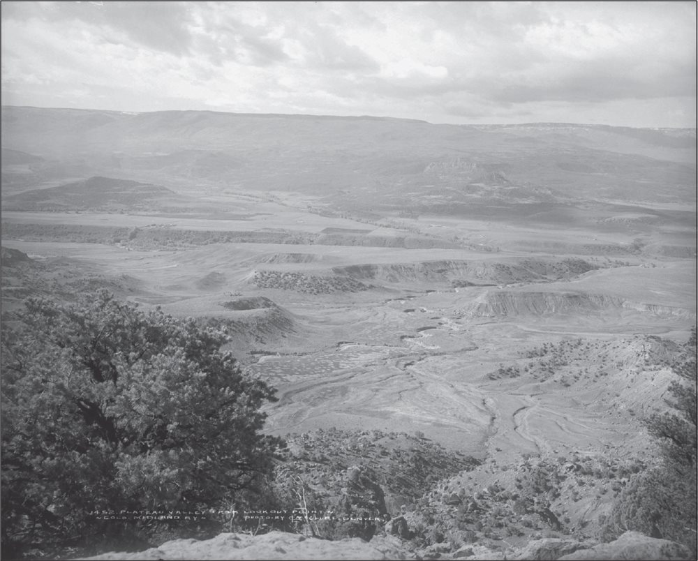
PLATEAU VALLEY FROM LOOKOUT POINT, C. 1910S. Pictured is the view from Lookout Point across Plateau Valley in Mesa County, Colorado, reached via the proposed Colorado Midland Railway. The image shows mesas, drainages, sage, juniper, and pinyon vegetation. (Denver Public Library, Western History Collection [Call MCC-1452].)
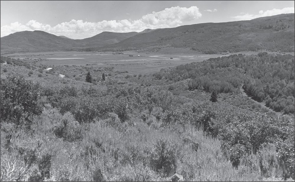
THE MEADOWS. The George Hawxhurst family and the Horace Dunlap family came to the area by way of Ute Indian trails when the Utes campfires were still smoldering. By 1885, most of the area of the Meadows had been homesteaded. At that time, 25 families were living there. A post office, cemetery, school, and two sawmills were soon started. Most of the settlers had moved away by 1924, and the school closed in 1936. (William H. Nelson Collection, Colorado Mesa University Special Collections.)
Next page

