GREAT SMOKY MOUNTAINS NATIONAL PARK as an ecosystem is the sum of many parts, each of which is vital to the whole. Similarly, as a national park, it exists because of the contributions from countless individuals, most of whom the average park visitor never encounters. The reason you can hike a trail in the Smokies without having to climb over fallen trees is because someone hiked the trail carrying a heavy saw and removed them for you. Despite operating on a shoestring budget, park employees and volunteers somehow are able to manage more than half a million acres for some 11 million annual visitors.
In preparing this book, I talked to dozens of these peoplepark rangers, interpretive volunteers, resource administrators, biologists, carpenters, and even trash collectors. Each of them helped generously and with a smile. Just as they are vital to the Smokies, they were instrumental in helping me create this book. Thank you all. And thanks to everyone who works for the well-being of the Smokies.
Thanks to my friend and coauthor, the inimitable Peter Barr, for sharing his insight and trail knowledge. And thanks to my friend Bill Lea for sharing his beautiful wildlife photos.
I want to give a special thanks to my favorite trail companion and shuttle driver, my lovely wife, Patricia. Sweetie, I would hike with you to the moon and back!
Kevin Adams, November 2020
The best sources for up-to-date and accurate information about Great Smoky Mountains National Park are the official park website at www.nps.gov/grsm and the site for Great Smoky Mountains Association at www.smokiesinformation.org. A plethora of other websites provide information about the park, but these official park sites are the most comprehensive and the only sites whose information you can trust to be accurate. In addition to useful online information about the Smokies, the GSMA website features the official park store, where you can buy everything that is sold in park visitor centers, including a wide selection of books and maps. In conjunction with this guidebook, these two websites provide everything you need for planning your adventure in the Smokies.
You might consider becoming a member of Great Smoky Mountains Association. Membership entitles you to a 15 percent discount on books and other items at park visitor centers; a subscription to Smokies Guide; the associations newsletter, The Bearpaw; Smokies Life magazine; and many other benefits. There is an annual membership fee. You can join through the GSMA website.
The main park phone number is (865) 436-1200.
COMMERCIAL SHUTTLE SERVICES
Utilizing a shuttle service increases your hiking options greatly. Even if you live close enough to bring two vehicles, the convenience of a commercial shuttle is often worth the cost, not to mention the fuel savings from leaving that second car behind. If you plan to hike in the Eagle Creek and Hazel Creek region on the north shore of Fontana Lake, a boat shuttle saves you from a long hike in and adds an exciting component to the hike.
The drawback to commercial shuttles, besides the cost, is that you must plan ahead. While its possible that youll catch the shuttle available on a last-minute call, in most cases youll need to call ahead and make reservations.
A Walk in the Woods: (865) 436-8283
Bryson City Outdoors: (828) 342-6444
Fontana Marina (for boat shuttles on Fontana Lake): (828) 498-2129
Smoky Mountain Guides: (865) 654-4545
PARK CONTACT INFORMATION
Great Smoky Mountains National Park
107 Park Headquarters Rd.
Gatlinburg, TN 37738
Park website: www.nps.gov/grsm
Website for backcountry camping permits: www.smokiespermits.nps.gov
Main park number: (865) 436-1200
Backcountry Information Office: (865) 436-1297
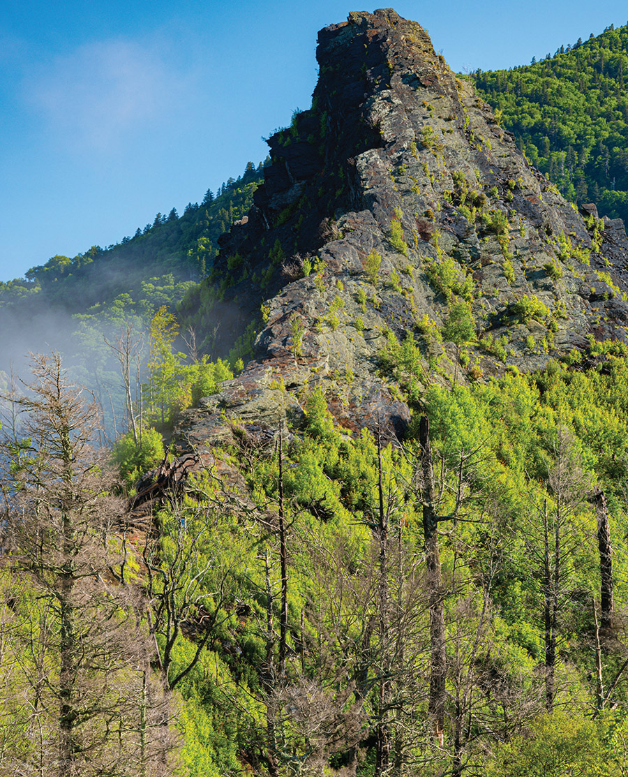
View of Chimney Tops from Chimney Tops Trail.
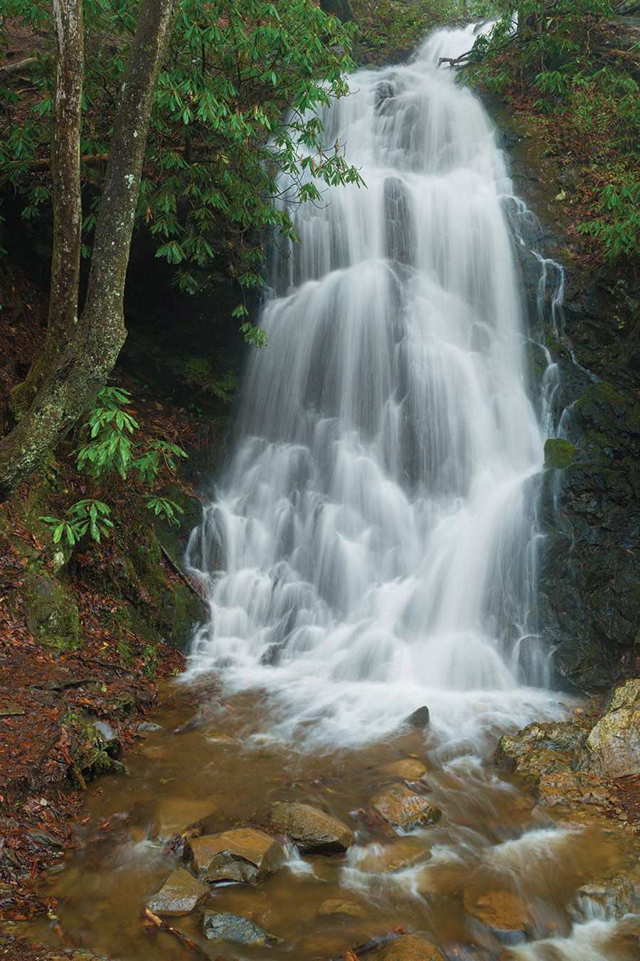
This walk between Sugarlands Visitor Center and Gatlinburg is not for people looking for a wilderness experience in the Smokies. As a shuttle or out-and-back hike, there are better short hikes than this. However, its a great split-party hike, especially if youre staying in Gatlinburg. Have your party drop you off at the visitor center and meet them back in town, or head out early in the morning and meet your party at the visitor center. The trail is popular among locals as a fitness and dog-walking path. Its one of only two trails in the park that allow dogs (on leash) and one of only four that allow bicycles. (Oconaluftee River Trail allows dogs and bikes; Deep Creek Trail and Indian Creek Trail allow bikes on their lower sections.) A highlight of the hike is the short side trip to Cataract Falls.
Start: Sugarlands Visitor Center
Distance: 3.8 miles out and back
Hiking time: About 2 hoursday hike
Difficulty: Easy
Trail surface: Concrete, asphalt, gravel, dirt, and a few yards of grass
Other trail users: Dogs, bicycles
Maps: Gatlinburg USGS quad; Trails Illustrated #229 Great Smoky Mountains; Trails Illustrated #317 Clingmans Dome Cataloochee; Trails Illustrated #316 Cades Cove Elkmont
Other: The visitor center parking lot is huge but still fills up on summer and autumn weekends. Restrooms and drink vending machines are available at the center. The end of the hike has parking for a halfdozen vehicles only. There is also a parking area at the entrance to the maintenance yard described in the hike narrative, so you could park there and avoid the visitor center and headquarters complex.
FINDING THE TRAILHEAD
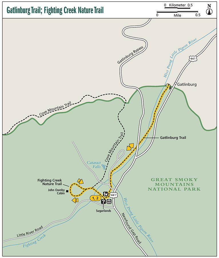
 The hike begins at Sugarlands Visitor Center, about 2 miles south of Gatlinburg along Newfound Gap Road. GPS: N35 41.148 / W83 32.214
If doing this hike as a shuttle, you need to leave a vehicle at the Gatlinburg end of the trail, which is located on the short spur road turning west off Newfound Gap Road, a few hundred feet from Gatlinburg. GPS: N35 42.343 / W83 31.420
THE HIKE
The hike begins on the concrete walkway in front of the restroom building. In 50 yards you come to the trailhead for Fighting Creek Nature Trail, turning to the left. Continue along the concrete path to the park headquarters building. Walk completely around the front and right side of the building to reach Park Headquarters Road at a small parking area. Cross the road, turn left (west), and follow the road 100 yards to another park service road turning to the left. If taking the side trip to Cataract Falls described under Options, you want to take this road; otherwise, continue following Park Headquarters Road to where it ends at the park maintenance yard. Gatlinburg Trail leaves the road here, bypassing to the right of the maintenance area and following West Prong Little Pigeon River downstream.
Cataract Falls on a rainy day.
Upon leaving the maintenance area, you are finally on a real trail, but this is no wilderness walk. On your way to Gatlinburg, you pass under the Gatlinburg Bypass road and closely parallel Newfound Gap Road for some distance. A few old homesites, rock walls, and the crossing of West Prong Little Pigeon River will help keep your mind off asphalt for part of the hike.


 The hike begins at Sugarlands Visitor Center, about 2 miles south of Gatlinburg along Newfound Gap Road. GPS: N35 41.148 / W83 32.214