About the Author
Since taking early retirement from his career as a physics and sports teacher, Brian Johnson has found time for three through-hikes of the Pacific Crest Trail, a 2700-mile round-Britain walk, six hikes across the Pyrenees from the Atlantic to the Mediterranean, a hike along the Via de la Plata from Seville to Santiago and a single summer compleation of the Munros (Scotlands 3000ft mountains) as well as climbing all the Corbetts (Scotlands 2500ft3000ft mountains) and most of the Grahams (Scotlands 20002500ft mountains). He has also completed a 2200-mile cycle tour of Spain and France and done multi-week canoe tours in Sweden, France, Spain and Portugal.
In his younger days, Brians main sport was orienteering. He competed at a high level and coached both Bishop Wordsworths School and South-West Junior Orienteering Squads. He also surveyed and drew many orienteering maps. He has walked and climbed extensively in summer and winter conditions in Britain, the Alps, the Pyrenees and California, often leading school groups.
As a fanatical sportsman and games player, Brian competed to a high level in cricket, hockey, bridge and chess. His crowning achievement was winning the 1995/96 World Amateur Chess Championships.
Other Cicerone guides by the author
The Pacific Crest Trail
Walking the Corbetts Volume one: South of the Great Glen
Walking the Corbetts Volume two: North of the Great Glen
The GR11 La Senda: through the Spanish Pyrenees
THE GR10 TRAIL
THROUGH THE FRENCH PYRENEES
by Brian Johnson
JUNIPER HOUSE, MURLEY MOSS,
OXENHOLME ROAD, KENDAL, CUMBRIA LA9 7RL
www.cicerone.co.uk
Brian Johnson 2016
First edition 2016 Reprinted 2019 (with updates)
ISBN 9781783624010
Replaces guide of same title by Paul Lucia
ISBN 9781852843649
Printed in China on behalf of Latitude Press Ltd
A catalogue record for this book is available from the British Library.
 Route mapping by Lovell Johns www.lovelljohns.com
Contains OpenStreetMap.org data OpenStreetMap contributors, CC-BY-SA. NASA relief data courtesy of ESRI
 The routes of the GR, PR and GRP paths in this guide have been reproduced with the permission of the Fdration Franaise de la Randonne Pdestre holder of the exclusive rights of the routes. The names GR, PR and GRP are registered trademarks.
FFRP 2016 for all GR, PR and GRP paths appearing in this work.
All photographs are by the author.
Updates to this Guide
While every effort is made by our authors to ensure the accuracy of guidebooks as they go to print, changes can occur during the lifetime of an edition. Any updates that we know of for this guide will be on the Cicerone website (www.cicerone.co.uk/773/updates), so please check before planning your trip. We also advise that you check information about such things as transport, accommodation and shops locally. Even rights of way can be altered over time. We are always grateful for information about any discrepancies between a guidebook and the facts on the ground, sent by email to updates@cicerone.co.uk or by post to Cicerone, Juniper House, Murley Moss, Oxenholme Road, Kendal LA9 7RL.
The route maps in this guide are derived from publicly-available data, databases and crowd-sourced data. As such they have not been through the detailed checking procedures that would generally be applied to a published map from an official mapping agency, although naturally we have reviewed them closely in the light of local knowledge as part of the preparation of this guide.
Register your book: To sign up to receive free updates, special offers and GPX files where available, register your book at www.cicerone.co.uk.
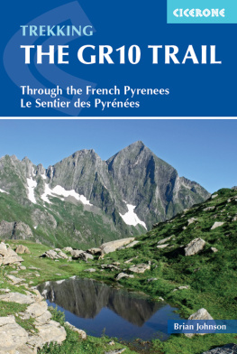
Front cover: Mont Valier from below Bouche dAula (Stage 34)
CONTENTS

Valle de la Canau (Stage 19)
AUTHORS PREFACE
Having walked the Pyrenean High-level Route and GR11 many times, I was apprehensive that the GR10 would be the poor relation to these coast to coast routes across the Pyrenees. However, I was delighted to find the GR10 to be every bit as good as these two magnificent routes.
The first Cicerone guide to the GR10 by Alan Castle was published in 1990. His work was taken on by Paul Lucia whose new guide was published in 2002. Unfortunately Paul died in 2007 and, despite updates by Ton Joosten, it was time for a new guide as the GR10 had gradually evolved, with improvements to the route and changes to accommodation and other facilities. This completely new guide includes all changes made to the route up to 2015.
It is now just about possible to walk the GR10 without camping or using bothies and this guide is organised into 55 stages for the benefit of those who are using accommodation along the route. Walkers who, like the author, prefer wild camping in the mountains will find much greater flexibility in their planning.
Brian Johnson
INTRODUCTION

Mont Valier from ponds below the Bouche dAula (Stage 34)

The north face of Vignemale from Oultes de Gaube (Stages 18 and 19)
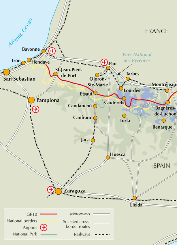
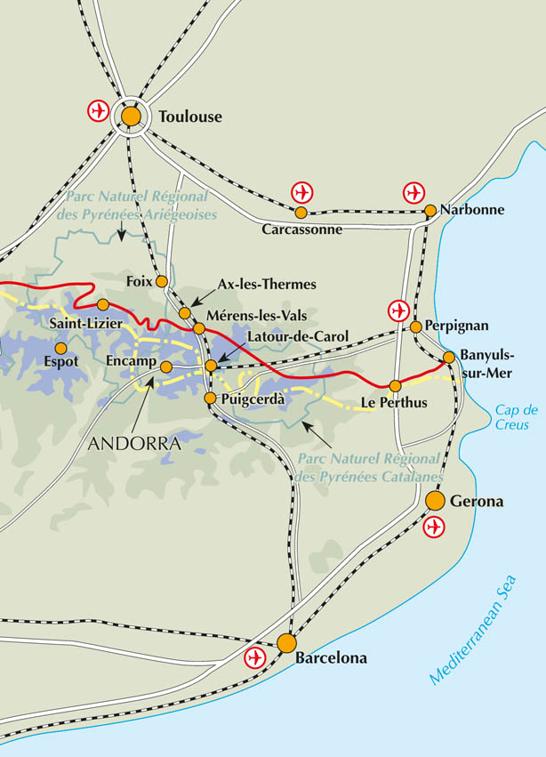
The Pyrenees, the mountain chain which forms the border between France and Spain, stretches over 400km from the Atlantic Ocean to the Mediterranean Sea. The GR10 is the easiest, oldest and most popular of the three long-distance routes that traverse the mountain range.
It is an extremely well-waymarked route following good mountain paths, with only a few tough stages with boulderfields to cross and occasional scrambling. Towns and villages are frequent so finding accommodation and supplies is rarely a problem.
Initially the GR10 follows ridges over the steep rolling hills of the Basque Country before reaching the impressive limestone peaks at the western end of the High Pyrenees. The fantastic Alpine scenery of the High Pyrenees includes a number of tourist hotspots, including the Pic du Midi dOssau, Vignemale and Gavarnie. After Bagnres-de-Luchon the GR10 passes into the less-frequented Arige where the route crosses a succession of deep valleys with occasional returns to spectacular Alpine terrain. As the Mediterranean is approached the Canigou massif dominates the scene and the terrain remains mountainous with the final 1000m peak being only a few miles from the routes end at Banyuls-sur-Mer.






 Route mapping by Lovell Johns www.lovelljohns.com
 The routes of the GR, PR and GRP paths in this guide have been reproduced with the permission of the Fdration Franaise de la Randonne Pdestre holder of the exclusive rights of the routes. The names GR, PR and GRP are registered trademarks.


