Madeline Tyler - Mapping People
Here you can read online Madeline Tyler - Mapping People full text of the book (entire story) in english for free. Download pdf and epub, get meaning, cover and reviews about this ebook. year: 2020, publisher: Greenhaven Publishing LLC, genre: Politics. Description of the work, (preface) as well as reviews are available. Best literature library LitArk.com created for fans of good reading and offers a wide selection of genres:
Romance novel
Science fiction
Adventure
Detective
Science
History
Home and family
Prose
Art
Politics
Computer
Non-fiction
Religion
Business
Children
Humor
Choose a favorite category and find really read worthwhile books. Enjoy immersion in the world of imagination, feel the emotions of the characters or learn something new for yourself, make an fascinating discovery.
- Book:Mapping People
- Author:
- Publisher:Greenhaven Publishing LLC
- Genre:
- Year:2020
- Rating:4 / 5
- Favourites:Add to favourites
- Your mark:
Mapping People: summary, description and annotation
We offer to read an annotation, description, summary or preface (depends on what the author of the book "Mapping People" wrote himself). If you haven't found the necessary information about the book — write in the comments, we will try to find it.
Madeline Tyler: author's other books
Who wrote Mapping People? Find out the surname, the name of the author of the book and a list of all author's works by series.


Mapping People — read online for free the complete book (whole text) full work
Below is the text of the book, divided by pages. System saving the place of the last page read, allows you to conveniently read the book "Mapping People" online for free, without having to search again every time where you left off. Put a bookmark, and you can go to the page where you finished reading at any time.
Font size:
Interval:
Bookmark:
Published in 2020 by KidHaven Publishing, an Imprint of Greenhaven Publishing, LLC
353 3rd Avenue, Suite 255, New York, NY 10010
2020 Booklife Publishing
This edition is published by arrangement with Booklife Publishing.
All rights reserved. No part of this book may be reproduced in any form without permission in writing from the publisher, except by a reviewer.
Written by: Madeline Tyler
Edited by: Kirsty Holmes
Designed by: Drue Rintoul
Cataloging-in-Publication Data
Names: Tyler, Madeline.
Title: Mapping people / Madeline Tyler.
Description: New York: KidHaven Publishing, 2020. | Series: Maps and mapping | Includes glossary and index.
Identifiers: ISBN 9781534531116 (pbk.) | ISBN 9781534530225 (library bound) | ISBN 9781534531529 (6 pack) | ISBN 9781534531055 (ebook)
Subjects: LCSH: Human geography--Juvenile literature. | Population--Juvenile literature. | Maps--Juvenile literature.
| Map reading--Juvenile literature.
Classification: LCC GF48.T95 2020 | DDC 300.223--dc23
Image Credits
All images are courtesy of Randy Miramontez, Wachiwit, Patricia Hofmeester, Gervasio S. _ Eureka_89, NEstudio, Lasse Hendriks. 30 george studio, Fotografiche.
Printed in the United States of America
CPSIA compliance information: Batch #BS19KL: For further information contact Greenhaven Publishing LLC, New York, New York at 1-844-317-7404.
CONTENTS
WHAT ARE MAPS FOR?
What Is a Map?
Maps are of the landscape, like mountains and rivers. Other maps show where buildings and roads are. Some maps only show specific things, like amusement park maps, which are for visitors to find their way around the park and plan their day.
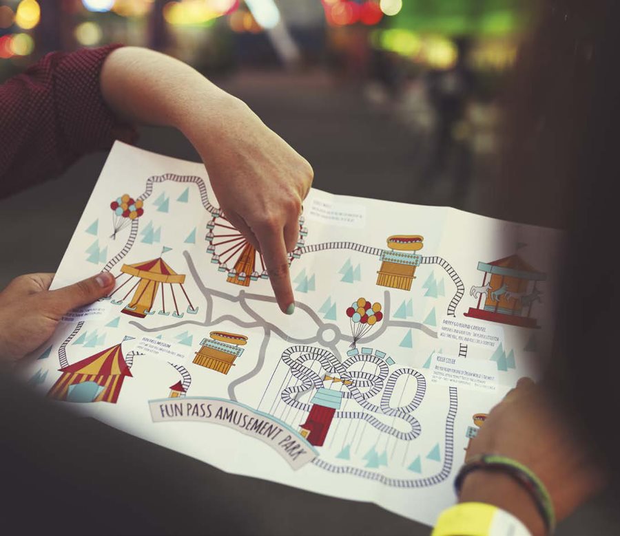
With this map, a visitor can see where all the rides and roller coasters are and how to get to each one.
CHOOSING WHAT TO MAP
A mapmaker, called a cartographer, often cant put all parts of an area on a map. Because some things are left out, or simplified, a map doesnt always look exactly like a place. It is a drawing instead of a photo. Maps are useful to see certain features, , people, vegetation, or animals. The finished map can show some of these things clearly, but cant show everything, so they have to choose what is important.

This map of Africa only shows some natural features, like vegetation, and not towns or cities.
BY NOT INCLUDING OTHER INFORMATION, THE MAP OF AFRICA IS EASIER TO READ.
GEOGRAPHIC MAPS
There are different maps for different purposes. Some are: road or street maps for planning journeys; climatic maps that show typical weather of a region depending on the season; weather maps, which let people know what the weather will be like in the near future such as today or tomorrow; political maps that highlight the size of countries and where the borders are; and terrain maps, which trace the ups and downs of the land.
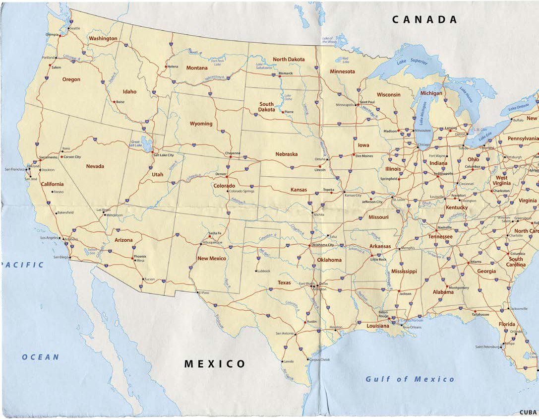
This is a map of the main roads between cities in the United States. Drivers can then use this map to plan the roads theyll need to travel from one city to another.
Non-Geographic Maps
There are even maps of objects and other things that arent on the surface of the Earth. There are maps of space, such as solar system maps. There are tree maps that show the order that things happened and how they are linked. For example, a family tree is an easy way to see how everyone in a family is related. Mind maps are ways to come up with ideas that are linked to one main topic.
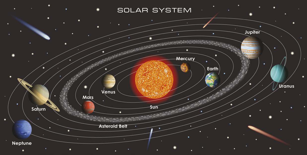
This is a map of our solar system.
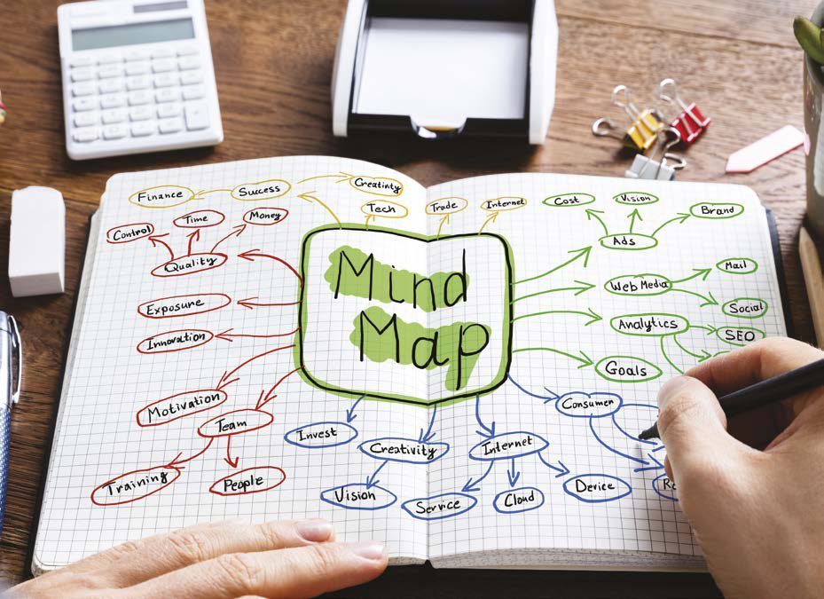
Different topics can be drawn as mind maps.
MAPPING PEOPLE
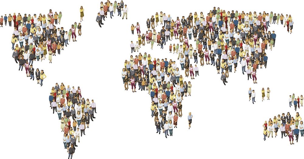
Maps are a very useful tool and have been used by people for thousands of years. They are often used for or for showing the locations of different countries and cities, but they are also helpful for plotting landmarks and displaying information. It is even possible to map people. This is part of a topic called human geography. Maps can be used to show lots of information about people, including how many people live in a specific place, how far they may have traveled to get there, and what languages they speak.
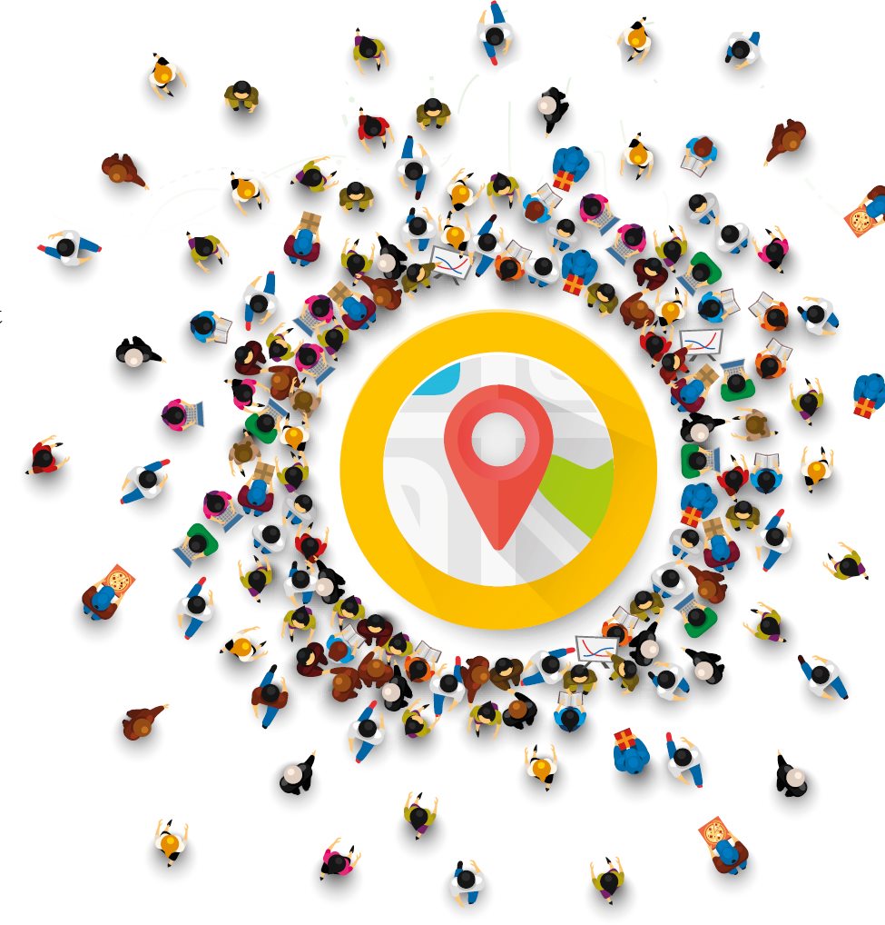
Maps are like pictures, and can be to show the data in a simple way. Sometimes it is quicker and easier to read information from a map than it is from a graph or spreadsheet.
Not all maps look the same or show the same types of information. Two types of maps that are used to map people are cartograms and choropleth maps.
CARTOGRAMS
Geographical, or , maps focus on the physical world and are usually geographically accurate, meaning that what you see on a map looks more or less like it does in the real world. They show natural features like mountains, oceans, and rivers. Political maps are similar to topographical maps, but instead they focus on countries, borders, and cities, and where these things actually are.
Cartograms are very different and are not geographically accurate. They show information like population numbers, the ages of citizens, or the amount of money a country has. Places on the map are made bigger or smaller depending on this information.
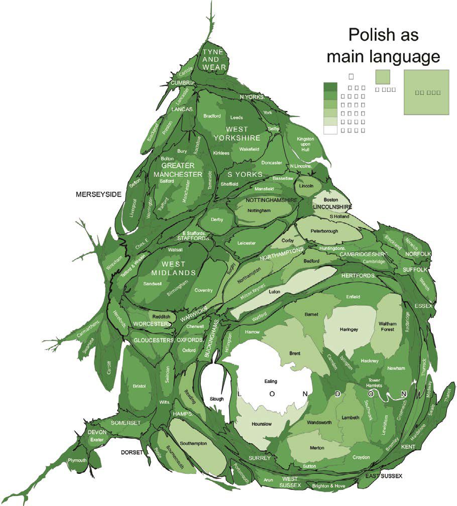
This is a cartogram. It shows the areas in Great Britain where lots of people speak Polish as their main language.
Choropleths
Choropleth maps are similar to cartograms. They show information about people, like life expectancy or population density (see page 8). Instead of making the countries or regions different sizes, they are colored in different colors or shades. Every choropleth is different, but usually the scale goes from a light shade to a dark shade. Cartograms are also sometimes colored in this way.
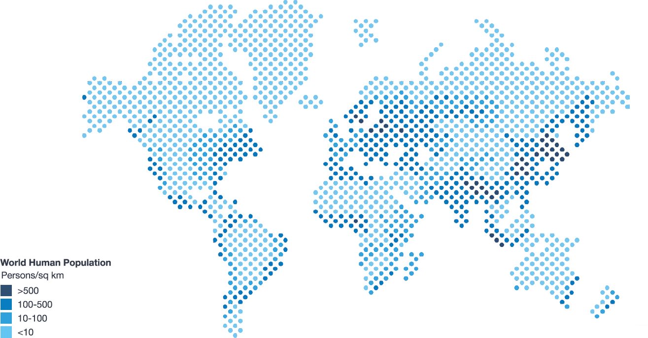
This is an example of a choropleth map. It shows the population density around the world.
MAPPING POPULATION
In some parts of the world, there are lots of people living very close to each other. In other areas, there are very few people and they may live very far away from each other. Population density can be used to measure how populated an area is. Population density is the average number of people who live in an area. It is a way of measuring population
Next pageFont size:
Interval:
Bookmark:
Similar books «Mapping People»
Look at similar books to Mapping People. We have selected literature similar in name and meaning in the hope of providing readers with more options to find new, interesting, not yet read works.
Discussion, reviews of the book Mapping People and just readers' own opinions. Leave your comments, write what you think about the work, its meaning or the main characters. Specify what exactly you liked and what you didn't like, and why you think so.