Using
Economic and
Resource Maps
Tracy Nelson Maurer
For my favorite explorers,
Mike, Meg, and Tommy
Copyright 2017 by Lerner Publishing Group, Inc.
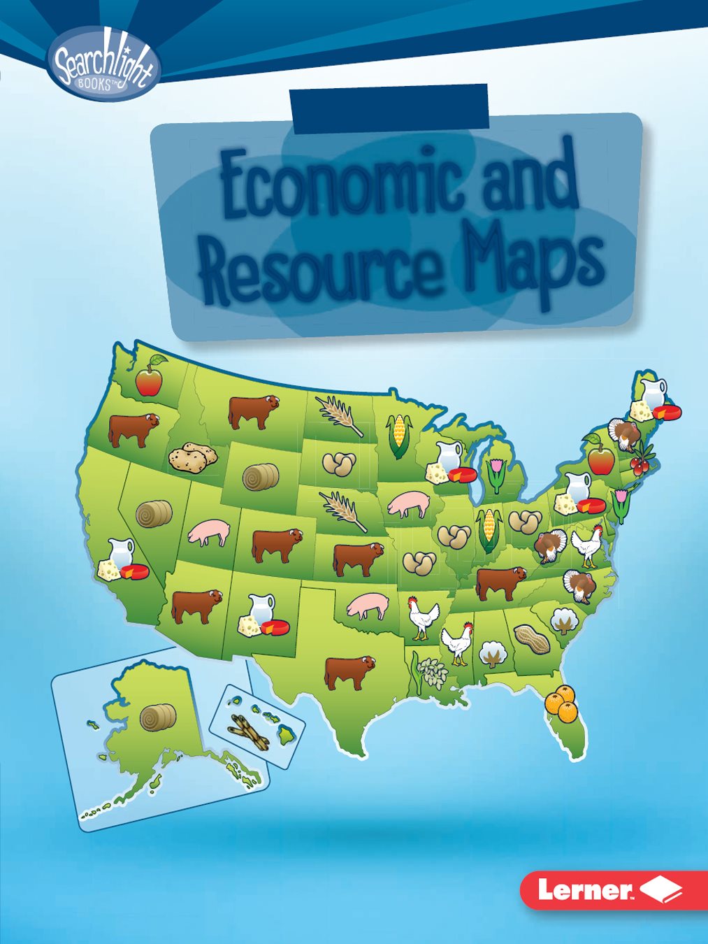
Cover image: This map shows a key natural and economic resource from
each one of the fifty US states as of 2015, according to the United States
Department of Agriculture Economic Research Service. The product shown for
each state is one of that states top five agricultural commodities. No data is
available for the District of Columbia.
All rights reserved. International copyright secured. No part of this book may be
reproduced, stored in a retrieval system, or transmitted in any form or by any means
electronic, mechanical, photocopying, recording, or otherwisewithout the prior written
permission of Lerner Publishing Group, Inc., except for the inclusion of brief quotations in
an acknowledged review.
Lerner Publications Company
A division of Lerner Publishing Group, Inc.
241 First Avenue North
Minneapolis, MN 55401 USA
For reading levels and more information, look up this title
at www.lernerbooks.com.
Library of Congress Cataloging-in-Publication Data
Names: Maurer, Tracy, 1965 author.
Title: Using economic and resource maps / Tracy Nelson Maurer.
Description: Minneapolis : Lerner Publications, 2016. | Series: Searchlight books what do
you know about maps? | Includes bibliographical references and index.
Identifiers: LCCN 2015038781| ISBN 9781512409512 (lb : alk. paper) | ISBN
9781512412925 (pb : alk. paper) | ISBN 9781512410716 (eb pdf)
Subjects: LCSH: Map readingJuvenile literature. | Economic geographyMaps
Juvenile literature. | Natural resourcesMapsJuvenile literature.
Classification: LCC GA130 .M44 2016 | DDC 912.01/4dc23
LC record available at http://lccn.loc.gov/2015038781
Manufactured in the United States of America
1 VP 7/15/16
Contents
WHAT ARE
ECONOMIC
AND RESOURCE
MAPS? ... page
WHATS ON ECONOMIC AND
RESOURCE MAPS? ... page
HOW DO YOU USE ECONOMIC
AND RESOURCE MAPS? ... page
ARE YOU AN ECONOMIC AND RESOURCE
MAP WHIZ? ... page
Chapter
WHAT ARE ECONOMIC
AND RESOURCE MAPS?
Where are you? What cities or
lakes are near you? What states
or countries border your location?
You can find
the answers
to all these
questions by
looking at a map!
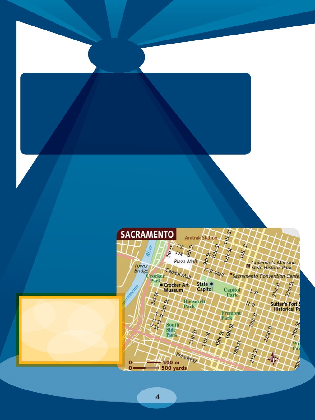
This map shows
roads and important
places in Sacramento,
California. What other
information might be
included on a map?
Maps use graphics to stand for different places. Maps
also share information about the living or nonliving things
you might find in those places. This information could
include numbers showing how many people live in a state.
Or it might be lines and labels showing roads in your city.
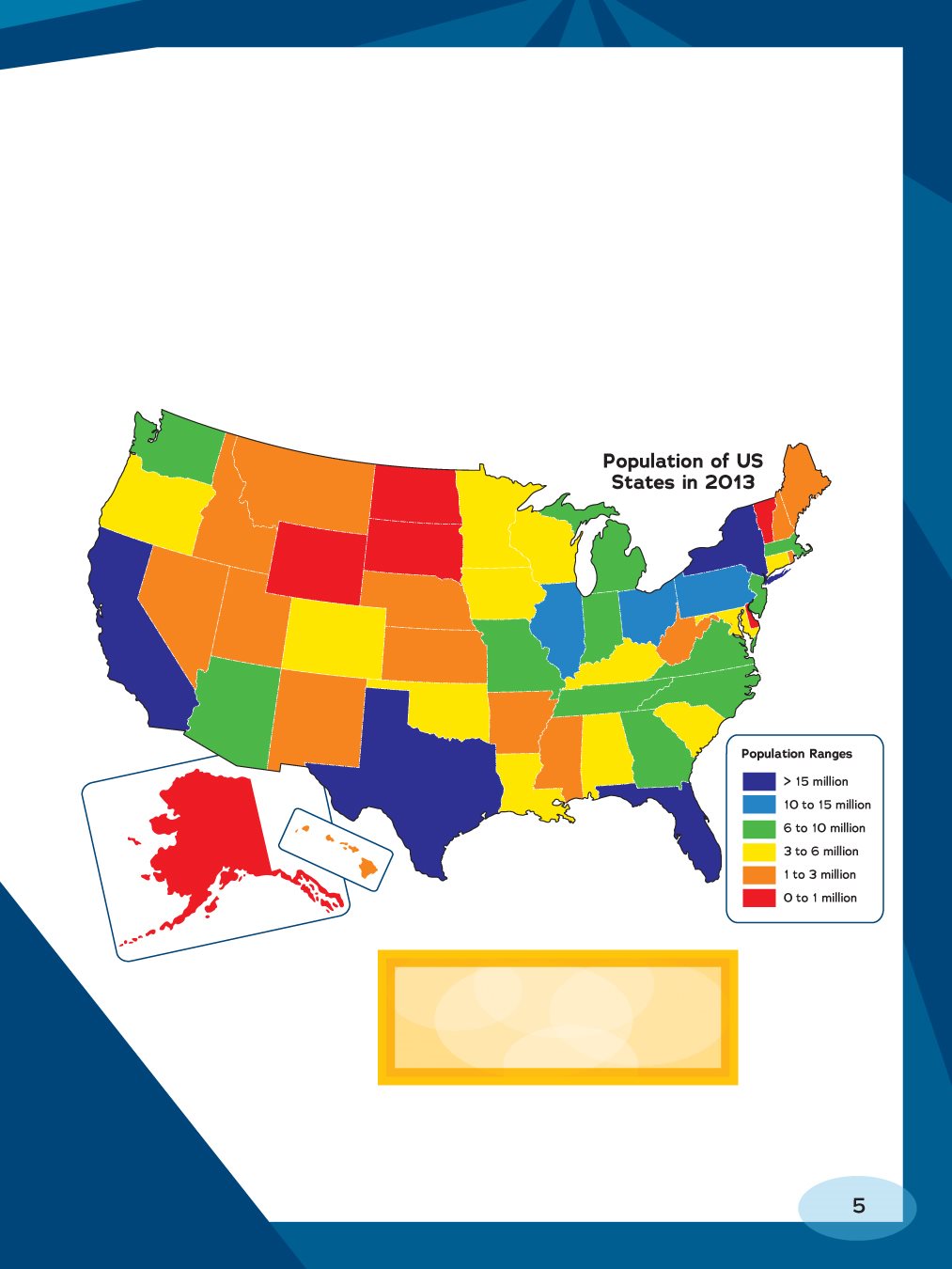
On this map, you can see
how many people lived in
different states in 2013.
People use maps for different reasons. Drivers might
use a map that shows roads to keep from getting lost. A
traveler may look at a map that shows countries to find
out what nations border Kenya the next place she plans
to visit. A student writing a report on North Carolina
would probably find it helpful to look at a map showing
agricultural (farming) products from that state. A map like
this would help the student report on what crops grow in
North Carolina. Maps that show what crops or natural
resources are in a place or how people in that place earn
money are called economic and resource maps.
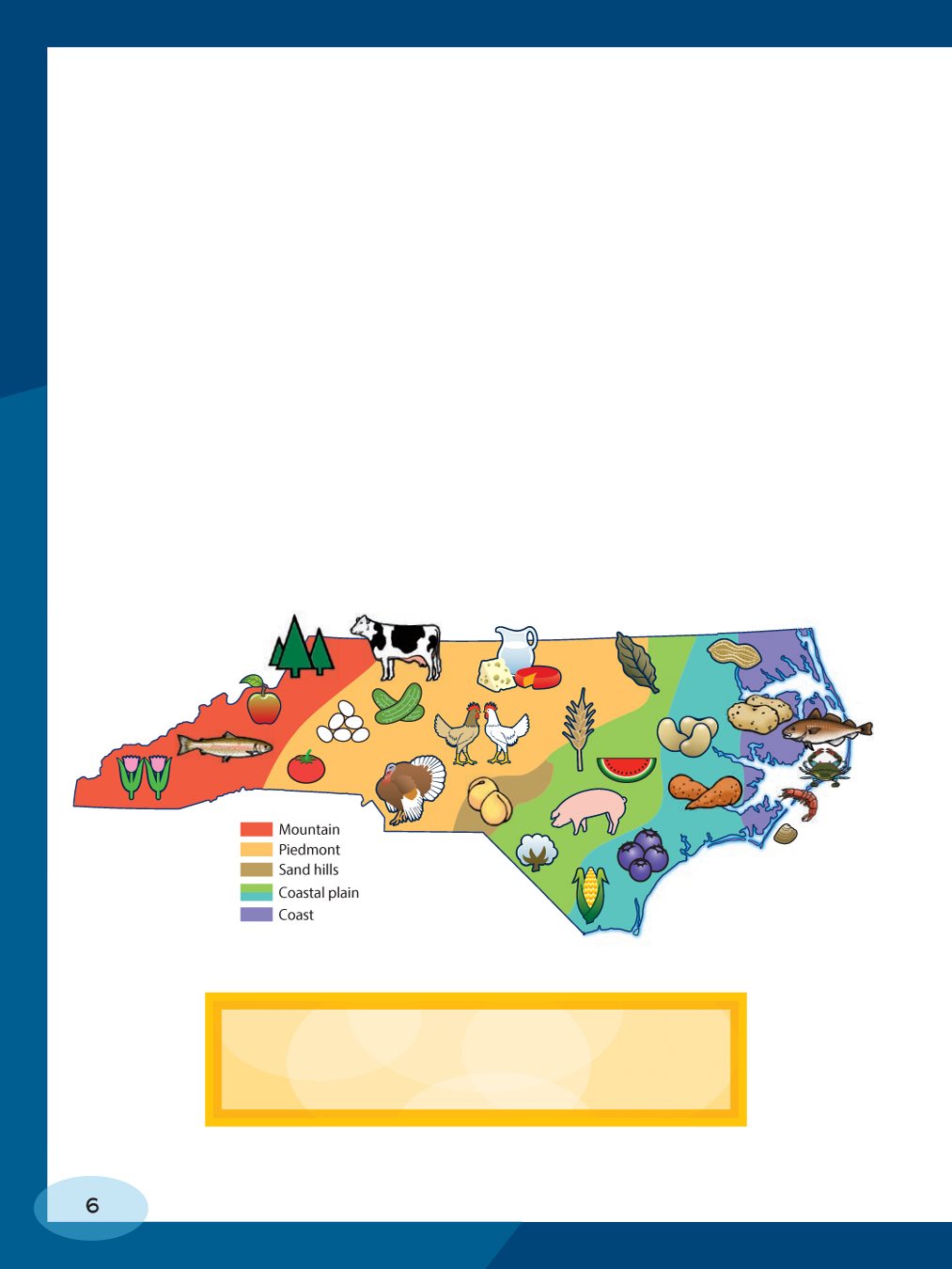
This map of North Carolina shows what
agricultural products come from the state.
Each picture stands for a different product.
The crops or resources a place has and how people
earn money are often related. For example, if a resource
map shows that a lake has lots of fish in it, then families
may decide to travel there to fish. That brings tourism
to the area. Tourism is the business of providing places
to stay, food to eat, and hospitality to people who visit an
area. People who visit a fishing area may rent a cabin
there, eat at local restaurants, and hire a local fishing
guide. This brings in tourism dollars.
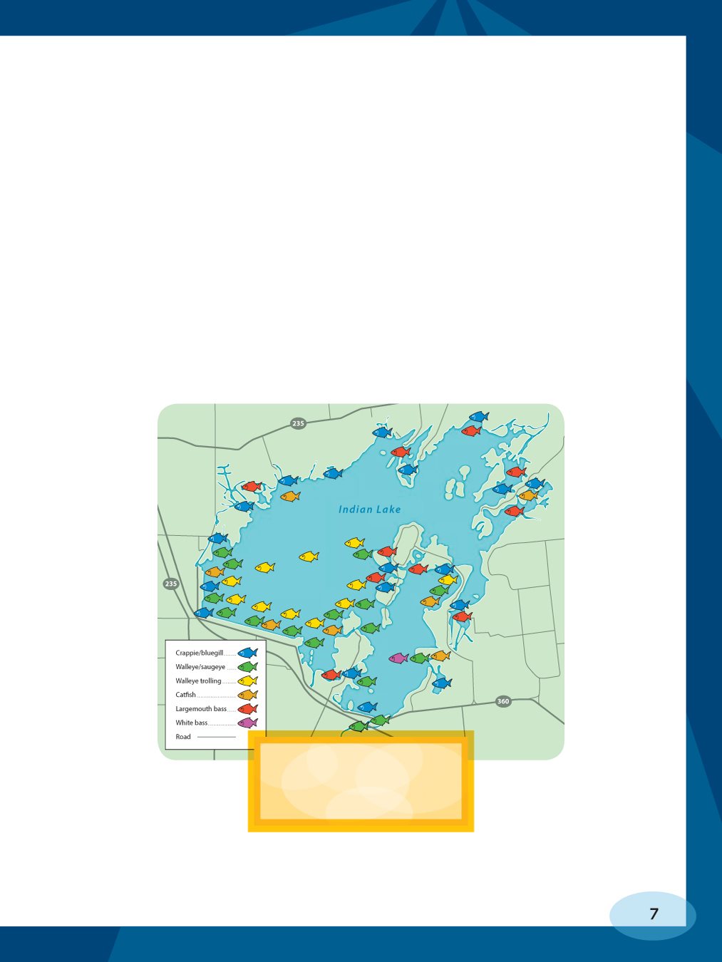
This is a map of
fishing spots in
Indian Lake, Ohio.
Early Resource Maps
No one knows for sure, but the first resource
maps probably showed where to hunt. Can you
guess why this was important for people to know?
Its because their survival depended on knowing
the location of animals they could hunt for food.
Hunting was a common topic in early art as well.
This shows that hunting mattered a great deal to
many early peoples.
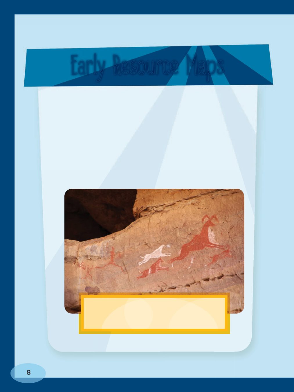
Hunting is the topic of this rock
painting in Libya. Why is hunting such
a common topic in early maps and art?
How Else Can Economic and Resource Maps Help?
Economic and resource maps can help you understand
how a certain topic say, farming is connected to a
certain place. They help you see what activities might
be common in an area. They can also help you make a
decision about a topic. If you want to pick apples at an
orchard in your state, an economic and resource map can
show you where in your state the most apples grow.
You wouldnt use an economic or resource map to
find your way to Buffalo, New York. But if you want to
learn what minerals
are mined in China
or where to find the
state park nearest
to your home, then
reach for an economic
or resource map!
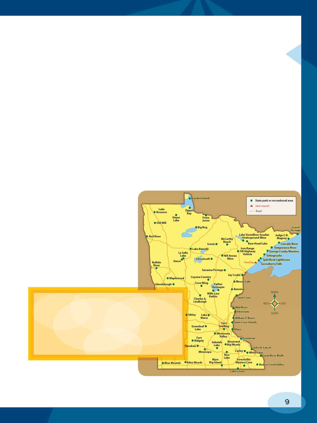
This map shows state parks and
recreation areas in Minnesota. Which
ones might you visit if you lived in
southeastern Minnesota? (Hint: The
compass rose on the right shows
which way is southeast.)
Chapter
WHATS ON ECONOMIC
AND RESOURCE MAPS?
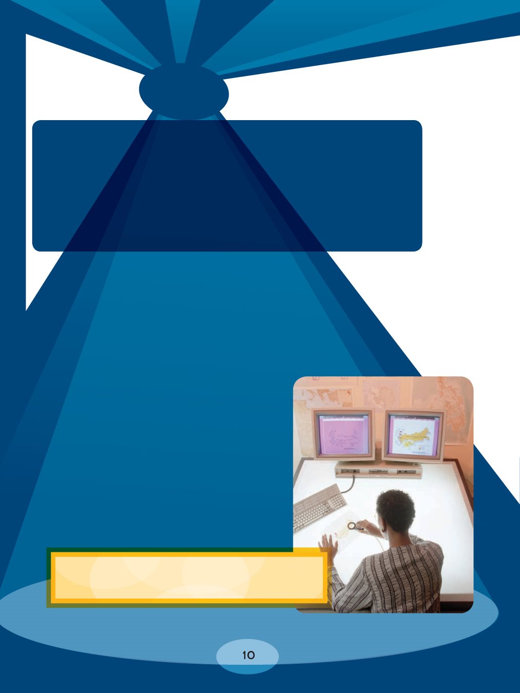
Cartographers are people who
make maps. They try to put
correct and current information on
their maps. They use facts

