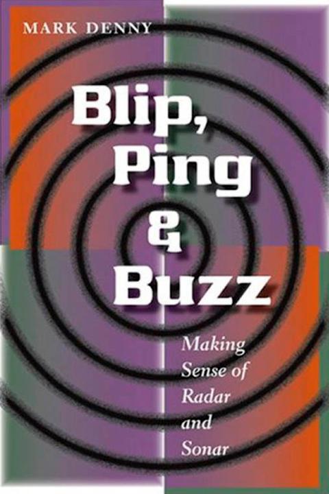
MARK DENNY
..........Making Sense of Radar and Sonar


To Bill Denny and his brother: two engineers who tried to teach me the value of practical things
I am grateful to the following individuals and organizations for providing me with excellent images: Prof. Brock Fenton, Captain Jerry Mason, Barry Stewart, Stephen Wilkinson; The Battle of Britain Historical Society (United Kingdom), Institute for Ocean Sciences (Canada), Klein Associates (United States), NASA, Shannon Dolphin and Wildlife Foundation (Ireland), U.S. Air Force, U.S. National Archives, U.S. Navy. For helping to create this book, I thank Trevor Lipscombe, Martha Sewall, and Nancy Wachter of the Johns Hopkins University Press.
!4#][4t tciIPd! .
Every author should explain to his readers, up front, what the book they hold in their hands is about and what it is not about. After all, if you are to invest some hard-earned cash in buying this book and a lot of time in reading it, then you naturally want to know whether the subject is of interest. The quick explanation, expanded over the next few paragraphs, is this: my book describes the ideas behind radar and sonar signal processing. I will use nonmathematical language (as far as possible) to explain the techniques of image processing and the physics behind human and nonhuman remote sensing.
Certain whales and dolphins can echolocate, as can a large family of bats; this means they provide nature's contribution to remote sensing. Humans have developed the rest: radar systems based on land and on surface ships, and inside civilian and military aircraft; sonar systems housed in ships and submarines; and both radar and sonar in remotely operated vehicles. "Blip," in the title, is the engineer's word for the pulse sent out by a radar transmitter. "Ping" is the sonar engineer's equivalent, and "buzz" is the noise made by echolocating bats.
The most advanced remote-sensing system today is what I'll call the MB800 family of airborne sonar processors (described in chapter 5). These machines have a processing capability that in some ways exceeds that of better-known sensors, such as the massive Airborne Warning and Control System (AWACS) "eye in the sky" airborne radar system, yet the MB800 central processor weighs less than half a gram, and a whole airframe can fit in a cigarette pack. The capabilities of the MB800s, and of the much cruder early radars (such as the Chain Home system that saved Britain during World War II, described in chapter 1) are outlined here and placed in historical and technological context.
I do not intend to write a textbook, though this book may well be read as a supplementary text. I am guessing that you are a technology buff who has wondered from time to time how radar or sonar works. Or perhaps you are a student who needs to know what remote sensors can do, but not every last detail of how they do it. You do not have the time or inclination to work through a degree in radar engineering, but you have been left unsatisfied by the comic-book explanations occasionally proffered in newspapers. You probably don't want to read several hundred pages of dense mathematics (and, believe me, a detailed treatment of signal processing gets very mathematical, very quickly). Anyway, the subject matter of remote sensing is cross-disciplinary, so I would need to write several academic tomes to cover it all, on optics and acoustics, engineering and signal processing, mathematics and statistics. So from the beginning I, as author, am faced with a conundrum: how can I convey to you a very technical subject in nonmathematical language, without jettisoning the central ideas? Also, some of you will harbor unreasonable prejudices against, say, statistics, considering it to be dry as dust or dull as ditchwater.
Happily, there is a way for me to get across to you the important ideas that underpin remote sensing without being dull or excruciatingly technical. The result is, though I say so myself, a unique read. I am unaware of any other book that broaches our subject with a light yet accurate touch. I feel like the chef who is pleased with himself (puffed up like one of his pastries, you might say), having created an airy yet substantial souffle, tasty and satisfying, fluffy but not frivolous. Enough bragging, I hear you mutter: tell its how. Well, remote sensing is unique in that many of the fundamental ideas can be conveyed with a few simple diagrams. The math behind such diagrams may be (often is) horrendous, but the core idea can be conveyed with clarity without math. I know of no other technical subject where so much of the foundations can be elucidated by this approach. My guess as to why remote sensing lends itself to a pictorial explanation? It is at bottom a geometrical subject. Even the signal processing is geometrical, since the aim of remote sensing is to form an image, a picture. So, in the following pages you will find many diagrams; these combined with a few paragraphs of text will get across complex ideas, such as superposition and aliasing, correlation and integration, phased arrays and beamforming. From these bricks, we can build the cathedrals of AWACS and MB800, as you will see.
There are a few mathematical equations in this hook, but not many. Those of you who shy away from equations as horses shy from rattlesnakes need not despair: you will be warned in advance when an equation is lurk ing in the scrub, and these equations will have their stings drawn -they will be tame and friendly. Cuddly, even. To be entertaining as well as informative, I have also chosen with care a number of the examples to illustrate a given point There is no excuse for an author who writes a dull page about, say, radar clutter, when so many amusing, historically relevant, and informative examples are at hand. Read on.
Seeing and Hearing
and is reflected back to a receiver. The wonders of signal processing then turn the jumble of received signals into an image. That is the essence of remote sensing.
The transmitted radiation consists of electromagnetic (EM) waves for radar and sound waves for sonar. These waves are very different in nature, but the signal processing of them is similar; many of the techniques used in forming radar images are also applied in sonar signal processors. The crucial factor, as we will see, is that the radiation consists of waves. The EM spectrum spreads from very short wavelength cosmic rays to very long wavelength, low-frequency radio waves, and includes visible light, infrared and ultraviolet waves, and microwaves. For reasons I will explore later on, only a small fraction of this spectrum is suitable for remote sensing. Most modern radars use microwaves, with wavelengths typically 0.3-100 cm (1 inch = 2.54 cm). An exception is the laser range finder, which utilizes infrared wavelengths. The wavelengths used by sonar transmitters-in air and water-are usually much shorter (i.e., higher frequency) than those we humans can hear.

