IMAGES
of America
THE LINCOLN HIGHWAY
ACROSS ILLINOIS
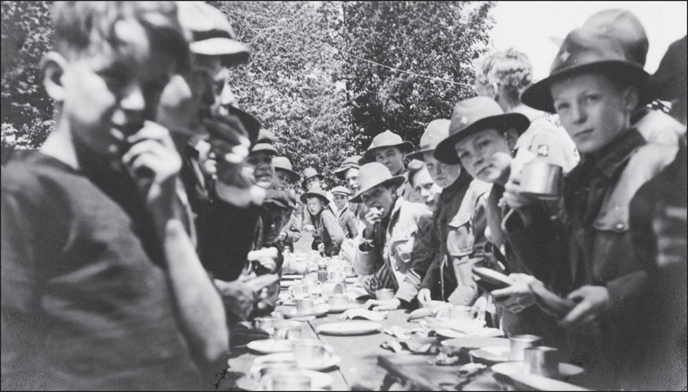
Affectionately known as The Main Street Across America, the Lincoln Highway has inspired many tourists, travelers, and towns along the coast-to-coast roadway to keep the legacy of Carl Fishers pioneering spirit alive. Since his death in 1939, the Lincoln Highway has remained a persistent memory in the minds of many. One such reminder of the old road is a few of the original Boy Scout markers that can still be found in places along the route. This image of the Boy Scouts enjoying some lunch after working hard along the highway in Illinois helps to show how important this old roadway has been to every citizen in the nation. (Courtesy of the University of Michigan.)
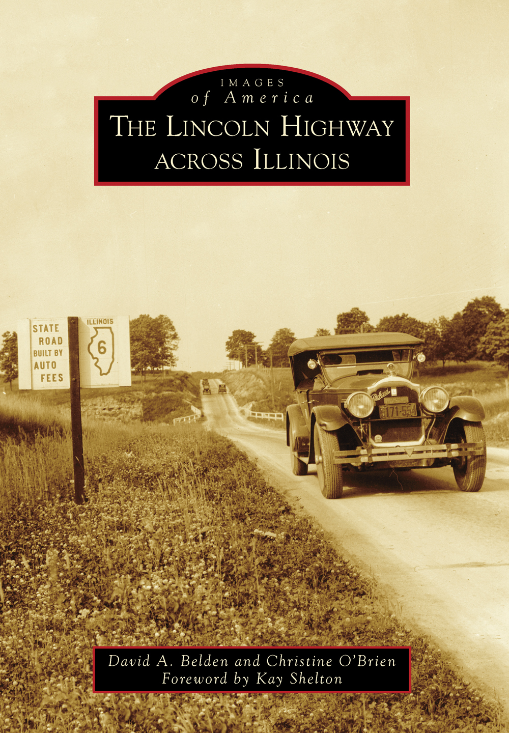
ON THE COVER: Much like the automobile assembly line transformed the nature of the workplace, the automobile revolutionized the entire transportation system in America. By the end of the 1930s, cars, trucks, and buses had almost completely replaced the horse-drawn vehicles that were still commonplace a generation before. To accommodate the increase in traffic, thousands of miles of new roads were built during the 1920s, and other routes, including the Lincoln Highway, were improved. This image shows an automobile along the Lincoln Highway about a mile west of Franklin Grove. Notice the sign to the left that indicates that this section of roadway was built by auto fees. (Courtesy of the University of Michigan.)
IMAGES
of America
THE LINCOLN HIGHWAY
ACROSS ILLINOIS
David A. Belden and Christine OBrien
Foreword by Kay Shelton

Copyright 2013 by David A. Belden and Christine OBrien
ISBN 978-0-7385-9358-6
Ebook ISBN 9781439644430
Published by Arcadia Publishing
Charleston, South Carolina
Library of Congress Control Number: 2013933263
For all general information, please contact Arcadia Publishing:
Telephone 843-853-2070
Fax 843-853-0044
E-mail
For customer service and orders:
Toll-Free 1-888-313-2665
Visit us on the Internet at www.arcadiapublishing.com
CONTENTS
ACKNOWLEDGMENTS
The publication of this book would not have been possible without the assistance and support of Kay Shelton and the Illinois Chapter of the Lincoln Highway Association. Area historical repositories and residents also provided help, material, and support: the University of Michigan and the Lincoln Highway Digital Image Collection; Michigan State University Libraries; the Will County Historical Society; Kim Shehorn-Martin, Joliet Historical Museum; Sam and Lynn Reichert; Patricia Thomson; Robert Horras; and Russell S. Rein. A large portion of the vintage and archival Lincoln Highway images used in this publication came from the Transportation History Collection of the Special Collections Library at the University of Michigan.
Several people at Minooka Community High School have also been helpful with local histories, materials, equipment, and expertise, and to the following individuals I am grateful: Debbie Dobson, Karen Turk, Glenda Smith, Dave DiLorenzo, Robert Williams, Stephanie Ledesma, Sherry Harris, and especially Christine OBrien for helping decide on the cover image. I also want to thank Lisa Wright and Evangeline Stephenson for assisting me with obtaining the research for this book. Both were extremely helpful in organizing and securing materials throughout the project. I also want to thank Jen Gabel for her time and help in obtaining images around Aurora.
I would also like to especially thank Russell S. Rein for his time and assistance in providing background material, images, and guidance on this project. This book would not have been possible without the use of Reins digital collections. And a very special thank you to Christine OBrien for providing numerous contemporary images of the Lincoln Highway and for providing her time, input, expertise, patience, and friendship in helping to proofread and edit the text for this book. For that I am grateful.
The production and preparation for this book would never have been possible without the dedication of students in my local history classes. I wish to thank Aaron Alexander, Camille Arroyo, Mishel Daletski, Ryan Fleming, Nicolette Krzywanos, Tara OShea, Gary Parker, Ian Pershey, Rico Sally, Macey Scranton, Joseph Sheppard, Jessica Smeets, Victor Turpin, Chad Van Meter, and Dylan Warnicke.
Finally, I wish to acknowledge the help and assistance of Jeff Ruetsche, Amy Perryman, and Kelsey Jones at Arcadia Publishing. Thank you for all your time and support on this publication. I also would like to thank Paige Stratemeyer, who originally had the idea for a Lincoln Highway book across Illinois.
FOREWORD
Close your eyes and imagine what it was like to drive an automobile 100 years ago. Many roads were made of dirt that turned into a sticky mud after a rain. Some roads had planksflat boards laid across dirt. Imagine what the automobile was like 100 years ago; many had no roof nor headlights. In an open car with no roof, drivers and passengers wore goggles to keep the grit and dust out of their eyes and long coats called dusters to keep the dust from damaging their clothing. Early automobiles had no air-conditioning, no heat, and no radios. Flat tires were common without paved roads and before technological improvements in tire design.
In those early days of the automobile, the Lincoln Highway became the first coast-to-coast highway in the United States developed on improved roads. Established in 1913, the Lincoln Highway stretches from Times Square, New York City, to the shadow of the Golden Gate Bridge in San Francisco. Envisioned by Carl Graham Fisher, the Lincoln Highway is the worlds largest memorial to Pres. Abraham Lincoln. Fisher was an entrepreneur involved with manufacturing headlights for automobiles, he developed the idea of the Indianapolis Motor Speedway and owned it with partners, he drove the first pace car for the Indianapolis 500 in 1911, and he was an early promoter of Miami Beach in Florida.
Partnering with other automobile industry pioneers like Henry Joy, president of the Packard Motor Company, and Frank Seiberling, cofounder of the Goodyear Tire & Rubber Company, Fisher imagined a coast-to-coast highway to show the public that it would be possible for people to drive automobiles across long distances. Fisher also knew the key to encouraging more people to buy automobiles was having good roads. Who would want to drive an automobile on muddy roads? The Lincoln Highway Association (LHA) formed to organize mapping out a route from New York City to San Francisco for the Lincoln Highway and to gather private donations to be used for road improvements. The goal was to have the highway finished in time for travelers to use it to attend the Panama-Pacific International Exposition in San Francisco, otherwise known as the 1915 Worlds Fair.
In 1913, very few roads were paved, so not everyone in the general public outside large cities had first-hand knowledge of the benefits of driving on paved roads instead of dirt roads. Paving over 3,300 miles of road could not be done overnightit would take too much labor and financial funding, so the LHA constructed Seedling Miles. The Seedling Miles were meant to show samples of how pleasant driving an automobile could be compared to getting stuck in the mud. The LHA chose particularly muddy sections to pave with concrete. Paving a mile-long section gave automobile owners the experience of driving on a good road.
Next page

