Your Guide to Arches National Park, First Edition (electronic)
ISBN: 978-1-62128-028-6
Published by: Stone Road Press
Author/Cartographer/Photographer/Designer: Michael Joseph Oswald
Editor: Derek Pankratz
Copyright 2012 Stone Road Press, LLC, Whitelaw, Wisconsin. All rights reserved. No part of this publication may be reproduced, stored in a retrieval system or transmitted in any form or by any means, electronic, mechanical, photocopying, recording, scanning or otherwise without written permission of the Publisher. Requests for permission should be addressed to Stone Road Press; c/o Michael Oswald; 4927 Stone Road; Whitelaw, WI 54247.
The entire work, Your Guide to the National Parks is available in paperback and electronic versions. Content that appears in print may not be available electronically.
Paperback ISBN: 978-1-62128-000-2
Library of Congress Control Number (LCCN): 2012934277
Printed in the United States of America
E-Book ISBN: 978-1-62128-065-1
Corrections/Contact
This guide book has been researched and written with the greatest attention to detail in order to provide you with the most accurate and pertinent information. Unfortunately, travel informationespecially pricingis subject to change and inadvertent errors and omissions do occur. Should you encounter a change, error, or omission while using this guide book, wed like to hear about it. (If you found a wonderful place, trail, or activity not mentioned, wed love to hear about that too.) Please contact us by sending an e-mail to . Your contributions will help make future editions better than the last.
You can contact us online at www.StoneRoadPress.com or follow us on
Facebook: www.facebook.com/thestoneroadpress
Twitter: www.twitter.com/stoneroadpress (@stoneroadpress)
Flickr: www.flickr.com/photos/stoneroadpress
FAQs
The world of electronic media is not cut and dry like print. Devices handle files differently. Users have a variety of expectations. These e-books are image- and map-intensive, requiring fairly powerful hardware. All books were tested for use on the Kindle Fire, Nook Tablet, and iPad. You can expect to have the best user experience on one of these devices, or a similar tablet, laptop, or desktop. In the event you have issues please peruse our Frequently Asked Questions (.
Maps
Numerous map layouts were explored while developing this e-book, but in the end it was decided that the most useful map is a complete one. Unfortunately, due to file size concerns and e-reader hardware limitations, some maps included in this guide book are below our usual high standards of quality (even using zoom features). As a workaround all of this books maps are available in pdf format by clicking the link below each map or visiting www.stoneroadpress.com/national-parks/maps .
Disclaimer
Your safety is important to us. If any activity is beyond your ability or threatened by forces outside your control, do not attempt it. The maps in this book, although accurate and to scale, are not intended for hiking. Serious hikers should purchase a detailed, waterproof, topographical map. It is also suggested that you write or call in advance to confirm information when it matters most.
The primary purpose of this guide book is to enhance our readers national park experiences, but the author, editor, and publisher cannot be held responsible for any experiences while traveling.
Arches - Introduction
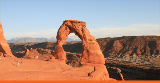
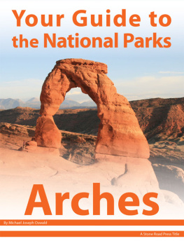
Delicate Arch
The only arches you see on a typical family vacation are golden, raised high above the ground, advertising the ubiquitous fast-food chain. But in southeast Utah, high atop the Colorado Plateau, is a collection of more than 2,500 natural sandstone arches, colored striking shades of pink, orange, and red. Standing tall, they frame the surrounding mountains. These natural advertisements are just as good at capturing the attention of passersby, but they have nothing to sell. In fact, all they do is give. They give inspiration to the many guests who come to admire Mother Natures patient handiwork.
Patient is a gross understatement; these fragile features began forming more than 300 million years ago . First a massive sea covering the region evaporated, depositing a salt bed thousands of feet thick in some places. During the Uncompahgre Uplift , rivers and streams buried the salt beds with debris and sediment. Desert conditions of the early Jurassic period led a layer of Navajo sandstone to be covered by a layer of Entrada sandstone (the substrate of most arches). But before sandstone could be sculpted by wind, water, and ice it was buried by another 5,000 feet of sediment. The weight of material caused lower salt beds to heat up and liquefy. Layers of rock became unstable. Faulting occurred and plumes of less dense liquefied salt penetrated the upper layers of rock forming salt domes. Domes provided a curve to sections of sandstone. Years of erosion wore away the surface sediment, eventually exposing the underlying sandstone. Water seeped into cracks in its surface, gradually enlarging them until walls of sandstone called fins were left, isolated from one another. As wind and water continued to work on these fins, the salt bed layer wore away faster than sandstone. Water, collected in joints and fissures, freezing and expanding it caused chunks of rock to flake and crumble. Many fins collapsed into piles of rubble. Others formed magnificent arches that continue to be sculpted by wind, water, and ice. But these too will concede to erosion and gravity. Since 1970, 43 arches have collapsed within the park.
The first inhabitants werent all that interested in seeing sandstone arches. More than 10,000 years ago nomadic people came to the region hunting and gathering. Until 700 years ago Fremont People and Ancestral Puebloans lived here, growing crops of maize, beans, and squash. Just as they picked up and moved south Paiute and Ute Indians moved in. Spanish missionaries encountered natives in the late 1700s while searching for a route between Santa Fe and Los Angeles. In 1855 European Americans settled in the region. Mormons established Elk Mountain Mission, but difficult farming and disputes with Native Americans led them to abandon their settlements. By the 1880s, ranchers , farmers , and prospectors were trickling into the area. John Wesley Wolfe , a Civil War veteran, was among them. He built a small ranch along Salt Wash with his son in 1898, which is still preserved in its original location near present-day Delicate Arch Trailhead.
It wasnt until 1911 that locals began to understand the recreational value of the area. Loren Bish Taylor , a local newspaperman, and John Doc Williams , Moabs first doctor frequented the area, marveling at these sandstone formations. Bish wrote about the natural wonders just north of Moab. Eventually, publicity grew to the point that Denver and Rio Grande Western Railroad and the federal government took notice. Both parties were impressed, and in 1929 President Hoover signed legislation creating Arches National Monument. In 1971, Congress redesignated it as a national park. Its an eroded landscape protected from man, but not from nature, and the landscapes are constantly changing. Changes unnoticed by the average visitor. Visitors drawn to and inspired by grand natural landmarks millions of years in the making.
Backpacking (ARCH)
Dont let the parks small size fool you. You can only get a few miles away from paved roads and developed areas, but theres more than enough land to escape the crowds and find the perfect location for a night under the stars. There are no designated trails or campsites in the backcountry, and there are no reliable sources of water.
Next page
