Published in 2020 by The Rosen Publishing Group, Inc. 29 East 21st Street, New York, NY 10010
Copyright 2020 by The Rosen Publishing Group, Inc.
All rights reserved. No part of this book may be reproduced in any form without permission in writing from the publisher, except by a reviewer.
First Edition
Editor: Sarah Machajewski
Book Design: Tanya Dellaccio
Photo Credits: Cover Education Images/Universal Images Group/Getty Images; p. 5 THEPALMER/ DigitalVision Vectors/Getty Images; p. 5 Keystone/Hulton Archive/Getty Images; p. 6 Time & Life Pictures/ The LIFE Picture Collection/Getty Images; p. 7 Science & Society Picture Library/SSPL/Getty Images; p. 8 https://upload.wikimedia.org/wikipedia/commons/6/65/Alfred_Wegener_ca.1924-30.jpg; p. 9 bortonia/DigitalVision Vectors/Getty Images; p. 11 (top) FrankRamspott/DigitalVision Vectors/ Getty Images; p. 11 (bottom) Designua/Shutterstock.com; p. 13 (bottom) Dan Shugar/Aurora/Getty Images; pp. 13 (top), 29 Vixit/Shutterstock.com; p. 15 Olga Danylenko/Shutterstock.com; p. 17 (top) Taylor Weidman/LightRocket/Getty Images; p. 17 Boris Rezvantsev/Shutterstock.com; p. 19 ET1972/Shutterstock.com; p. 21 (top) Westend61/Getty Images; p. 21 bottom) Nigel Killeen/Moment/Getty Images; p. 23 Godong/Universal Images Group/Getty Images; p. 25 (top) Alex Treadway/National Geographic/Getty Images; p. 25 (bottom) Jason Maehl/Moment/Getty Images; p. 27 maps4media/Getty Images News/Getty Images; p. 30 Daniel Prudek/Shutterstock.com.
Library of Congress Cataloging-in-Publication Data
Names: Tolli, Jenna, author.
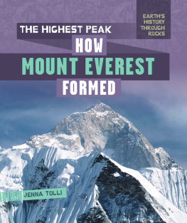
Title: The highest peak : how Mount Everest formed / Jenna Tolli.
Other titles: How Mount Everest formed
Description: New York : PowerKids Press, [2020] | Series: Earths history through rocks | Includes index.
Identifiers: LCCN 2018049464| ISBN 9781725301443 (pbk.) | ISBN 9781725301467 (library bound) | ISBN 9781725301450 (6 pack)
Subjects: LCSH: Everest, Mount (China and Nepal)--Juvenile literature. | Geology--Everest, Mount (China and Nepal)--Juvenile literature.
Classification: LCC DS495.8.E9 T65 2020 | DDC 555.496--dc23
LC record available at https://lccn.loc.gov/2018049464
Manufactured in the United States of America
CPSIA Compliance Information: Batch #CSPK19. For Further Information contact Rosen Publishing, New York, New York at 1-800-237-9932.
THE HIGHEST PEAK ON EARTH
Where is the highest peak in the world? Its at the top of Mount Everest! This huge mountain is part of the Himalayas, a mountain range that spreads across six countries in Asia and is about 1,500 miles (2,414 km) long. There are over 110 mountain peaks in this range. Mount Everest, located on the border of Tibet and Nepal, is the highest peak.
The weather on Mount Everest is extremely cold. Even in the warmest months, the temperature is still below freezing at a bitter -2 Fahrenheit (-19 Celsius). Wind speeds at the summit are very fast, too. They average around 100 miles (161 km) per hour, but the highest winds have been recorded at 175 miles(281.6 km)per hour.
DIFFERENT MEASUREMENTS
Scientists disagree on the exact height of Mount Everest. The snow level at the peak changes, and different methods of measuring can provide different results. Scientists have also questioned whether recent destructive earthquakes in Nepal have changed the height of the mountain. At this time, Nepal and China agree that the current height is around 29,029 feet (8,848 m).
READING THE ROCKS
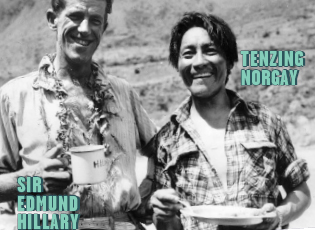
SIR EDMUND HILLARY AND TENZING NORGAY WERE THE FIRST EXPLORERS TO REACH THE SUMMIT OF MOUNT EVEREST. THEY CLIMBED TO THE TOP TOGETHER ON MAY 29, 1953.
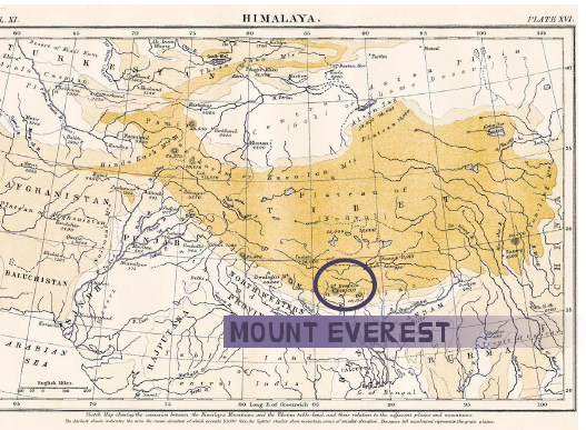
The summit of Mount Everest is about 5.5 miles (8.9 km) above sea level. Scientists estimate that it grows up to 0.4 inch (1 cm) taller a year!
SIR EVEREST
Mount Everest is named after Sir George Everest, who was the British surveyor general of India from 1830 to 1843. His job was to survey, or measure, different landforms and the distances between them so that maps could be made for future travelers. When he stopped working in 1843, Andrew Scott Waugh took his place to continue the project.
During their survey, Waugh and his team came across the mountain we now know as Mount Everest. At the time, the mountain was known as Peak XV.The team preferred to use the local names for landforms, but Waugh and his team werent aware of another name for Peak XV. He suggested it be named Mount Everest to honor Sir Everest. The name was officially approved in 1865.
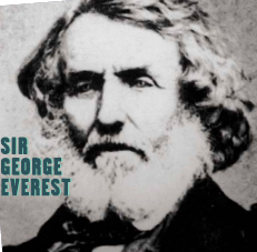
Its unknown if Sir Everest ever saw Mount Everest in person. Some sources say it would have been unlikely, since he retired before the survey team went to Nepal.
READING THE ROCKS
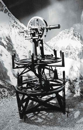
A THEODOLITE IS A TOOL THAT SURVEYORS USE TO VIEW PLACES IN THE DISTANCE AND MEASURE THE ANGLES BETWEEN THEM. WHEN WAUGH AND SIR EVEREST WERE COMPLETING THEIR SURVEYS IN THE MID-1800S, THEODOLITES WEIGHED OVER 1,000 POUNDS (453.6 KG)!
DIFFERENT NAMES
Although Waugh and his team didnt know it, there were local names for Mount Everest in Tibet and Nepal. In Tibet, the mountain was known as Chomolungma, which means Goddess Mother of Mountains. In Nepal, people call it Sagarmatha, which means Peak of Heaven. The rest of the world, however, now refers to it as Mount Everest.
MOVING CONTINENTS
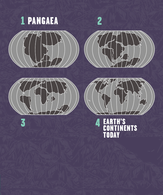
How did something as majestic as Mount Everest form? Looking at a map could give you a clue. You may notice that some continents look like they could fit together like a puzzle. That may have been what Earth looked like 200 million years ago. It looked very different than it does today.
Scientists believe that almost all Earths continents were once connected as a supercontinent called Pangaea. This name comes fromThe answer to why the continents eventually moved a Greek word that mea s all the Earth.
The answer to why the continents eventually moved apart can be found under Earths surface. Earth is made of different layers that go miles deep under the ground. Geological processes that happen in these layers explain how the continents became separated millions of years ago.

Alfred Wegener, a German meteorologist, first proposed the idea of Pangaea in 1912 as part of his theory on continental drift.

