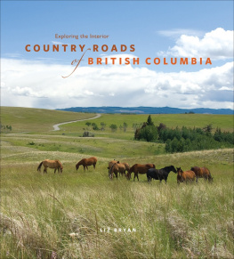
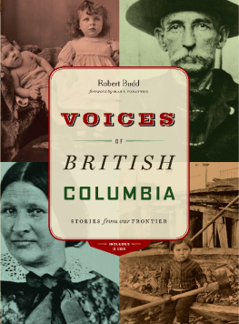
Bryan - Exploring the Interior: country roads of British Columbia
Here you can read online Bryan - Exploring the Interior: country roads of British Columbia full text of the book (entire story) in english for free. Download pdf and epub, get meaning, cover and reviews about this ebook. City: British Columbia;Surrey;B.C, year: 2011;2010, publisher: Heritage House, genre: Detective and thriller. Description of the work, (preface) as well as reviews are available. Best literature library LitArk.com created for fans of good reading and offers a wide selection of genres:
Romance novel
Science fiction
Adventure
Detective
Science
History
Home and family
Prose
Art
Politics
Computer
Non-fiction
Religion
Business
Children
Humor
Choose a favorite category and find really read worthwhile books. Enjoy immersion in the world of imagination, feel the emotions of the characters or learn something new for yourself, make an fascinating discovery.

- Book:Exploring the Interior: country roads of British Columbia
- Author:
- Publisher:Heritage House
- Genre:
- Year:2011;2010
- City:British Columbia;Surrey;B.C
- Rating:4 / 5
- Favourites:Add to favourites
- Your mark:
Exploring the Interior: country roads of British Columbia: summary, description and annotation
We offer to read an annotation, description, summary or preface (depends on what the author of the book "Exploring the Interior: country roads of British Columbia" wrote himself). If you haven't found the necessary information about the book — write in the comments, we will try to find it.
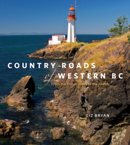
Join Liz Bryan on 18 picturesque journeys through the diverse landscapes of the British Columbia Interior. Winding through sagebrush and forest, grassland plateaus and mountain valleys, beside river canyons and multicoloured volcanic rocks, these road trips reveal the rich variety of the provinces geology and natural history and show how the strands of human history are closely interwoven with the land. First Nations, fur traders, explorers, gold miners, ranchers and homesteadersall have left their mark.
Country Roads of British Columbia is an invitation to celebrate the provinces scenic heartland and to learn a little of the history of this westernmost province. Driving instructions and maps complement the text, and Bryans colour photographs show just how beautiful British Columbia is.
Bryan: author's other books
Who wrote Exploring the Interior: country roads of British Columbia? Find out the surname, the name of the author of the book and a list of all author's works by series.


Exploring the Interior: country roads of British Columbia — read online for free the complete book (whole text) full work
Below is the text of the book, divided by pages. System saving the place of the last page read, allows you to conveniently read the book "Exploring the Interior: country roads of British Columbia" online for free, without having to search again every time where you left off. Put a bookmark, and you can go to the page where you finished reading at any time.
Font size:
Interval:
Bookmark:
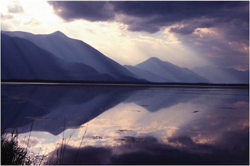
Kootenay evening
of BRITISH COLUMBIA
Exploring the Interior
LIZ BRYAN
![]()
Copyright 2008 Liz Bryan
All rights reserved. No part of this publication may be reproduced, stored in a retrieval system or transmitted in any form or by any meanselectronic, mechanical, audio recording or otherwisewithout the written permission of the publisher or a photocopying licence from Access Copyright, Toronto, Canada.
Published by Heritage House Publishing in 2008 in paperback with
ISBN 978-1-894974-43-1
This electronic edition was released in 2011.
e-pub ISBN 978-1-926613-03-1
e-pdf ISBN: 978-1-926613-38-3
Edited by Marial Shea
Proofread by Karla Decker
Maps by Darlene Nickull
Photographs by Liz Bryan
Heritage House acknowledges the financial support for its publishing program from the Government of Canada through the Canada Book Fund (CBF), Canada Council for the Arts and the province of British Columbia through the British Columbia Arts Council and the Book Publishing Tax Credit.

www.heritagehouse.ca
Discovered by Europeans little more than 200 years ago, British Columbia still retains most of its wilderness and wildlife and, fortunately, much of its Native heritage. While the entire province is amazingly beautiful, the B.C. Interior, east of the Coast Range, is considered the most scenic. It is also the most ecologically diverse, with icy alpine peaks, warm lakeshores, meadows, forests, semi-deserts, sagebrush grasslands and badlands. With some of the deepest lakes, longest rivers, highest mountains and lowest valleys, this is indeed a most extraordinary land.
The great variety of the provinces landforms and the strong northsouth trend of its major features can be explained in part by the way the province was formed. In geological terms, B.C. is not one land but several, created over unimaginable time from strings of volcanic islands, formed far out in the Pacific Ocean and borne eastward by relentless tectonic forces. Crushed onto the bones of ancestral North America, the island continents (geologists call them terranes) were pushed up and folded into mountain ranges. With each arrival, B.C.s landmass increased and, where each new terrane joined the existing land, the weaker seams between them became valleys, which later filled with ice, rivers and lakes. Over the millennia, volcanic activity, glaciers and erosion modified B.C.s bare bones, but the separate island terranes, in northsouth blocks like pieces of a patchwork quilt, can usually still be recognized.
Any map of B.C. clearly reveals this strong northsouth alignment of mountains and valleys, a topographic inconvenience for road and railway builders who pushed west to connect B.C. to the rest of Canada. The Trans-Canada Highway and Highway 3, both of which head from the coast across the Rockies to Alberta and beyond, provide sinuous and undulating journeys, across several mountain ranges, from one terrane to another. In contrast, B.C.s early trails followed easier travel routes along the major river valleys. Fur traders were the first outsiders to forge paths through the wilderness, but it was the huge rush of gold miners to the Cariboo that first put B.C. in the international spotlight and attracted later waves of resource developers and immigrants. It was their trails that opened up the land for settlement.
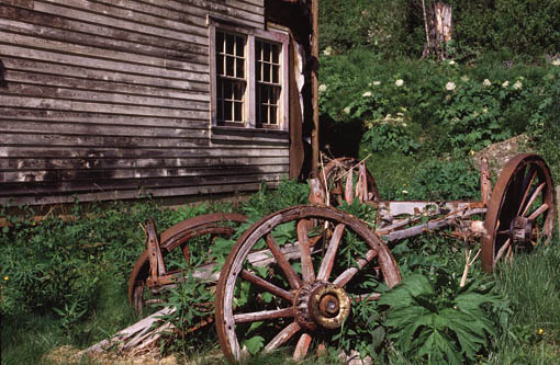
Barkerville wheels.
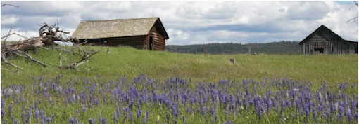
Todays cities, towns, villages, ranches and homesteads still lie mostly along the valley seams of B.C.s fractured landscapes and can trace their beginnings back to the mining boom days of the Victorian and Edwardian eras, the heyday of colonial expansionism and prideand missionary zeal. Of all the fine 19th-century buildings along the country roads of B.C., the pioneer churches are the most beautiful. All are wonderfully different, whether humble log structures or triumphs of elaborate architecture. Built with love and faith and huge community effort, they are well worth seeking out.
The country roads in this book traverse the provinces heartland where the landscapes are always lovely and sometimes breathtaking. Interwoven with strands of yesterday that lie along the highways and byways, the B.C. tapestry has become a lyrical fusion of landscape and history. This is indeed a beautiful province.
A final note: the maps in this book are for general reference; be sure you also have a good British Columbia road map. I also like to have on hand books in the Backroad Mapbooks series; they show all the roads, as well as topography and information on parks, trails and recreational possibilities. These spiral-bound books are widely available and can also be ordered online at www.backroadmapbooks.com.
Like gold rushes everywhere, the one that catapulted the infant colony of British Columbia into world headlines provoked a kind of madness. Men left their jobs and families and made long, difficult journeys to reach the land of possibilities, where a grubstake and a gold pan might be all they needed for instant riches. It was the giant lottery of the Victorian era. Men, most of them greenhorns, arrived in huge numbers at the small, staid colonial outpost of Victoriaand suddenly realized just how far away the goldfields were, through trackless mountains and across raging rivers, through thick forests and swamps, across wilderness where winters were unbearably cold and summers abuzz with flies and mosquitoes. But they pushed on, up the great river named for explorer Simon Fraser and into the depths of the Cariboo Mountains. And here, a few of themvery fewmade a fortune. Eventually, the colonial government scratched out trails and supply routes, most of them now todays highways. But some of the original trails remain as footpaths or unpaved country roads where, if you stop long enough to feel the vibrations of history, the greedy grubbing days of the gold rush, only 160 years away, can seem like yesterday.
Perhaps the best of the gold-rush routes, often known simply as the River Trail, follows the Fraser River from Lillooet to Williams Lake. North from Pavilion the road is mostly unpaved, likely muddy in spring and certainly dusty in deep summer. But driving this route though the hills and across the high sagebrush shoulders of the Fraser, youll experience a heady mix of landscape and history. Barkerville itself, the resurrected capital of the Cariboo camps, might well be the final destination for todays travellersas it was during the gold rushbut the journey there can be equally memorable.
Lillooet sits at the confluence of the Fraser River and boiling Cayoosh Creek on the site of an ancient Native fishing village. An old town, it stretches long and thin on a high river bench, one of the hottest spots in the province. In 1941, thermometers here topped 112F (44.4C). It was also a hot spot in the early days of the gold rush when the two main trails from the coast converged here. By 1860, with its main street peppered with 13 saloons, it sported a shifting population of 16,000. The town became Mile 0 on the Cariboo Trail, a designation that stayed even when it was later bypassed by the wagon road from Lytton along the Thompson River to Cache Creek. Most of the Mile Houses (stopping places) along this road (now Highways 1 and 97) still took their distance from Lillooet, though others were numbered from Yale or Ashcroft.
Next pageFont size:
Interval:
Bookmark:
Similar books «Exploring the Interior: country roads of British Columbia»
Look at similar books to Exploring the Interior: country roads of British Columbia. We have selected literature similar in name and meaning in the hope of providing readers with more options to find new, interesting, not yet read works.
Discussion, reviews of the book Exploring the Interior: country roads of British Columbia and just readers' own opinions. Leave your comments, write what you think about the work, its meaning or the main characters. Specify what exactly you liked and what you didn't like, and why you think so.