Gottfried - Maps of First Bull Run An Atlas of the First Bull Run (Manassas) Campaign
Here you can read online Gottfried - Maps of First Bull Run An Atlas of the First Bull Run (Manassas) Campaign full text of the book (entire story) in english for free. Download pdf and epub, get meaning, cover and reviews about this ebook. year: 2009, publisher: Savas Beatie, genre: History. Description of the work, (preface) as well as reviews are available. Best literature library LitArk.com created for fans of good reading and offers a wide selection of genres:
Romance novel
Science fiction
Adventure
Detective
Science
History
Home and family
Prose
Art
Politics
Computer
Non-fiction
Religion
Business
Children
Humor
Choose a favorite category and find really read worthwhile books. Enjoy immersion in the world of imagination, feel the emotions of the characters or learn something new for yourself, make an fascinating discovery.

Maps of First Bull Run An Atlas of the First Bull Run (Manassas) Campaign: summary, description and annotation
We offer to read an annotation, description, summary or preface (depends on what the author of the book "Maps of First Bull Run An Atlas of the First Bull Run (Manassas) Campaign" wrote himself). If you haven't found the necessary information about the book — write in the comments, we will try to find it.
The Maps of First Bull Run breaks down the entire operation (and related actions) into numerous map sets or action-sections enriched with more than fifty full-color original full-page maps. These cartographic originals bore down to the regimental and battery level and include the march to and from the battlefield and virtually every significant event in between. At least two--and as many as seventeen--maps accompany each action-section. Keyed to each piece of cartography is a full facing page of detailed text describing the units, personalities, movements, and combat (including quotes from eyewitnesses) depicted on the accompanying map, all of which make the story of First Bull Run come alive.
This original presentation makes it easy for readers to quickly locate a map and text on virtually any portion of the campaign. Readers will maneuver with Confederate and Union armies in the Shenandoah Valley, march with General McDowells Federals to the plains of Manassas, and fight blow-by-blow through the battle up to its stunning climax on Henry House Hill and the final retreat from the battlefield all the way to Washington. The smaller but important Battle of Balls Bluff is also covered in the same fashion, as is the skirmish at Lewinsville. Serious students will appreciate the extensive and authoritative endnotes, bibliography, and complete orders of battle. They will also want to bring the book along on their trips to the battlefields.
Perfect for the easy chair or for walking hallowed ground, The Maps of First Bull Run is a seminal work that, like his earlier Gettysburg study, belongs on the bookshelf of every serious and casual student of the Civil War.
About the Author: Bradley M. Gottfried, Ph.D., is the President of the College of Southern Maryland. An avid Civil War historian, Dr. Gottfried is the author of five books, including Brigades of Gettysburg: The Union and Confederate Brigades at the Battle of Gettysburg (2002) and The Maps of Gettysburg (2007). He is currently working with co-editor Theodore P. Savas on a Gettysburg Campaign encyclopedia.
Gottfried: author's other books
Who wrote Maps of First Bull Run An Atlas of the First Bull Run (Manassas) Campaign? Find out the surname, the name of the author of the book and a list of all author's works by series.


Maps of First Bull Run An Atlas of the First Bull Run (Manassas) Campaign — read online for free the complete book (whole text) full work
Below is the text of the book, divided by pages. System saving the place of the last page read, allows you to conveniently read the book "Maps of First Bull Run An Atlas of the First Bull Run (Manassas) Campaign" online for free, without having to search again every time where you left off. Put a bookmark, and you can go to the page where you finished reading at any time.
Font size:
Interval:
Bookmark:

2009 by Bradley M. Gottfried
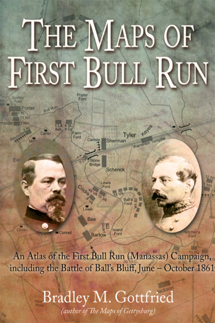
The Maps of First Bull Run: An Atlas of the First Bull Run (Manassas) Campaign, Including the Battle of Balls Bluff, JuneOctober 1861
All rights reserved. No part of this work may be reproduced, stored in a retrieval system, or transmitted, in any form or by any means, electronic, mechanical, photocopying, recording, or otherwise, without the prior written permission of the publisher. Printed in the United States of America.
Cataloging-in-Publication Data is available from the Library of Congress.
ISBN-13: 978-1-932714-60-9
eISBN: 978-1-61121-041-5
10 9 8 7 6 5 4 3 2
First Edition, First Printing

Published by
Savas Beatie LLC
521 Fifth Avenue, Suite 3400
New York, NY 10175
Editorial Offices:
Savas Beatie LLC
P.O. Box 4527
El Dorado Hills, CA 95762
Phone: 916-941-6896
(E-mail) editorial@savasbeatie.com
Savas Beatie titles are available at special discounts for bulk purchases in the United States by corporations, institutions, and other organizations. For more details, please contact Special Sales, P.O. Box 4527, El Dorado Hills, CA 95762. You may also e-mail us at sales@savasbeatie.com, or click over for a visit to our website at www.savasbeatie.com for additional information.
T he Civil War in general (and Gettysburg in particular) has long been the subject of deep interest and study for me. Over the years I have researched and written several books on the Gettysburg campaign, including The Roads to Gettysburg, The Brigades of Gettysburg, and The Artillery of Gettysburg. The completion of The Maps of Gettysburg (2006)the first book in what would become the bedrock of the Savas Beatie Military Atlas Seriesleft me at something of a crossroads: do I continue my Gettysburg studies or strike out in a new direction? Based upon the heavy feedback I have received, I decided to strike out on the latter course.
According to many readers of The Maps of Gettysburg, that books unique approach helped them gain a better understanding of campaign and battle than had more traditional approacheseven though they had studied it for many years and visited the field. Your book, my publisher and I often heard, helped unlock all the other Gettysburg titles I had in my library, and now I use your Maps book when I read the others. Comments like that are both humbling and deeply appreciated. From my own experience, I can understand how original maps placed opposite the text describing them can be helpful. Like nearly everyone who reads military history, even the most basic troop movements are difficult to follow and visualize without a good map.
Based upon the positive feedback and success of The Maps of Gettysburg, I decided to put aside my Gettysburg explorations for a more ambitious journey that will, with a little luck and a lot of work, document the campaigns of the Civil Wars Eastern Theater. The volume you now hold in your hands is the result of that decision. Although I do not intend to put the volumes out in chronological order, my goal is to eventually complete the series with books spanning from First Bull Run/Manassas to Appomattox. Having produced two books for the series, I am keenly aware that this process will take me many, many years to complete. While the task is daunting, meaningful journeys begin one step at a time, or in this case, one map at a time.
The Maps of First Bull Run: An Atlas of the First Bull Run (Manassas) Campaign, including the Battle of Balls Bluff, JuneOctober 1861 takes a different approach on two levels. First, its neutral coverage includes the entire campaign from both points of view. The text and maps travel with the armies from the opening steps of the campaign in the weeks before the actual fighting to the battlefield on the plains of Manassas in north-central Virginia. Coverage continues through the skirmishing at Blackburns Ford, the day-long fighting on July 21, and the collapse and retreat of the Federal army, and Confederate pursuit. My purpose is to offer a broad and full understanding of the complete First Bull Run/Manassas campaign, rather than a micro-history of one aspect of the campaign or one sector of the battle.
Second, The Maps of First Bull Run dissects the actions within each sector of the battlefield for a deeper and hopefully more meaningful experience. Each section of this book includes a number of text and map combinations. Every left-hand page includes descriptive text corresponding with a facing right-hand page original map. An added advantage of this arrangement is that it eliminates the need to flip through the book to try to find a map to match the text. Wherever possible, I utilized relevant firsthand accounts to personalize the otherwise straightforward text.
To my knowledge, no single source until now has pulled together the movements and events of the wars first major campaign and offered them in a cartographic form side-by-side with reasonably detailed text complete with end notes. I hope readers find this method of presentation useful. Newcomers to First Bull Run/Manassas should find the plentiful maps and sectioned coverage easy to follow and understand. The various map sections may also trigger a special interest and so pry open avenues for additional study. I am optimistic that readers who approach the subject with a higher level of expertise will find the maps and text not only interesting to study and read, but helpful. If someone, somewhere, places this book within reach to refer to it now and again as a reference guide, the long hours invested in this project will have been worthwhile.
The Maps of First Bull Run is not the last word or definitive treatment of this campaign, the main battle of July 21, or any part thereofand I did not intend it to be so. Given space and time considerations, I decided to cover the major events of the campaign and battle, the retreat, pursuit, and reorganization of the Federal army, and follow that up with operations that fall, including the skirmish at Lewinsville (September 11, 1861) and the mini-campaign of Balls Bluff (mid-October 1861). Original research was kept to a minimum. My primary reliance was upon firsthand accounts, battle reports, various other official records, and quality secondary scholarship. I am also very familiar with the entire battlefield, having walked it many times. Therefore, you should not expect to find any groundbreaking revelations within these pages (although you find a few new theories or twists on various movements, personalities, and reasons why the battle unfolded as it did).
Whenever a book uses short chapters or sections, as this one does, there will inevitably be some narrative redundancy. As far as possible, I have endeavored to minimize those occurrences. I am also keenly aware that the Civil War is a very hot topic of debate in many circles, and even relatively bland observations can spark rancorous discourse. And of course, the sources themselves can and usually do conflict on many points, including numbers engaged and casualties. I have tried to follow a generally accepted interpretation of the campaign and battle, and (I hope with some success) portray the information accurately and with an even hand.
Inevitably, a study like this makes it likely that mistakes of one variety or another have slipped into the text (or on a map) despite endless hours of proofreading. I apologize in advance for any errors and assume full responsibility for them.
Font size:
Interval:
Bookmark:
Similar books «Maps of First Bull Run An Atlas of the First Bull Run (Manassas) Campaign»
Look at similar books to Maps of First Bull Run An Atlas of the First Bull Run (Manassas) Campaign. We have selected literature similar in name and meaning in the hope of providing readers with more options to find new, interesting, not yet read works.
Discussion, reviews of the book Maps of First Bull Run An Atlas of the First Bull Run (Manassas) Campaign and just readers' own opinions. Leave your comments, write what you think about the work, its meaning or the main characters. Specify what exactly you liked and what you didn't like, and why you think so.