Heald - Boats and Ports of Lake Winnipesaukee
Here you can read online Heald - Boats and Ports of Lake Winnipesaukee full text of the book (entire story) in english for free. Download pdf and epub, get meaning, cover and reviews about this ebook. year: 2011, publisher: Arcadia Publishing, genre: Home and family. Description of the work, (preface) as well as reviews are available. Best literature library LitArk.com created for fans of good reading and offers a wide selection of genres:
Romance novel
Science fiction
Adventure
Detective
Science
History
Home and family
Prose
Art
Politics
Computer
Non-fiction
Religion
Business
Children
Humor
Choose a favorite category and find really read worthwhile books. Enjoy immersion in the world of imagination, feel the emotions of the characters or learn something new for yourself, make an fascinating discovery.

- Book:Boats and Ports of Lake Winnipesaukee
- Author:
- Publisher:Arcadia Publishing
- Genre:
- Year:2011
- Rating:5 / 5
- Favourites:Add to favourites
- Your mark:
Boats and Ports of Lake Winnipesaukee: summary, description and annotation
We offer to read an annotation, description, summary or preface (depends on what the author of the book "Boats and Ports of Lake Winnipesaukee" wrote himself). If you haven't found the necessary information about the book — write in the comments, we will try to find it.
Lake Winnipesaukee has a long and well-deserved history as one of the most scenic and popular resort lakes in New England. Within this, the second volume of Boats and Ports of Lake Winnipesaukee, you can observe the lakes beauty and enjoy the continued history of the people, boats, and port towns which hug its shore. Lake Winnipesaukee has long drawn visitors to the area, offering a beautiful landscape and an abundance of natural treasures. Boats and Ports of Lake Winnipesaukee Volume II thematically represents the history of the lakes appeal, its surrounding mountain ranges, its harvest of boats, and its varied island and port towns. As you linger through the pages within, you will witness the evolution of the water crafts that have graced the lakes surface, from passenger steamboats to racing speedboats. Boats have been an integral part of the regions economy dating back to the early settlement of the area, providing transportation for work and leisure; even today, the...
Heald: author's other books
Who wrote Boats and Ports of Lake Winnipesaukee? Find out the surname, the name of the author of the book and a list of all author's works by series.


Boats and Ports of Lake Winnipesaukee — read online for free the complete book (whole text) full work
Below is the text of the book, divided by pages. System saving the place of the last page read, allows you to conveniently read the book "Boats and Ports of Lake Winnipesaukee" online for free, without having to search again every time where you left off. Put a bookmark, and you can go to the page where you finished reading at any time.
Font size:
Interval:
Bookmark:

Special thanks are extended to the following individuals, towns, and historical societies for their contribution to this volume:
The Appalachian Mountain Club, Gladys Bickford, Joanne and Dick Binette and Handy Landing, C.T. Bodwell, The Boston & Maine Railroad, William J. Buchanan, Joseph Bush Sr., The Center Harbor Historical Society, The Concord & Montreal Railroad, Merrill Fay and Fays Boat Yard, William H. Genne and the Geneva Point Center, The Granite State Monthly, Holy Trinity School, Al Horne, Warren D. Huse, Irwin Maine, James Irwin, Jack Irwin, The Lakes Region Association, Beth Lavertur, Bob Lawton and The Weirs Publishing Co., Don Minor, James Morash and The Winnipesaukee Flagship Corporation, Mark Morris and The New Hampshire Antique & Classic Boat Museum, New Hampshire Profile, New Hampshire Troubadour, New Hampshire Planning and Development Commission, Harold Orne, E.D. Putnam, Thomas Quinn, Charles Whitten and The Weirs Chamber of Commerce, Lake Winnipesaukee Historical Society, and all those unsung contributors who have made this historic publication possible.
Find more books like this at
www.imagesofamerica.com
Search for your hometown history, your old
stomping grounds, and even your favorite sports team.
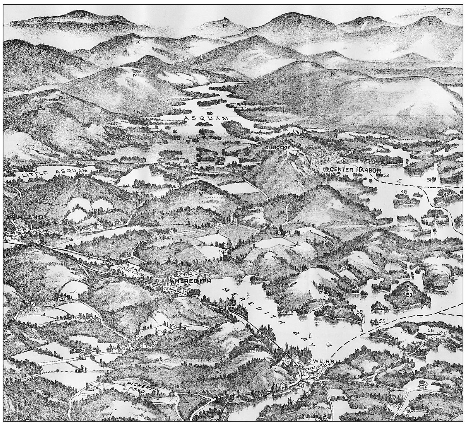
A sectional map of Lake Winnipesaukee and its surroundings, issued by the passenger department of the Boston & Lowell Railroad, 1909.
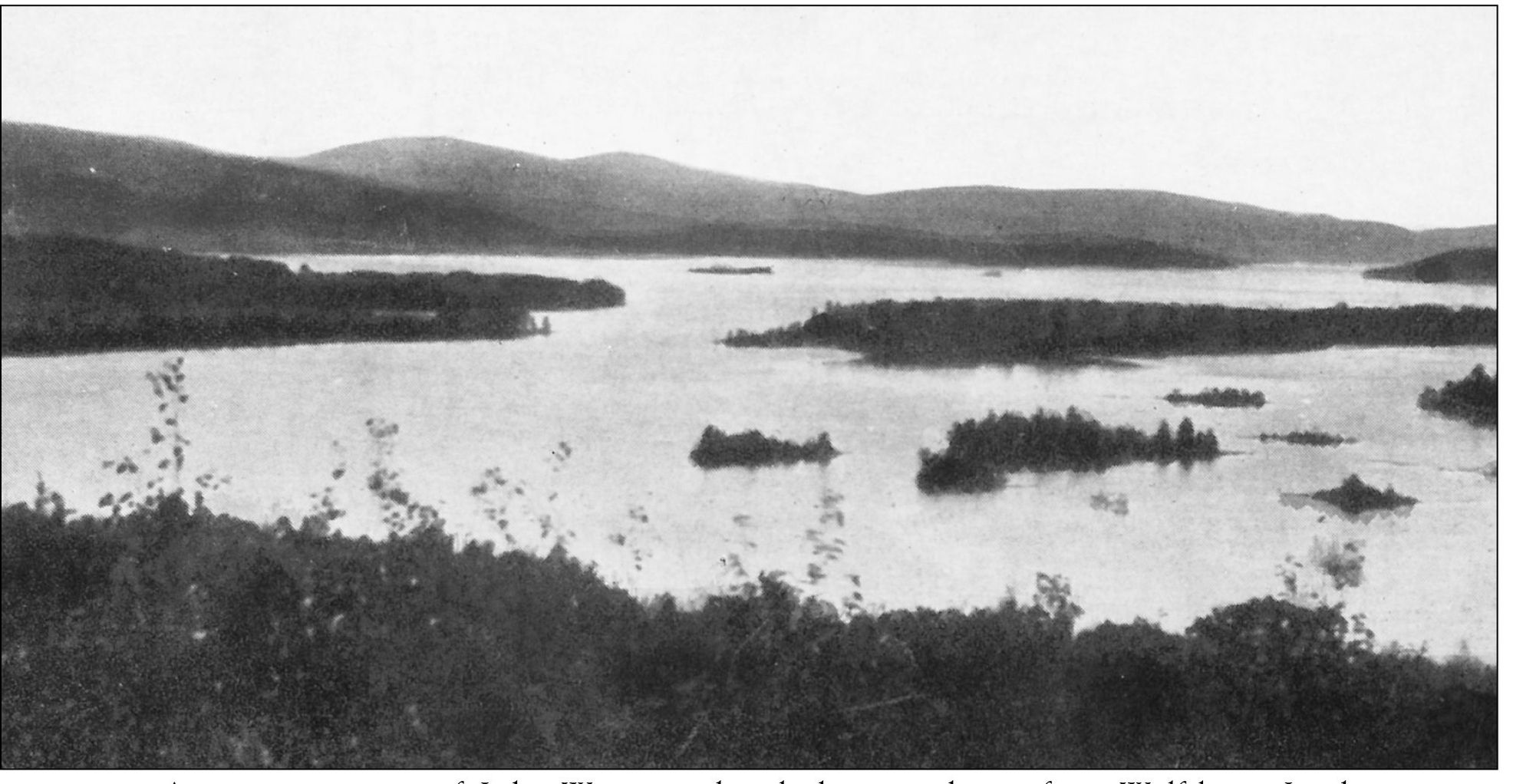
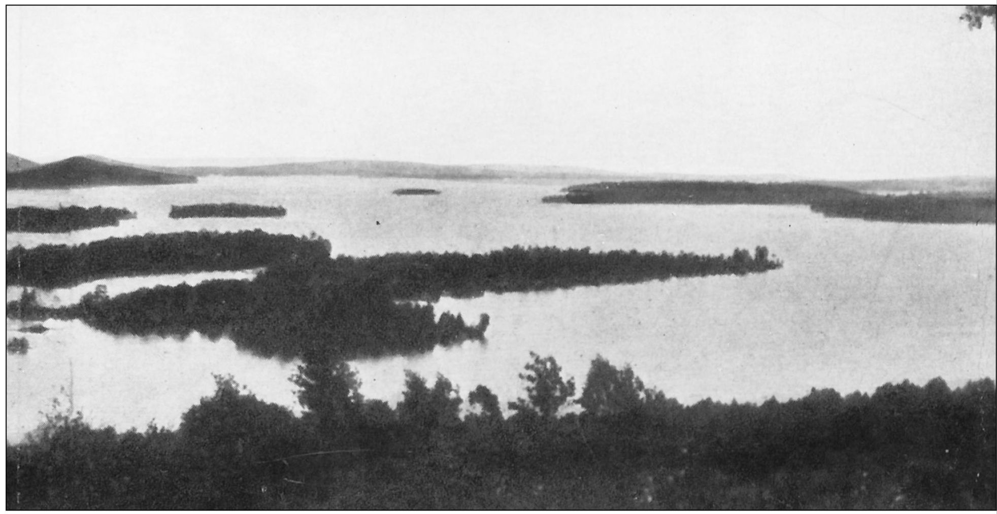
A panoramic view of Lake Winnipesaukee looking northwest from Wolfeboro. In the background is Rattlesnake Island with the Belknap Mountain Range on the far left. This lake is one of the three largest freshwater lakes in the continental United States that lies wholly within the borders of one state. Winnipesaukee, New Hampshires largest lake, with an area of 72 square miles and a mainland shoreline of 186 miles, is dotted with 274 habitable islands and surrounded by the foothills of the White Mountains.
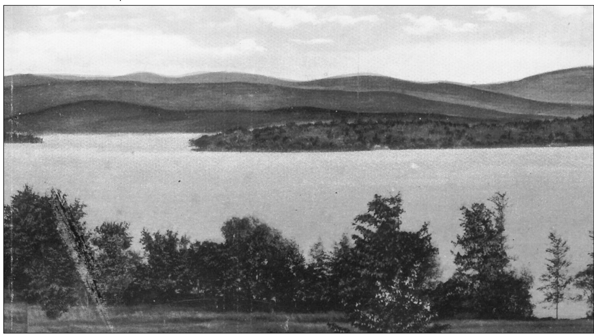
A panoramic view of Lake Winnipesaukee looking northeast from Gilford. Rattlesnake Island is on the right with the Ossipee Mountain Range in the background. Nothing can exceed the beauty of the mountains on the north shore; they are the Ossipee, Sandwich, and Presidential Range in the White Mountains framing the waters edge. The water of this lake empties into the Winnipesaukee River, which soon forms a junction with the Pemigewasset River; the two rivers unite making the Merrimack River at Franklin Falls, New Hampshire.
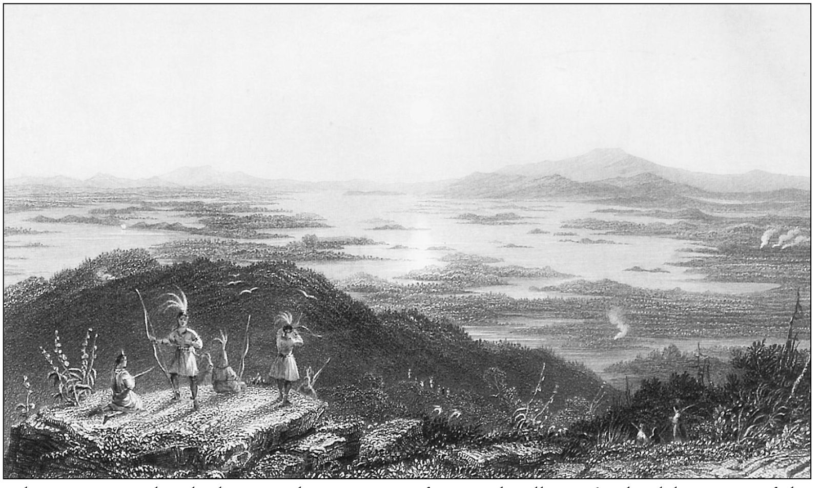
Lake Winnipesaukee looking southwest as seen from Red Hill, 1836. This lake is one of the most beautiful water sheets in the world with islands ranging in size from 1,000 acres down to tiny dots of rock and turf which are scarcely large enough to hold a small summer camp. The Smile of the Great Spirit was aptly named by the Native Americans, although a more proper translation of the name means Beautiful Water in a High Place. Today, this lake is home for thousands who have come to cherish it as much as the Native Americans did hundreds of years ago. (A William H. Bartlett print.)
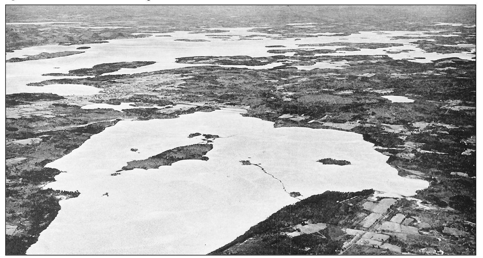
An aerial view of the Lake Winnipesaukee quadrangle looking to the west with Lake Wentworth in the foreground and Wolfeboro village center left. Lake Winnipesaukee was glacially formed. At one time the Belknap and Ossipee Mountains, located on either side of the lake, were active volcanoes. The lake is very deep, ranging in depth up to 200 feet, and is mostly spring fed. Many of the cottages around its shores take their water directly from it without any treatment.
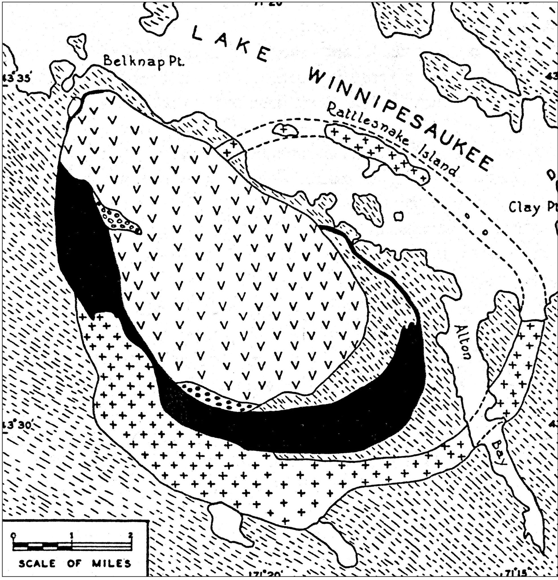
A simplified geological map of the Belknap Mountains and vicinity. In the Belknap Mountains there exists a large and spectacular variety of rocks as in the other areas of the White Mountain magma series. Spectacular exposures of the contact of the Albany quartz syenite and the Meredith porphyritic granite may be found on the top of Mt. Major and the hills which are 1.3 miles east of Round Pond.
This range shows superb examples of a peculiar type of geological structure known as a ring-dike. Only part of the Belknap Mountains lies in the Winnipesaukee quadrangle; the rest are in the adjacent Gilmanton, Alton, and Wolfeboro quadrangle.
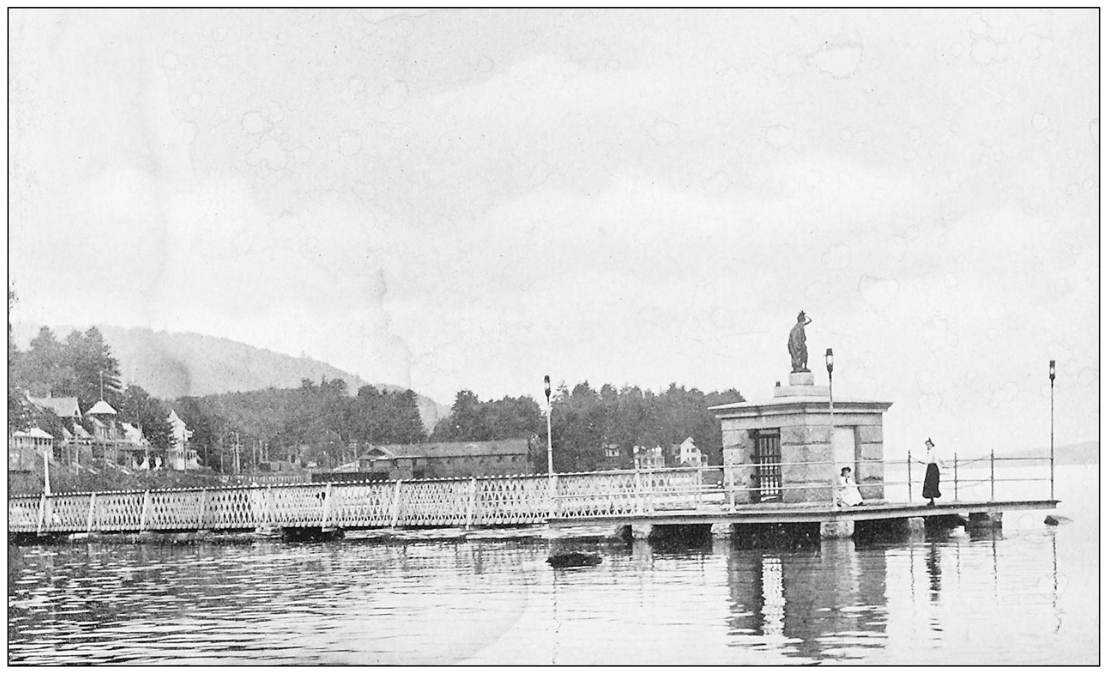
The Endicott Rock Monument in the channel at Weirs Beach, 1900s. In 1652 the Massachusetts Bay Colony sent a delegation to ascertain the northernmost boundary of its territory. They chiseled the name of Governor Endicott on a large, round-topped boulder at the river mouth of the outlet of Lake Winnipesaukee. For 181 years this was apparently forgotten. In 1833 it was rediscovered and in 1892 the State of New Hampshire erected, as a memorial, a granite structure enclosing it.
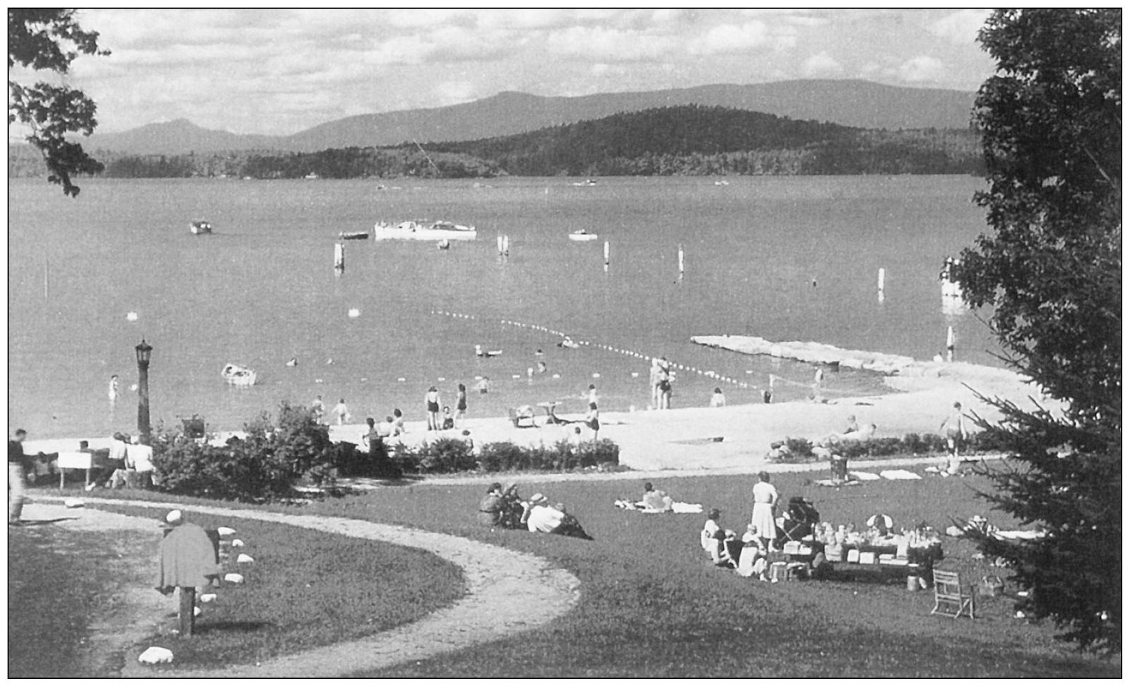
The Weirs Beach and picnic area next to the Endicott Rock Monument, c. 1950s. The beach has continued to be very popular with summer bathers. This beach and channel serve as the outlet of Lake Winnipesaukee to join Lake Paugus, the Winnipesaukee River, Lake Winnisquam, and finally, the Pemigewasset River in Franklin to form the Merrimack River.
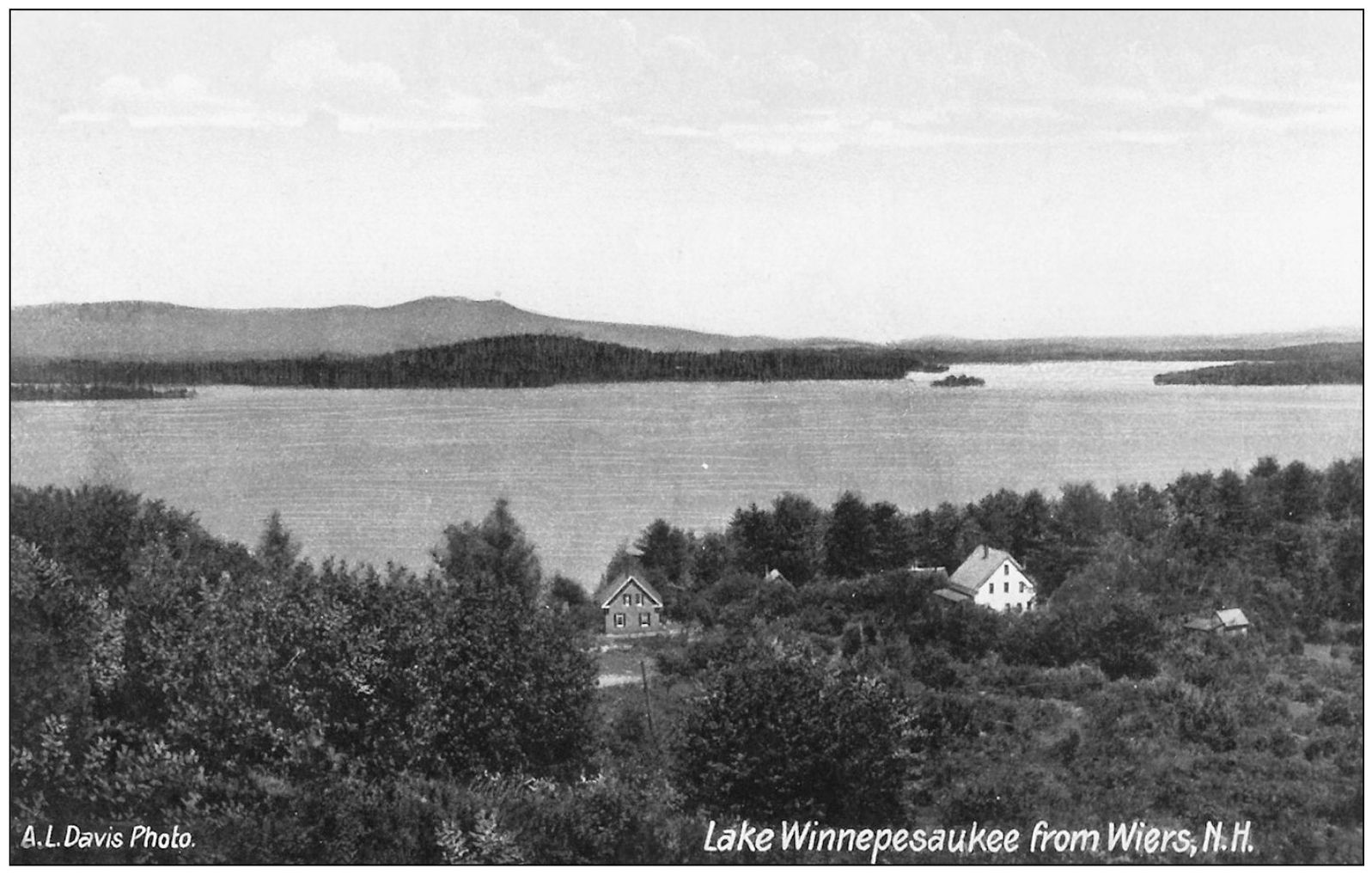
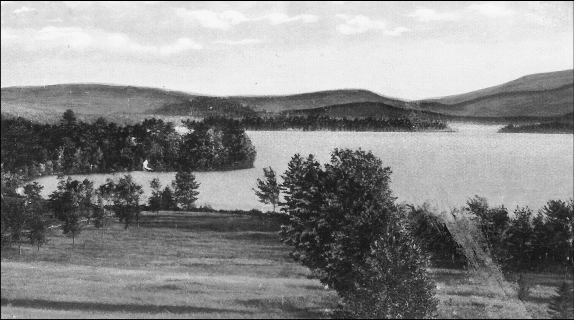
The Meredith and Weirs Bays from Winnecoette Hill looking south. Mount Shaw, in the far distance, dominates the horizon. To the right is the northern tip of Governors Island and to the far left is Spindle Point. The small island in the center is Eagle Island.
Font size:
Interval:
Bookmark:
Similar books «Boats and Ports of Lake Winnipesaukee»
Look at similar books to Boats and Ports of Lake Winnipesaukee. We have selected literature similar in name and meaning in the hope of providing readers with more options to find new, interesting, not yet read works.
Discussion, reviews of the book Boats and Ports of Lake Winnipesaukee and just readers' own opinions. Leave your comments, write what you think about the work, its meaning or the main characters. Specify what exactly you liked and what you didn't like, and why you think so.