LAKE SUPERIORS HISTORIC NORTH SHORE
LAKE SUPERIORS
HISTORIC NORTH SHORE
A Guided Tour
Deborah Morse-Kahn

MINNESOTA HISTORICAL SOCIETY PRESS
2008 by the Minnesota Historical Society. All rights reserved. No part of this book may be used or reproduced in any manner whatsoever without written permission except in the case of brief quotations embodied in critical articles and reviews. For information, write to the Minnesota Historical Society Press, 345 Kellogg Blvd. W., St. Paul, MN 55102-1906.
www.mhspress.org
The Minnesota Historical Society Press is a member of the Association of American University Presses.
Manufactured in Canada
10 9 8 7 6 5 4 3 2 1
The paper used in this publication meets the minimum requirements of the American National Standard for Information SciencesPermanence for Printed Library Materials, ANSI Z39.48-1984.
Credits
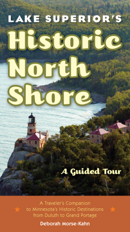
Front cover: Split Rock Lighthouse, by Brian Peterson
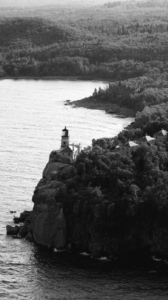
Back cover: MHS collections
Interior: McDougall-Barnes Shipyards, 1942, courtesy of NEMHC, Duluth (S3766b2f5); all other photos from MHS collections
Maps: CartoGraphics Incorporated
Design: Percolator
International Standard Book Number
ISBN 13: 978-0-87351-621-1 (paper)
ISBN 10: 0-87351-621-4 (paper)
Library of Congress Cataloging-in-Publication Data
Morse-Kahn, Deborah, 1952
Lake Superiors historic North Shore : a guided tour / Deborah Morse-Kahn.
p. cm.
Includes bibliographical references and index.
ISBN-13: 978-0-87351-621-1 (pbk. : alk. paper)
ISBN-10: 0-87351-621-4 (pbk. : alk. paper)
Ebook ISBN: 978-0-87351-677-8
1. Superior, Lake, RegionTours.
2. Historic sitesSuperior, Lake, RegionGuidebooks.
3. Historic buildingsSuperior, Lake, RegionGuidebooks.
4. LandscapeSuperior, Lake, RegionGuidebooks.
5. Superior, Lake, RegionHistory, Local.
I. Title.
F552.M67 2008
917.76 ' 70454dc22
2007049739
For my parents, Joyce and Howard Kahn, who loved Lutsen in the autumn
CONTENTS
The St. Louis River and St. Louis Bay
Duluths West End
Central Duluth
Duluths East End
The Lower Shore
Two Harbors
Flood Bay to Gooseberry Falls
Split Rock to Beaver Bay
Silver Bay
Palisade Head and Tettegouche
Little Marais
Crosby-Manitou and Caribou Falls
Sugarloaf Cove and Taconite Harbor
Schroeder and the Cross River
Temperance and Tofte
The Lutsen Resort District
The Cascade River District
Grand Marais and the Lower Gunflint
Chippewa City and Croftville
Colville and Magney State Park
Hovland
Grand Portage and the Pigeon River
PREFACE
When I made my final research trip for this book in spring 2007, wildfires had been raging for a week along the Gunflint Trail. Though most of the flames were out, one could still smell the wood smoke as far south as Tofte. But the fire I had come to monitorthe wildfire of property development that has been sweeping up the shorewas unabated, even accelerating, taking too many markers of the life and culture, history and prehistory of this magnificent place; erasing great sweeps of historic shoreline; and dismantling the story of Lake Superiors north coast.
My professional discipline of public history subsumes the crafts of history, historiography, archaeology, sociology, geography, geology, architectural history, cartography, and archival science to understand and codify the story of people and place in time. Public historians are vigilant of assaults on our collective history. We fall in love with what we see, story and land and all, and when the historic structures and landscapes we love are threatened, we raise our warning flags and alert those who might help lessen the damage.
This guide to the history and people of the North Shore was written in the hope of reclaiming this coastline of Gii-dzhii Ojibwe-gah-meeng, the Great Sweet Water Sea, for our national inheritance. We must do so, or at the current pace of change, there will be far fewer visible remnants left to tell the stories of the past to future generations.
I hope this book brings you great heart for, and delight in, a very special place.
LAKE SUPERIORS HISTORIC NORTH SHORE
INTRODUCTION
Minnesotas Lake Superior shore stretches nearly 150 milesfrom Duluth to Grand Portageand comprises thirty distinct communities, eight state parks, several state and national forests, countless rivers and streams, and a broad range of ethnic and religious groups. It is the physical evidence left behind that exemplifies a way of life passing or now gone and begs the questions: How did this lodge, bridge, church, graveyard, barn, hotel, fish house, lighthouse, or cabin come to be here? Why does it look this way? Who lived here? Labored here? Died here? How can we honor those who have passed this way before us?
This guidebook to Lake Superiors North Shore tells its history while guiding readers to the historic sites and districts found along this great coasts main road, Highway 61. Recommendations on favorite places to put down your overnight case and some wonderful places to pick up a fork are given, because even these lodgings and cafs play a part in the North Shores story.
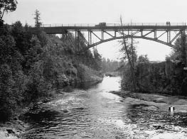
North Shore bridge over the St. Louis River, c1920
RECOMMENDATIONS FOR SAFETY AND COMFORT
Traveling the North Shore is a unique road trip experience. Roads appear on maps but are never found on the ground. Roads are not roads but driveways into private property. Roads are crowded, filled with cars, logging trucks, gas tankers, and motorcycles.
Did someone mention the weather?
Having no guidebook on my shelf that speaks to these issues, I drafted a list gleaned from my field experiences on the North Shore. Take it with a very large pinch of salt, but do take it. It could make the difference in your physical comfort, your physical safety, and, at the very least, your enjoyment of your journey. You may not encounter every situation during every single journey, but youll know all about that road (moose, dead end, sudden fog, lumber truck) when you meet it.
RULES OF THE ROAD
To North Shore residents, north is east and south is west. The North Shore does, indeed, extend from the southwest to the northeast, but travelers will have no sense of this on the highway. For the purposes of this guidebook, directions up the shore road toward Canada are noted as north and down the shore road toward Duluth as south.
Many roads leading from Highway 61 down to the lake terminate in someones driveway. These roads are often named for the families who have cabins there or are named for their cabin... or their child... or their dog! A good map will keep you on the good roads.
Pulling out onto Highway 61 is a North Shore art form: turn onto the right shoulder, then merge. You are starting from a dead stop, and that logging truck so far back in your rearview mirror is moving at 70 MPH .
Resist the lure of the unpaved roads leading up into the inland hills north of Grand Marais unless you are in a heavy four-wheel-drive vehicle, or you may find yourself at a ninety-degree angle with half the Laurentian Divide under your wheels.

