All rights reserved. No part of this book may be reproduced in any form or by any electronic or mechanical means including information storage and retrieval systems without permission in writing from the publisher, except by a reviewer, who may quote brief passages.
Distributed by W. W. Norton & Company, Inc.,
500 Fifth Avenue, New York, NY 10110
Contents

Flame azalea in the Balsam Recreation Area
Introduction
Somewhere between eight and ten million people will visit the Great Smoky Mountains National Park this yearas they have every year since 1975, making it the perennial winner in the contest to be the most visited national park in America. And no wonder. This park, straddling the state line between Tennessee and North Carolina, protects some of the grandest mountains in the Appalachians, with slopes that can climb a mile above the valleys below to reach peaks exceeding 6,000 feet in elevation. Indeed, this park contains 100 miles of ridgelines that never sink below 4,000 feet. In all, it contains over a half million acres of nonstop ruggedness, making it the second largest national park in the East.
This book will lead you to the most beautiful spots in and around the Great Smoky Mountains National Park, tell you what makes them so rewarding, and give you hints on how to capture that beauty in your photographs. You dont have to be a serious photographeror even a photographer at allto enjoy this book. You only need to be a lover of nature, and a person who appreciates the interesting, the unusual, and the spectacular. But if youre serious about your photography, youll get a bonus: Youll be able to go straight to the best places, with help on weather and times of day as well as subjects calling out to be photographed. Nor will this book ignore the settled areas that surround the park. Youll be guided to the best photo sites around the tourist towns of Gatlinburg, Tennessee, and Cherokee, North Carolina; led across Fontana Dam (the tallest dam in the East); and directed through the streets of the homey county seat of Bryson City, North Carolina. Youll find the best overlooks, outside the park as well as in.

Countryside near Cherokee

The Smokies, viewed from a back road near Bryson City, North Carolina
Using This Guide
This book deals with the Great Smoky Mountains, both the range and the national park. For brevity, in this book the Great Smoky Mountains National Park will become simply the national park, and the Great Smoky Mountains will be known as the Smokies, their most common local name.
The mountain range called the Smokies is itself only part of a much larger district, a segment of the western edge of a vast mountainous oval occupying the western quarter of North Carolina and overlapping into Tennessee (as well as three other neighboring states). Too large to have its own name, this mountain district has instead a mishmash of localized ridgelines: the Smokies, the Balsams, the Nantahalas, the Cowees, the Blacks, the Unicois, the Unakas, Pisgah Ridge, Roan Mountain, Stone Mountain, and (of course) the Blue Ridge. We will call this giant, multi-state orogeny the Blue Ridge District, following the lead of geologists. Its an island of extremely old, super-hardened rocks projecting far above the surrounding valleys and hills, thrust upward as a block when Europe and America last collided and since then shaped by erosion. (Its enormous outwash formed Florida and much of the Southern coast.) This district is far taller than any other Eastern mountain area, with 40 peaks that top 6,000 feet (compared to only one such peak in New Hampshire, and none elsewhere in the East). The Smokies stand out in this tall and broken land by being even taller and more broken than most of it; fully half of the 40 super-high peaks are inside the national parks boundaries.
Within the national park, the Smokies stretch as an unbroken wall through the center, almost entirely above 4,000 feet, with numerous mile-high peaks. The border between North Carolina and Tennessee follows this ridgeline, as does (for the most part) the Appalachian Trail, the great long-distance footpath that wanders more than 2,000 miles from Georgia to Maine. Walk along this trail and youll witness the defining sight of the Smokies: On the North Carolina side, the high crests of the Blue Ridge District stretch eastward beyond the horizon as a mad jumble of tall peaks and deep valleys, while on the Tennessee side the mountains end precipitously as a solid front, and plunge suddenly to the floor of Tennessees Great Valley.
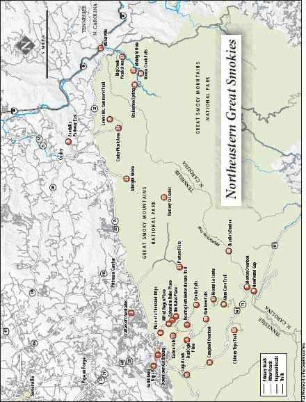
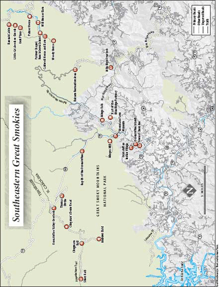
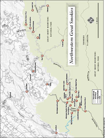
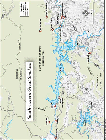
This high central ridge is pierced by exactly one road: the Newfound Gap Road. Formerly known as US 441, this National Park Service scenic highway bisects the park, crossing the Smokies at an elevation of 5,046 feet as it travels between Cherokee, North Carolina, and Gatlinburg, Tennessee. Access to the park is via either this great central highway, or any number of short and long roads that penetrate its perimeter. Because none of these roads is particularly good, it will take you a very long time to get from one section of the perimeter to the other. For that reason, this book divides the park into quadrants defined by the Newfound Gap Road and the crest of the Smokies. Each quadrant contains an area that can be readily explored from a base of operation immediately outside the national park: Gatlinburg, Cherokee, Bryson City, or Townsend.
Within each quadrant youll find a number of entries, cross-referenced on the maps by number. These are grouped together into sections, or areas, in such a way that you could, if you wanted, visit every place in an area easily from a central location. Some entries describe a single feature; others describe a group of nearby related features. In both cases, each separate feature gets its own number. Anything of high visual interest, inside the park or adjacent to it, can become an entrynot just the forests, rivers, log cabins, and views for which the national park is justly famous, but also anything striking in the towns and farmlands along its borders.


