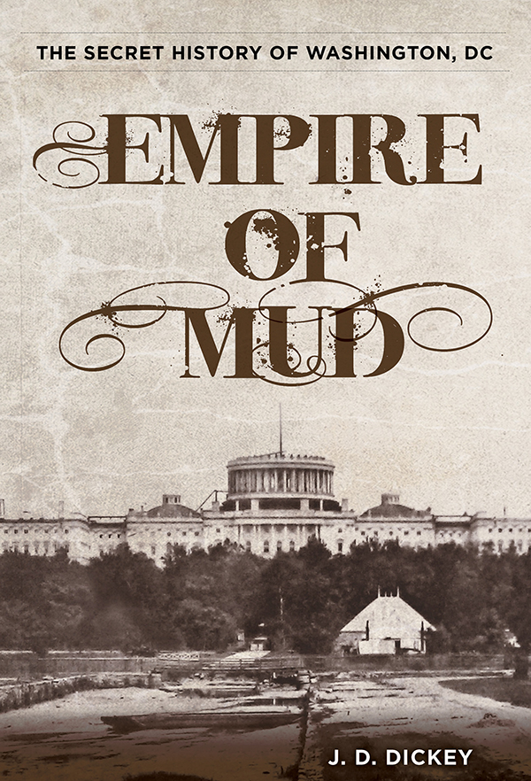
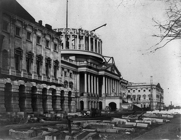
The new iron dome of the US Capitol rising in 1859.
The Secret History of Washington, DC
J. D. Dickey
To my parents
Copyright 2014 by J. D. Dickey
Distributed by NATIONAL BOOK NETWORK.
ALL RIGHTS RESERVED. No part of this book may be reproduced or transmitted in any form by any means, electronic or mechanical, including photocopying and recording, or by any information storage and retrieval system, except as may be expressly permitted in writing from the publisher.
Lyons Press is an imprint of Rowman & Littlefield.
Frontispiece photo courtesy of the Library of Congress Prints and Photographs Division. Photos on pp. 2, 6, 36, 43, 46, 59, 71, 72 (top and bottom), 76, 83, 93, 114, 122, 125, 142, 153, 174, 187, 189, 216, 235, and 238 courtesy of the Library of Congress Prints and Photographs Division. Photos on pp. 16 and 201 (all) courtesy of the National Archives and Records Administration. Photos on pp. 113, 183, 231, and 244 courtesy of the Historical Society of Washington, DC. Photos on pp. 9, 38, 62, 106, 111, 137, 149, 164, 170, 176, 197, 203, 206, and 211 courtesy of DC Public Library, Washingtoniana Division. Photo on p. 98 from a private collection. Photos on pp. 120 and 156 by the author. All page numbers refer to the printed book.
Maps by Daniel Rosen and Melissa Baker Rowman & Littlefield
Project editor: Meredith Dias
Layout: Melissa Evarts
Library of Congress Cataloging-in-Publication Data
Dickey, Jeff.
Empire of mud : the secret history of Washington, DC / J. D. Dickey.
pages cm
Includes bibliographical references and index.
ISBN 978-0-7627-8701-2
1. Washington (D.C.)History. I. Title. II. Title: Secret history of Washington, DC.
F197.D53 2014
975.3dc23
2014015136
eISBN 978-1-4930-1393-7
Contents
A Note on Maps of Washington City
Few reliable sources indicate how the District of Columbia appeared when it became the site of the nations capital. Most of the depictions created by Pierre LEnfant, Andrew Ellicott, and their imitators present plans for the city rather than descriptive diagrams. Not until Albert Boschkes highly detailed 1857 map of the District did any comprehensive viewas it was, rather than as it should have beenachieve widespread dissemination. After later editions of Boschkes work and that of other cartographers, the Districts urban landscape was depicted more accurately.
Yet how the District actually looked in the beginning remained a mystery until recently. Tee Loftin, Joseph Passonneau, Don Hawkins, and the Imaging Research Center have filled in some of the gaps. Daniel Rosens 1801 map of Washington City (pages 2627) draws from these sources and period accounts such as reminiscences by Christian Hines and other firsthand witnesses. This books 1860s map (pages 16061) draws from the 1861 edition of the Boschke map, providing a clearer view of the downtown area where most of the capital activity occurred. For the years between, especially circa 1830, no accurate, detailed representation of the District exists. Jacksonian-era Washington still awaits its modern cartographer.
A Note on Geographical Terms
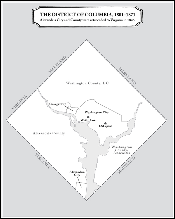
Alexandria: Tobacco port and slave-trading city founded in the eighteenth century; included in the District of Columbia from 1801 until its retrocession to the state of Virginia in 1846.
Alexandria County: Largely unincorporated land surrounding Alexandria, west of the Potomac River; included in the District of Columbia from 1801 until its retrocession to the state of Virginia in 1846; since renamed Arlington County.
District of Columbia: The ten-mile square encompassing former parts of Maryland and, until 1846, Virginia; selected by George Washington and designated by Congress as the federal capital of America.
Georgetown: Maryland port city founded in the mid-eighteenth century; included in the District of Columbia from 1801 to the present. In 1871 Congress revoked its charter and designated it as a neighborhood in the District.
Territory of the District of Columbia: Short-lived experiment, from 1871 to 1874, to reorganize the District as a US territory under the control of a federal governor.
Washington City: Independent city founded in 1802; synonymous with the federal capital for much of the nineteenth century and home to most of its key sites. Congress revoked its charter in 1871 and consolidated it into the District.
Washington County: Largely unincorporated land surrounding Washington City east of the Potomac River and a constituent part of the District starting in 1801. Congress consolidated it into the District in 1871.
Washington, DC: Name for the capital in use since the early days of the republic. Since 1871 there has been no official city of Washingtononly the District of Columbiaso the term has been both misleading and redundant for nearly 150 years.
Introduction
Capital Movers
Washington is not the official capital of America. Maps include a place called Washington, everyone refers to the seat of federal power as Washington, and the citys homegrown politicians, celebrities, and athletes all claim to hail from Washington. But according to the lawand law is very important in the capitalsuch a place doesnt exist. There is only the District of Columbia, and its been that way for nearly a century and a half.
A Washington City did exist once, though, and this older version of the capital, its life span from 1802 to 1871, is the primary subject of this book. But Washington City was always a misnomer. When that was its legal name in the nineteenth century, it was hardly a town, let alone a city. By the time it emerged as a city in the Gilded Age, Congress had abolished it and consolidated it into the District of Columbia. Thus, as with so much about the place in its early years, its planners even got the name wrong.
Familiar Origins
The usual story of the origin of the federal capital goes back to two key events: the Residence Act of 1790, by which Congress designated the general site for the future American capital, and Pierre LEnfants 1791 presentation of his survey map, which outlined the street plan of that capital. The maneuvers and machinations that led to those events form part of a convoluted tale of nation building that historians have recounted well and often in recent years: political wrangling to choose a suitable site, contentious debates between surveyor and city commissioners, bureaucratic conflicts and inevitable lawsuits.
In a nutshell: The founders placed the national capital close to the geographical center of the country but still in the South as a concession to Southern states in exchange for the federal assumption of state debt, most of which the Northern states held.
However, the genesis of the idea of a federal capital began nearly a decade before LEnfant presented his map. It is a tale that, if not quite the stuff of legend, at least makes for a good yarn with a decent measure of adventure and intrigue. More importantly, it helps explain why Washington City, instead of Philadelphia or New York, became the US capital and why this new capitalfar from a citadel of democracyemerged as a fiefdom ruled by national politicians, and why its citizens were denied the right to vote for those politicians.


