Transcription:
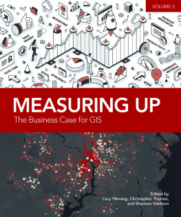
Measuring Up: The Business Case for GIS, Volume 3
How do leaders and innovators drive change and improvement?
Governments often depend on a geographic context for making major decisions, sharing information, and expanding their operations. When organizations face the need for change from a drastic event, such as economic downturns or a pandemic, how do they maintain the quality of their day-to-day operations while continuing to find solutions to existing and new problems?
Many governments and professionals turn to geographic information systems (GIS). Using GIS and location intelligence produces more informed, data-driven decisions, which lead to improved outcomes.
Measuring Up: The Business Case for GIS, volume 3, is the third book in the Measuring Up series, demonstrating how government agencies have embraced GIS as a critical infrastructure in their processes. Through a collection of all-new, updated, real-world stories, each chapter covers how GIS helps organizations in saving time, saving money, avoiding costs, increasing accuracy, improving productivity, increasing efficiency, automating workflows, managing resources, and aiding in budgeting. Readers can look to this new collection as a model for working through their organizations new challenge or to understand the business value of introducing GIS into their organization.
Measuring Up: The Business Case for GIS, volume 3, explores how organizations can continue to move forward using GIS as not just a tool but as necessary to the solution.
Cory Fleming is a senior project manager with the International City/County Management Association (ICMA). She lives in Washington, DC.
Christopher Thomas is the director of Government Marketing at Esri. He is a subject matter expert in government, technology, GIS, marketing, and global business development. His books include GIS for Decision Support and Public Policy Making, Standards for Success: GIS for Federal Progress and Accountability, and Building a Smarter Community: GIS for State and Local Government.
Shannon Valdizon is the State and Local Government marketing lead on the Esri Industry Solutions team. She works with government strategists to identify emerging trends in government and GIS across the globe.

Esri Press, 380 New York Street, Redlands, California 92373-8100
Copyright 2022 Esri
All rights reserved. First edition 2012e-ISBN: 9781589486256The information contained in this document is the exclusive property of Esri or its licensors. This work is protected under United States copyright law and other international copyright treaties and conventions. No part of this work may be reproduced or transmitted in any form or by any means, electronic or mechanical, including photocopying and recording, or by any information storage or retrieval system, except as expressly permitted in writing by Esri. All requests should be sent to Attention: Director, Contracts and Legal Department, Esri, 380 New York Street, Redlands, California 92373-8100, USA.The information contained in this document is subject to change without notice.US Government Restricted/Limited Rights: Any software, documentation, and/or data delivered hereunder is subject to the terms of the License Agreement. The commercial license rights in the License Agreement strictly govern Licensees use, reproduction, or disclosure of the software, data, and documentation. In no event shall the US Government acquire greater than RESTRICTED/LIMITED RIGHTS. At a minimum, use, duplication, or disclosure by the US Government is subject to restrictions as set forth in FAR 52.227-14 Alternates I, II, and III (DEC 2007); FAR 52.227-19(b) (DEC 2007) and/or FAR 12.211/12.212 (Commercial Technical Data/Computer Software); and DFARS 252.227-7015 (DEC 2011) (Technical Data Commercial Items) and/or DFARS 227.7202 (Commercial Computer Software and Commercial Computer Software Documentation), as applicable. Contractor/Manufacturer is Esri, 380 New York Street, Redlands, California 92373-8100, USA.Esri products or services referenced in this publication are trademarks, service marks, or registered marks of Esri in the United States, the European Community, or certain other jurisdictions. To learn more about Esri marks, go to: links.esri.com/EsriProductNamingGuide. Other companies and products or services mentioned herein may be trademarks, service marks, or registered marks of their respective mark owners.For purchasing and distribution options (both domestic and international), please visit esripress.esri.com.The Library of Congress has cataloged the print edition as follows:Thomas, Christopher, 1963 Aug. 6Measuring up : the business case for GIS / Christopher Thomas and Milton Ospina. p. cm. Includes bibliographical references. ISBN 1-58948-088-0 (pbk. : alk. paper) 1. Decision support systems. 2. Geographic information systems. 3. Industrial management. I. Ospina, Milton. II. Title. HD30.213.T47 2004 658.4038dc222004013898174251
Introduction Embracing a geographic approach
Every few decades, something happens that makes organizations and their executives reevaluate how they do business. Economic downturns, advancements in technology, the worldwide spread of disease, and the need to address diversity and racial equity can alter our everyday work. And with that, professionals may find themselves in a position to justify their processes, expenditures, and operations. Today, there is perhaps no other technology as significant and ingrained in government as GIS. Organizations have used GIS across disciplines and industries to better understand problems and opportunities and drive real business value.
The intention of this book, Measuring Up: The Business Case for GIS, volume 3, is to offer you and your organization a resource to take you through your next challenge or simply show you how you can improve your everyday operations. The book can be used to demonstrate the benefits of GIS to your leadership, show best practices of GIS use that help justify your expenditure on the technology, and provide examples to help you calculate and document return on investment (ROI) from GIS. It features a wide variety of case studies and new applications designed to improve government operations and engage community residents more fully. For instance, in this volume, the city of Johns Creek, Georgia, explores the use of artificial intelligence for answering nonemergency questions, leaving staff time for more critical duties. To meet residents demand for high-speed internet service, leaders in Potter County, Pennsylvania, used GIS to plan and develop a budget that minimized the digital divide. The volume includes 30 such case studies that can help policy makers and other decision-makers understand how GIS technology can be used in almost every discipline that government supports. The chapters are aligned with the tangible and inspiring benefits organizations have realized from GIS, including:
- Saving time
- Saving money
- Avoiding costs
- Increasing accuracy
- Improving productivity
- Generating revenue
- Increasing efficiency
- Automating workflows
- Managing resources
- Aiding in budgeting
This is the third time Esri and the International City/County Management Association (ICMA) have come together to prepare such an educational book. As we worked together to produce this current volume, we concluded that there is an endless supply of such stories; it is now a matter of sharing them. The more we all share our needs and our stories with colleagues, the more they will spark innovation and creativity within our organizations.


 Esri Press, 380 New York Street, Redlands, California 92373-8100