Bruce D. Heald Ph.D - White Mountain National Forest and Great North Woods
Here you can read online Bruce D. Heald Ph.D - White Mountain National Forest and Great North Woods full text of the book (entire story) in english for free. Download pdf and epub, get meaning, cover and reviews about this ebook. City: Charleston;S.C;White Mountain National Forest (N.H. and Me.);United States;White Mountain National F, year: 2011, publisher: Arcadia Publishing, genre: Children. Description of the work, (preface) as well as reviews are available. Best literature library LitArk.com created for fans of good reading and offers a wide selection of genres:
Romance novel
Science fiction
Adventure
Detective
Science
History
Home and family
Prose
Art
Politics
Computer
Non-fiction
Religion
Business
Children
Humor
Choose a favorite category and find really read worthwhile books. Enjoy immersion in the world of imagination, feel the emotions of the characters or learn something new for yourself, make an fascinating discovery.

- Book:White Mountain National Forest and Great North Woods
- Author:
- Publisher:Arcadia Publishing
- Genre:
- Year:2011
- City:Charleston;S.C;White Mountain National Forest (N.H. and Me.);United States;White Mountain National F
- Rating:5 / 5
- Favourites:Add to favourites
- Your mark:
White Mountain National Forest and Great North Woods: summary, description and annotation
We offer to read an annotation, description, summary or preface (depends on what the author of the book "White Mountain National Forest and Great North Woods" wrote himself). If you haven't found the necessary information about the book — write in the comments, we will try to find it.
Bruce D. Heald Ph.D: author's other books
Who wrote White Mountain National Forest and Great North Woods? Find out the surname, the name of the author of the book and a list of all author's works by series.


White Mountain National Forest and Great North Woods — read online for free the complete book (whole text) full work
Below is the text of the book, divided by pages. System saving the place of the last page read, allows you to conveniently read the book "White Mountain National Forest and Great North Woods" online for free, without having to search again every time where you left off. Put a bookmark, and you can go to the page where you finished reading at any time.
Font size:
Interval:
Bookmark:
Thanks go to Appalachian Mountain Club, John B. Allen, Rebecca Alosa, Balsams Resort and Wilderness, Steve Barba, Boston & Maine Railroad, Cannon Mountain Ski Area, Chisholms White Mountains, Cranmore Ski Area, Terry Fifield, Sarah Jordan, Loon Mountain Ski Area, New Hampshire American Guide, New Hampshire Fish and Game, Bryant F. Tolles Jr., Wildcat Mountain Ski Area. Special credit is given to the White Mountain National Forest, which supplied the images for this publication.

Find more books like this at
www.imagesofamerica.com
Search for your hometown history, your old
stomping grounds, and even your favorite sports team.
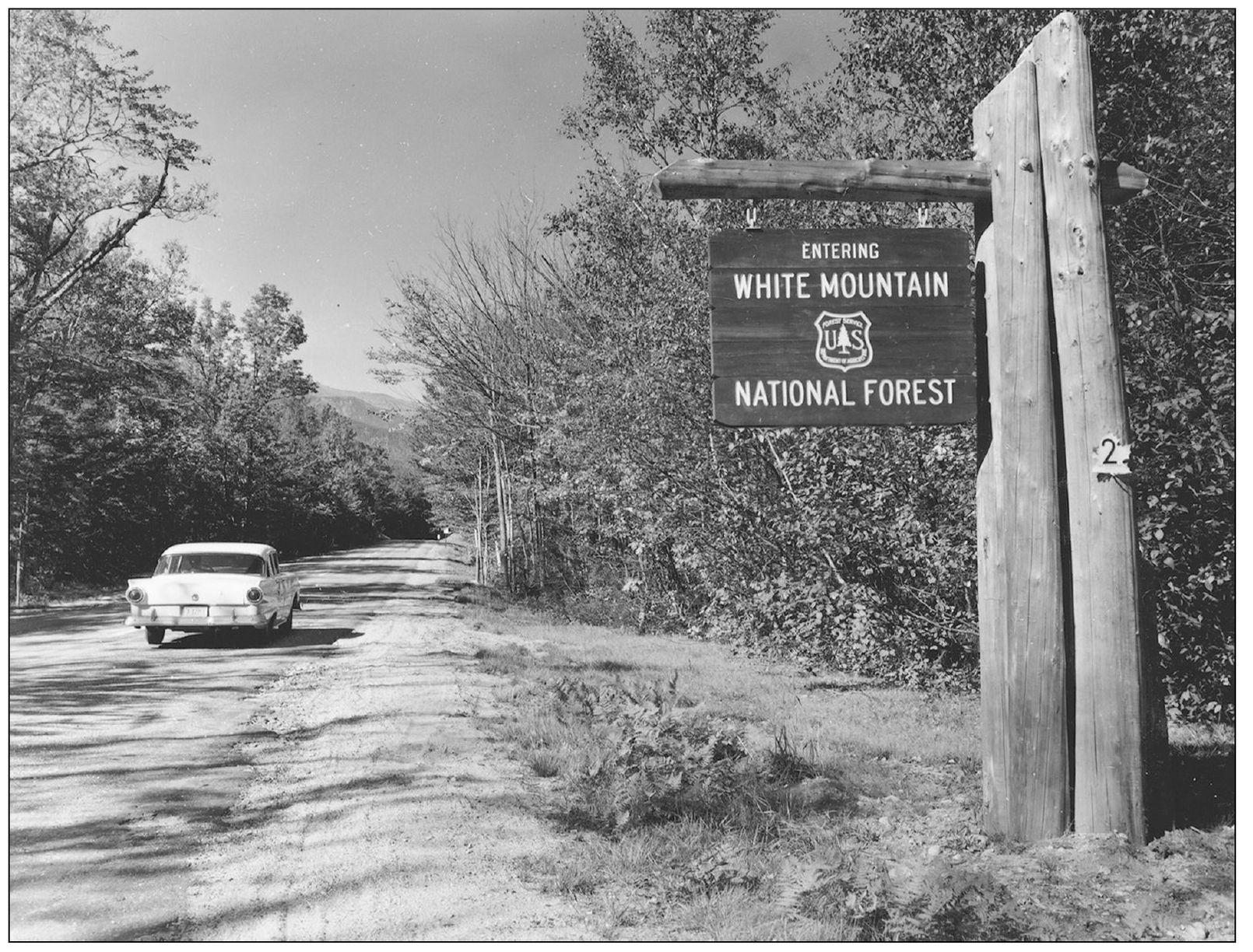
The White Mountain National Forest is the only national forest located in either New Hampshire or Maine. Most of the major peaks over 4,000 feet high in New Hampshire are located here. Over 100 miles of the Appalachian Trail traverses the White Mountain National Forest. The total area of land is 784,505 acres (1,225 square miles).
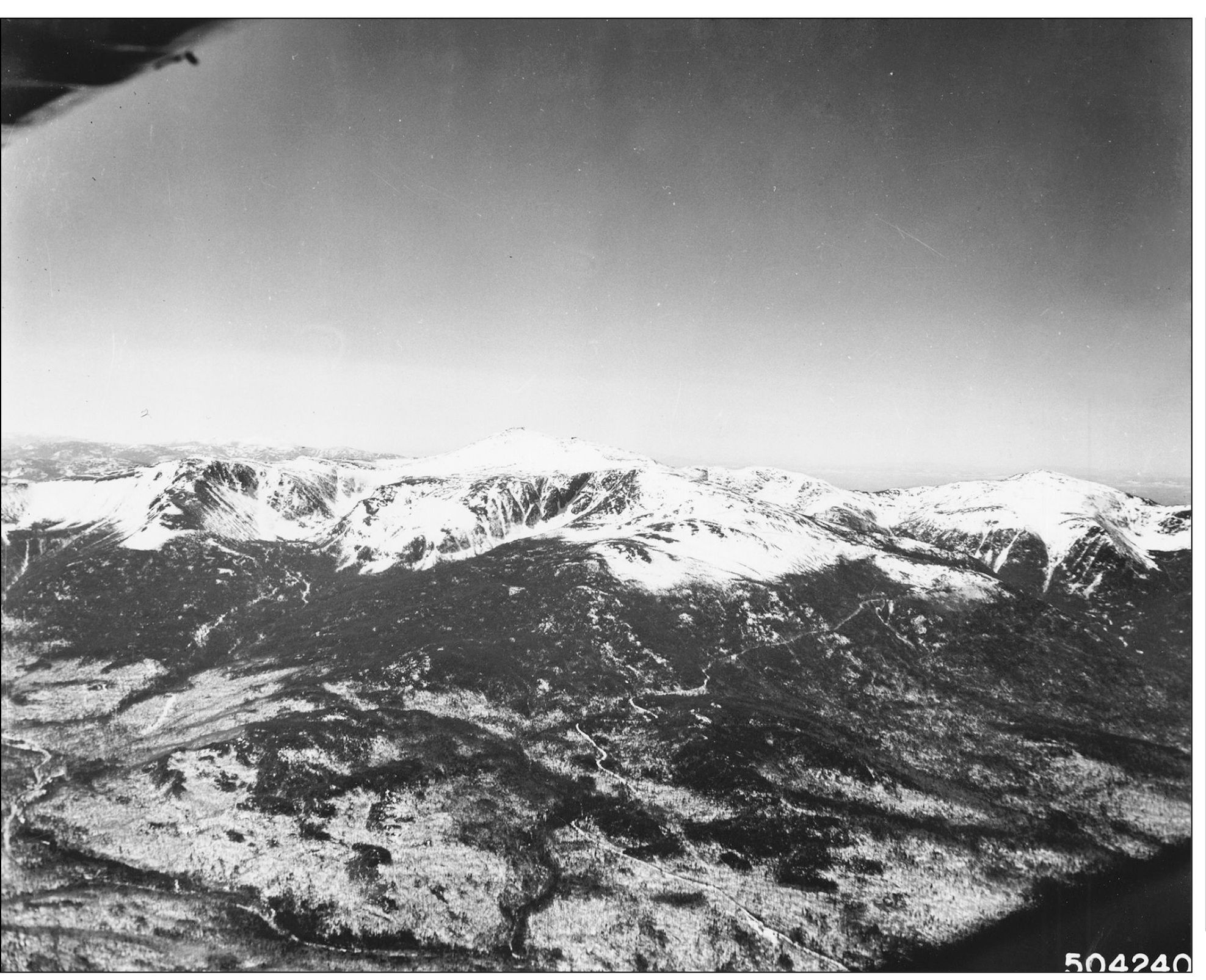
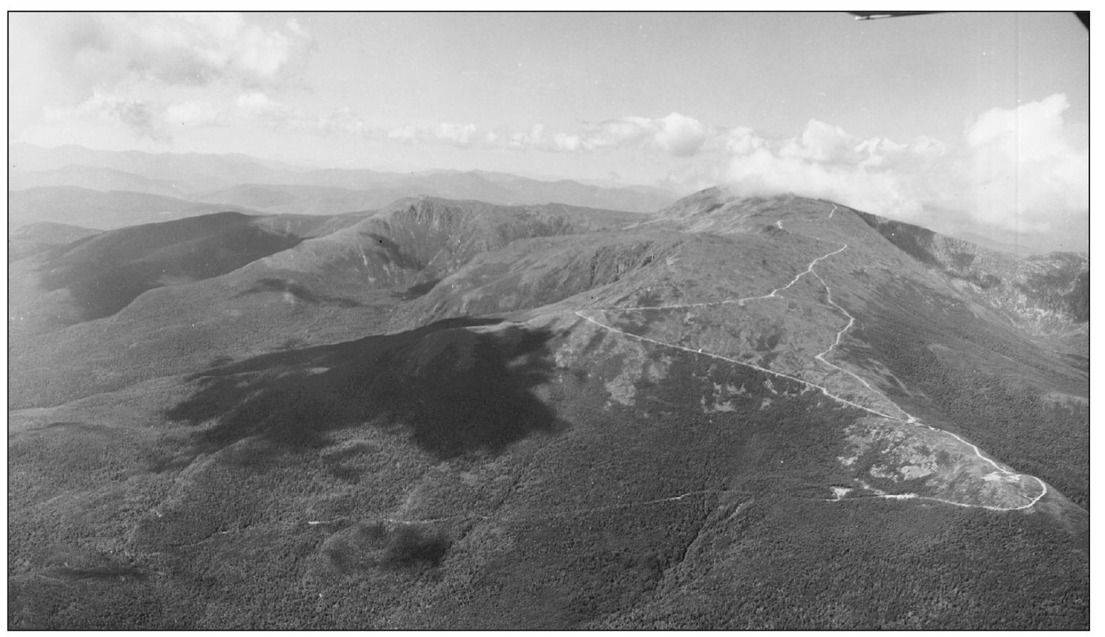
The Presidential Range poses majestically in the heart of the White Mountains. This aerial view of the east side of the range shows the carriage road as it weaves up the side of the mountain. Dropping gradually down from that superb height are Mount Monroe (elevation 5,372 feet), Franklin (elevation 5,001 feet), Eisenhower (elevation 4,760 feet), Jackson (elevation 4,052 feet), Pierce (elevation 4,310 feet), and Webster (elevation 3,910 feet). The Dry River rises in Oakes Gulf, a glacial cirque on the south slope of Mount Washington. The river flows southwest through a wooded mountain valley between the southern part of the Presidential to its west and the lower Montalban Ridge. The Presidential Wilderness is comprised of 29,000 acres, which was designated by the 1975 Eastern Wilderness Act in 1984; it was expanded by the New Hampshire Wilderness Act.
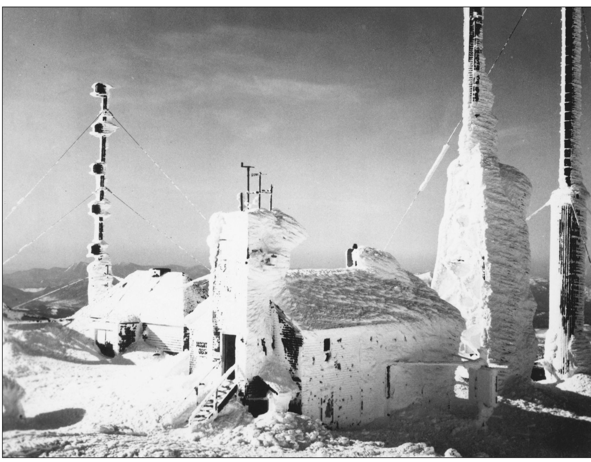
This is a view of the weather installation atop Mount Washington. The present observatory was launched in 1932 with a grant from the New Hampshire Academy of Science. It was that year when the first scientists from around the world gathered their meteorological observations to help develop new theories about the weather. Today, the Mount Washington Observatory is considered a class-A weather station for the US Weather Bureau. This is a winter scene of the Mount Washington summit and the weather station installation for 19371938. The observatory is operated by a nonprofit corporation and maintains museum exhibits in the Sherman Adams summit building.
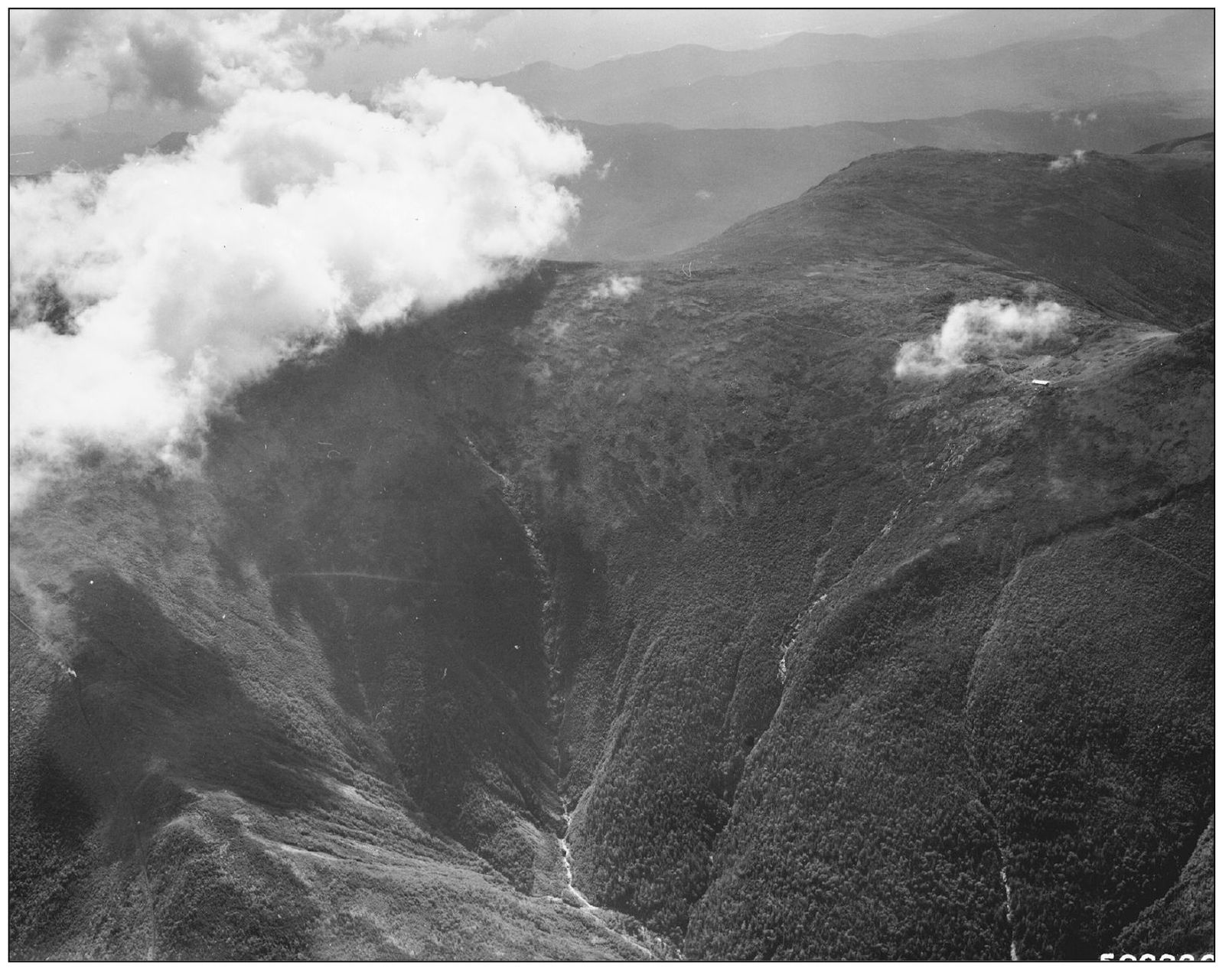
An aerial view is shown of Mount Washington (elevation 6,288 feet), the Lake of the Clouds, and the AMC Hut on Mount Washington as they recline in a cloud cap at the left. Mount Washington is a broad and massive mountain with great ravines, which are cut deeply into its steep profile, leaving buttress ridges that reach up through the timberline and support the upper plateau. The timberline is realized at an elevation of 4,500 to 5,000 feet, depending on the degree of exposure to the weather.
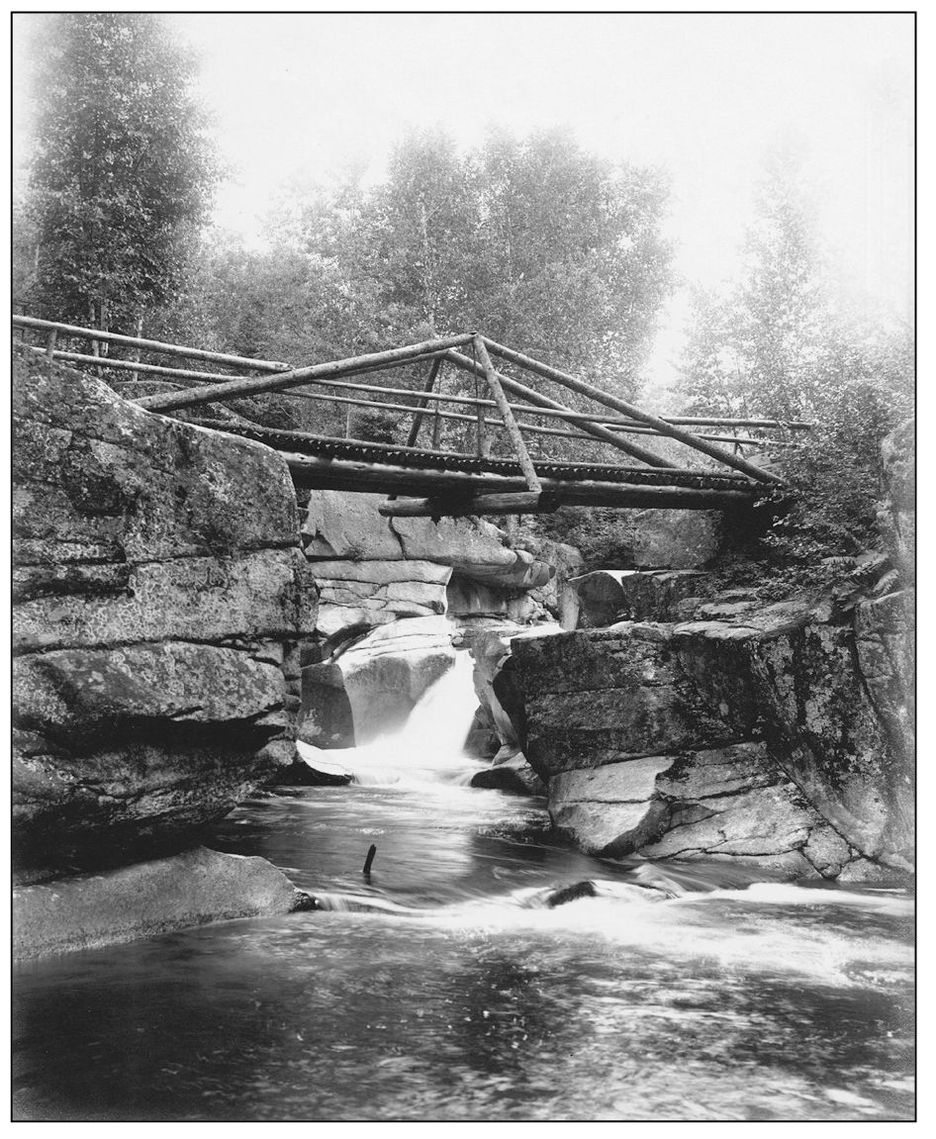
The Upper Ammonoosuc Falls is a striking example of the fury of the little stream as it rushes from its source in the Lake of the Clouds on the side of Mount Monroe. Here at the falls, it rushes and plunges over and under the ledges of glistening granite.
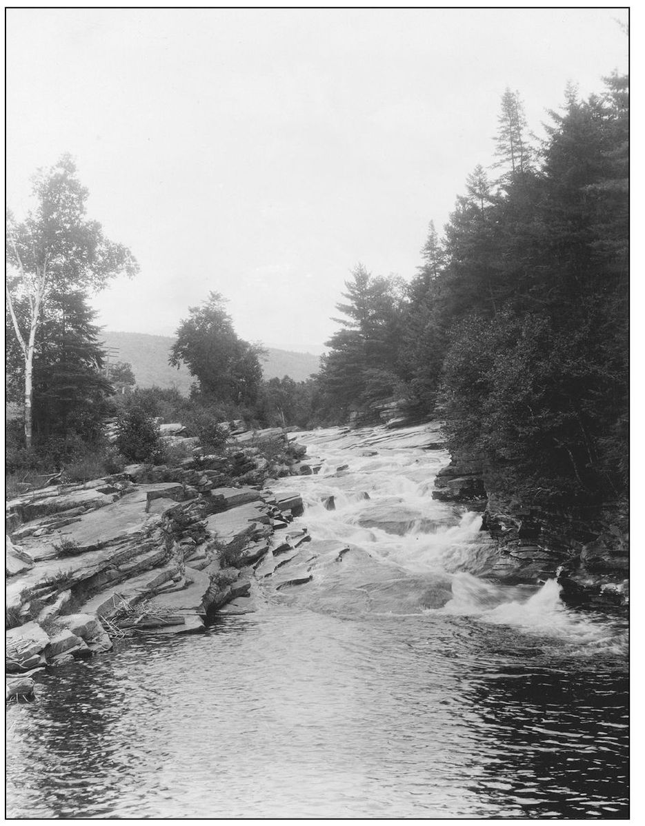
The Lower Falls of the Ammonoosuc River is located between Twin Mountains (elevation 4,761 feet) and Fabyan, along highway 302. The stream descends over rapids and falls for approximately 50 feet and then continues through a narrow gorge of polished ledges of granite. This has been called the wildest stream in all New England, and it may well be for its water drop.
Looking southwest, this is an aerial view of the Mount Washington Auto Road as it winds itself to the summit. It was built between 1855 and 1861. Mount Washington is seen capped in clouds at right. The Mount Washington Auto Road has watched all the events that have shaped the national forest. The 100th anniversary of the Weeks Act is being celebrated in 2011. From the center of the photograph to the left is Huntington Ravine, Tuckerman Ravine, and the Great Gulf of Slides carved out of the eastern slopes of Mount Washington and the Presidential Range.
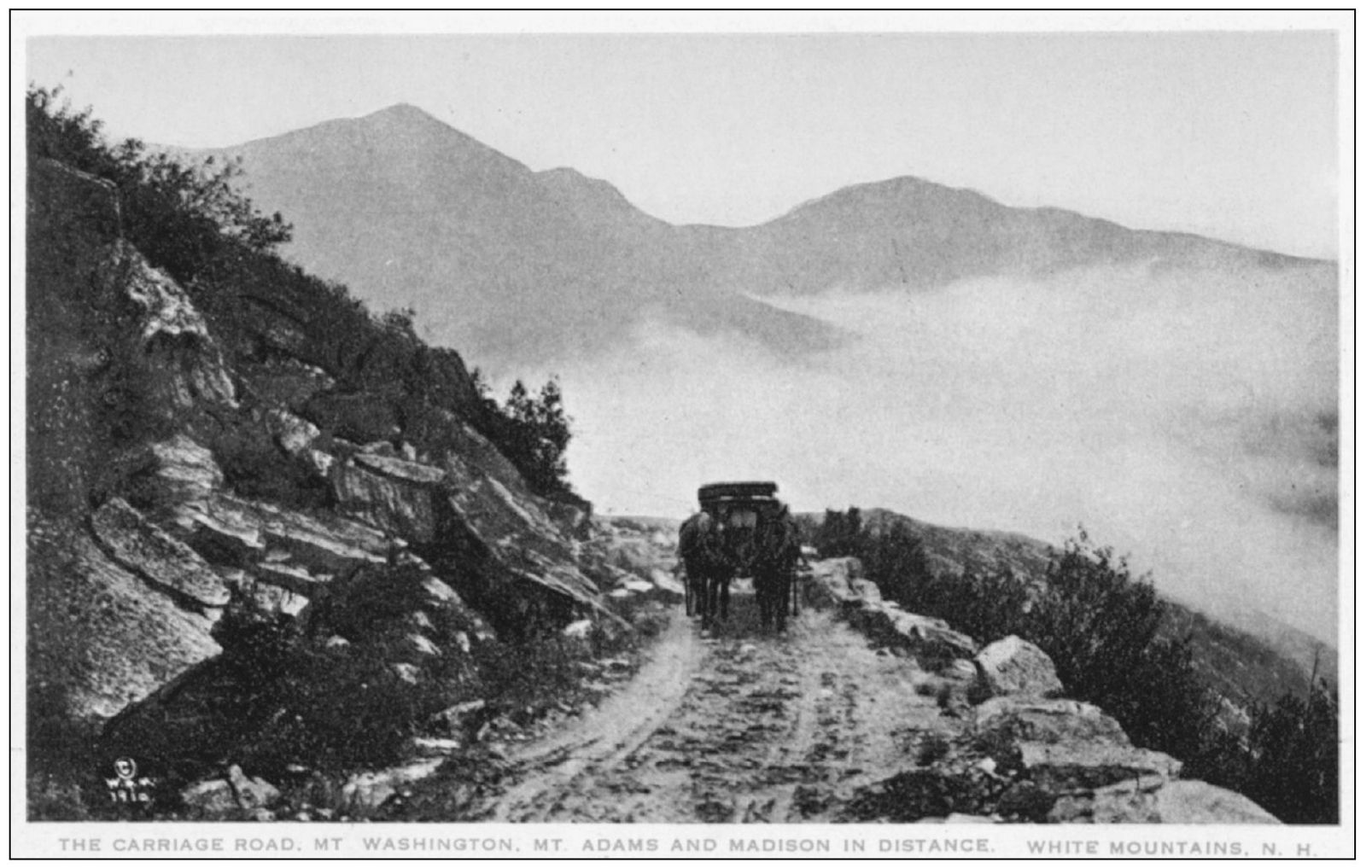
During the early 1900s, a horse-drawn carriage is proceeding up the road to the summit of Mount Washington. Mounts Adams (elevation 5774 feet) and Madison (elevation 5,366 feet) are seen in the distance. For the first few miles, the road climbs through thick scenic woods. The halfway point is almost exactly at the timberline, as seen in the photograph.
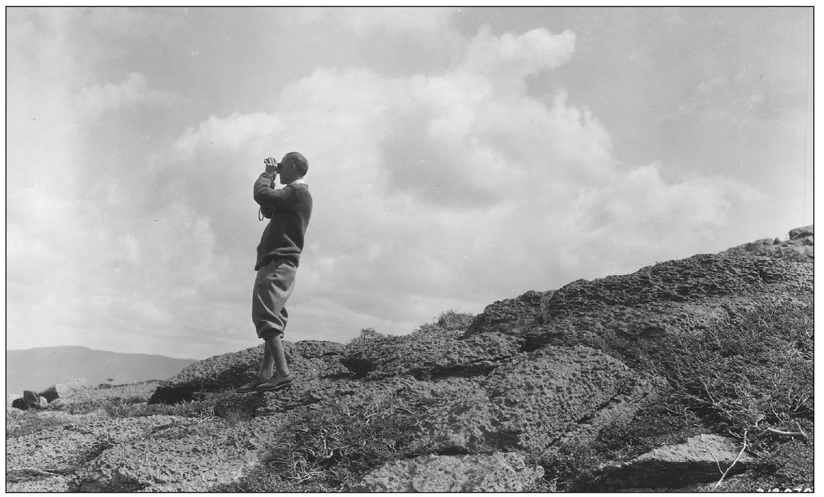
Near the summit of Mount Washington, an unidentified tourist is seen enjoying the view of the surrounding ranges. The first ascent of Mount Washington was made by Darby Fields, a New Hampshire settler who accomplished this feat in 1642 from a southerly approach of the mountain. Partly guided by Abenaki Indians and with only primitive equipment at his disposal, he is, thus, alleged to be the originator of all Mount Washington ascensions.
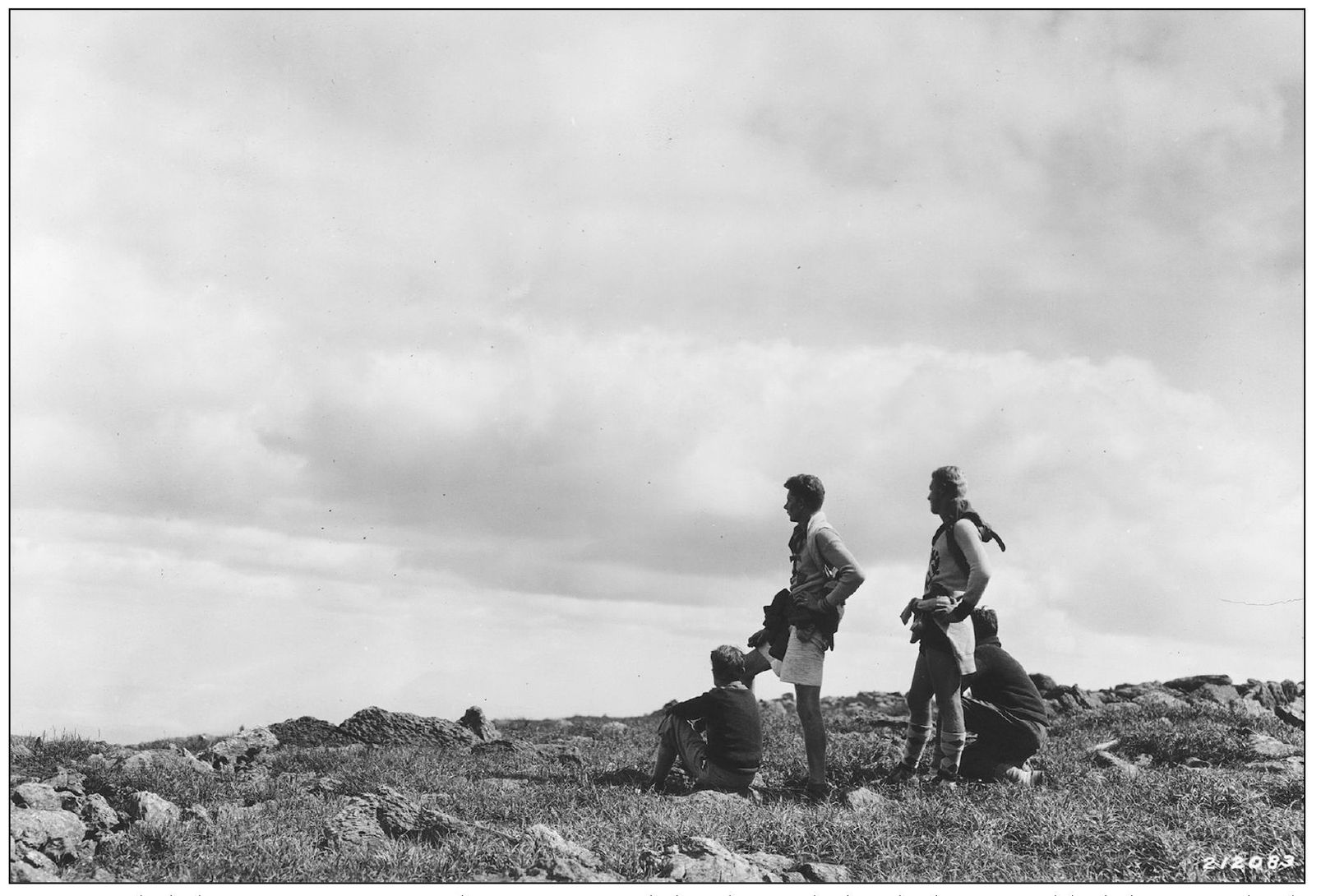
Many early hikers on Mount Washington found that loose, light clothing enabled them to climb more easily. There are well-marked trails, which offer many one-day tramps in the White Mountain National Forest. The Great Gulf Link Trail was formerly a segment of the Great Gulf Trail. It leaves Dolly Copp Campground at the south end of the main camp road, as seen here.
Font size:
Interval:
Bookmark:
Similar books «White Mountain National Forest and Great North Woods»
Look at similar books to White Mountain National Forest and Great North Woods. We have selected literature similar in name and meaning in the hope of providing readers with more options to find new, interesting, not yet read works.
Discussion, reviews of the book White Mountain National Forest and Great North Woods and just readers' own opinions. Leave your comments, write what you think about the work, its meaning or the main characters. Specify what exactly you liked and what you didn't like, and why you think so.