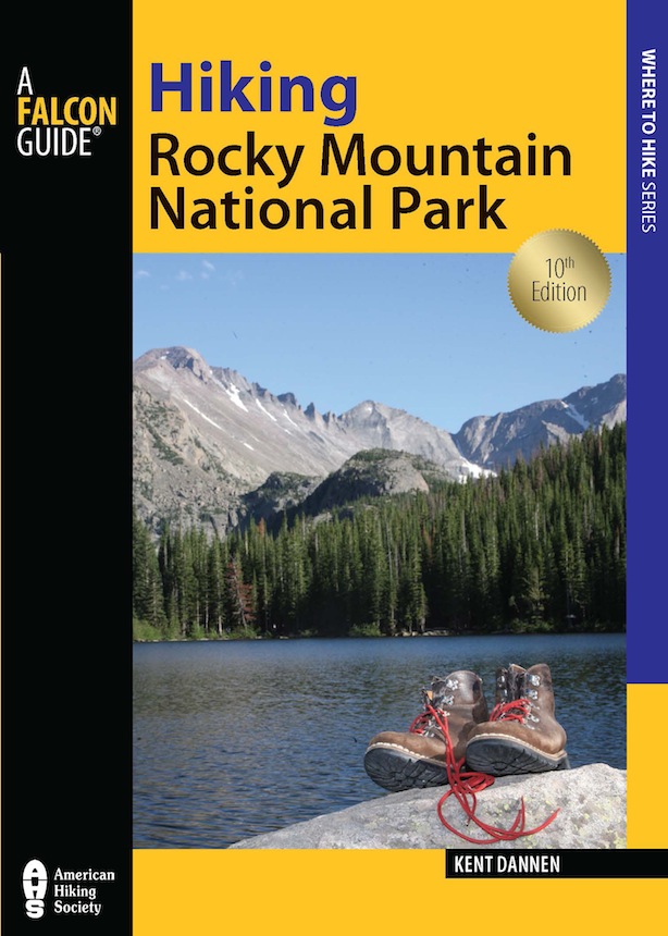
Hiking
rocky mountain national park
...trail expertise and gift for vivid wildlife descriptions make this book a must for the hikers backpack.
American West
A very comprehensive guide to the trails.
Colorado Daily
Remains the most comprehensive trail guide available to the Rocky Mountain National Park. Written for both day hikers and backpackers, it describes over 400 miles of trails in the park and in the adjacent Indian Peaks area.
Bookpaper
The definitive trail guide.
Kansas Motorist
Help Us Keep This Guide Up to Date
Every effort has been made by the author and editors to make this guide as accurate and useful as possible. However, many things can change after a guide is publishedestablishments close, phone numbers change, hiking trails are rerouted, facilities come under new management, etc.
We would appreciate hearing from you concerning your experiences with this guide and how you feel it could be made better and be kept up to date. While we may not be able to respond to all comments and suggestions, well take them to heart and well also make certain to share them with the author. Please send your comments and suggestions to the following address:
Globe Pequot Press
Reader Response/Editorial Department
PO Box 480
Guilford, CT 06437
Or you may e-mail us at:
editorial@globe-pequot.com
Thanks for your input, and happy travels!
Hiking
rocky mountain national park
Including Indian Peaks
Wilderness
Tenth Edition
Kent Dannen

Copyright 1978, 1979, 1980, 1982, 1983, 1985, 1989, 1994, 2002, 2012
Morris Book Publishing, LLC
All rights reserved. No part of this book may be reproduced or transmitted in any form by any means, electronic or mechanical, including photocopying and recording, or by any information storage and retrieval system, except as may be expressly permitted by the 1976 Copyright Act or by the publisher. Requests for permission should be made in writing to Globe Pequot Press, P.O. Box 480, Guilford, Connecticut 06437.
FalconGuides is an imprint of Globe Pequot Press.
Falcon, FalconGuides, and Outfit Your Mind are registered trademarks of Morris Book Publishing, LLC.
Illustrations by Dwight and Mary Ellen Dannen.
All maps reproduced courtesy US Geological Survey and USDA Forest Service.
Maps on pages 22 and 2425 created by Tony Moore, Globe Pequot Press.
Project editor: Heather Santiago
Layout: Sue Murray
ISBN 978-0-7627-9708-0
Printed in the United States of America
10 9 8 7 6 5 4 3 2 1
Ask for the ancient paths
where the good way is; and walk in it
and find rest for your souls.
Jeremiah 6:16
To my parents,
who showed me ancient paths:
Mary Ellen and Dwight Dannen
Contents
List of Maps
Note on the Maps
The maps for Hiking Rocky Mountain National Park were adapted from resource base maps prepared by the USDA Forest Service, Region 2, Denver, and from the US Geological Surveys topographic map of the park. I have made corrections to the original maps based on my hiking experience.
If you desire maps with a larger scale than those in this book, I recommend ordering 7.5-minute 1:24,000-scale quadrangle maps from the US Geological Survey, P.O. Box 25286, Denver 80255. Some quads are also available in area outdoor stores and in Rocky Mountain National Park book outlets.
The names of quads for Rocky Mountain National Park and Indian Peaks Wilderness Area are (in descending order of usefulness) McHenrys Peak, Longs Peak, Trail Ridge, Fall River Pass, Allens Park (spelling differs here from my text because USGS and US Postal Service spellings differ), Isolation Peak, Estes Park, Grand Lake, Mount Richthofen, Ward, Monarch Lake, East Portal, Nederland, Bowen Mountain, Glen Haven, Pingree Park, Comanche Peak, Chambers Lake, Clark Peak, Trail Mountain, Granby, Strawberry Lake, Gold Hill, Raymond, Panorama Peak, and Crystal Mountain. Circumambulating these maps when they are laid out together is a pretty long hike in itself.
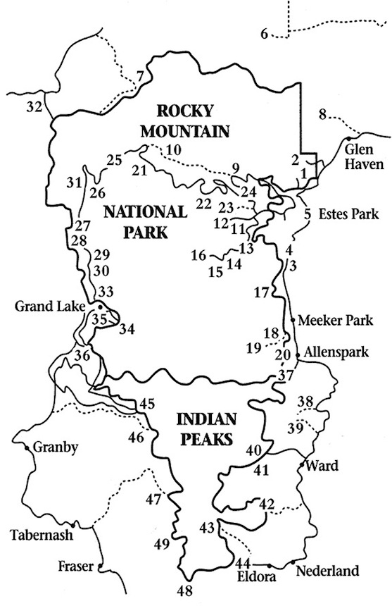
Trailhead Locator
EAST EDGE
1. (7,740')
2. (7,840')
3. (8,927')
4. (8,780')
5. (7,360')
MUMMY RANGE
6. (9,030')
7. (10,000')
8. (7,960')
9. (8,540')
10. (10,640')
MORAINE PARK
11. (8,080')
12. (8,155')
BEAR LAKE ROAD
13. (8,400')
14. (8,850')
15. (9,240')
BEAR LAKE TRAILHEAD
16. (9,475')
LONGS PEAK AND NEARBY GOALS
17. (9,400')
WILD BASIN
18. (8,312')
19. (8,500')
20. (8,526')
TRAIL RIDGE ROAD
21.Fall River Pass (11,796')
22. (11,440')
23. (8,440')
24. (8,930')
25. (10,750')
26. (9,000')
27. (8,884')
28. (8,864')
29. (8,765')
30. (8,794')
COLORADO RIVER TRAILS
31. (9,010')
32. (10,300')
GRAND LAKE AREA
33. (8,545')
34. (8,391')
35. (8,391')
36. (8,400')
INDIAN PEAKS, EAST OF THE DIVIDE
37. (8,800')
38. (8,638')
39. (9,161')
40. (10,480')
41. (10,480')
42. (9,960')
43. (10,121')
44. (9,009')
INDIAN PEAKS, WEST OF THE DIVIDE
45. (8,281')
46. (8,346')
47. (10,040')
48. (11,671')
49. (9,660')
Acknowledgments
The author thanks fellow hikers in the National Park Service and USDA Forest Service who checked the manuscript of this guidebook, refreshed my memories, supplied information on recent trail alterations, made many helpful suggestions, and caught mistakes. The value of this aid cannot be overstated. The staff of Rocky Mountain National Park created a special compliment by vehemently debating among themselves their criticisms of the text (the war of the marginal notes). These proofreaders will see much of their own effort in this book as they read it from cover to coverwith sharp red pencils ready.
I have set some place-names in boldface type to make descriptions of various destinations easier to find. I made decisions about what to emphasize by intuition based on many years of answering hikers questions.
Introduction
On Rocky Mountain National Park trails, it sometimes seems as if the whole world has heeded Jesuss command to rise, take up your bed, and walk. A conservative estimate indicates that 1.5 million people hike the park trails each year. In Roosevelt-Arapaho National Forest along the parks southern boundary, approximately 120,000 visitors hike the trails of the Indian Peaks Wilderness each year.
Obviously there is a quality to these mountains that multitudes of people want to experience. Just as obviously, that quality eventually will be stomped out by lug soles if we are careless in our use of this spectacular stretch of the Rockies.
In writing this guidebook I have two goals, neither of which is to encourage more people to hit the trail (an activity needing no encouragement). First, I want the book to help both novice and experienced hikers to enjoy the backcountry more fully. Second, and even more important, the guide is intended to help everyone use the Rocky Mountain wilderness in a disciplined way so it will not be loved to death.


