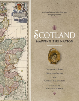
Susan Schulten - Mapping the Nation: History and Cartography in Nineteenth-Century America
Here you can read online Susan Schulten - Mapping the Nation: History and Cartography in Nineteenth-Century America full text of the book (entire story) in english for free. Download pdf and epub, get meaning, cover and reviews about this ebook. City: Chicago, year: 2012, publisher: University of Chicago Press, genre: History / Science. Description of the work, (preface) as well as reviews are available. Best literature library LitArk.com created for fans of good reading and offers a wide selection of genres:
Romance novel
Science fiction
Adventure
Detective
Science
History
Home and family
Prose
Art
Politics
Computer
Non-fiction
Religion
Business
Children
Humor
Choose a favorite category and find really read worthwhile books. Enjoy immersion in the world of imagination, feel the emotions of the characters or learn something new for yourself, make an fascinating discovery.

- Book:Mapping the Nation: History and Cartography in Nineteenth-Century America
- Author:
- Publisher:University of Chicago Press
- Genre:
- Year:2012
- City:Chicago
- Rating:4 / 5
- Favourites:Add to favourites
- Your mark:
Mapping the Nation: History and Cartography in Nineteenth-Century America: summary, description and annotation
We offer to read an annotation, description, summary or preface (depends on what the author of the book "Mapping the Nation: History and Cartography in Nineteenth-Century America" wrote himself). If you haven't found the necessary information about the book — write in the comments, we will try to find it.
In the nineteenth century, Americans began to use maps in radically new ways. For the first time, medical men mapped diseases to understand and prevent epidemics, natural scientists mapped climate and rainfall to uncover weather patterns, educators mapped the past to foster national loyalty among students, and Northerners mapped slavery to assess the power of the South. After the Civil War, federal agencies embraced statistical and thematic mapping in order to profile the ethnic, racial, economic, moral, and physical attributes of a reunified nation. By the end of the century, Congress had authorized a national archive of maps, an explicit recognition that old maps were not relics to be discarded but unique records of the nations past.
All of these experiments involved the realization that maps were not just illustrations of data, but visual tools that were uniquely equipped to convey complex ideas and information. In Mapping the Nation, Susan Schulten charts how maps of epidemic disease, slavery, census statistics, the environment, and the past demonstrated the analytical potential of cartography, and in the process transformed the very meaning of a map.
Today, statistical and thematic maps are so ubiquitous that we take for granted that data will be arranged cartographically. Whether for urban planning, public health, marketing, or political strategy, maps have become everyday tools of social organization, governance, and economics. The world we inhabitsaturated with maps and graphic informationgrew out of this sea change in spatial thought and representation in the nineteenth century, when Americans learned to see themselves and their nation in new dimensions.
Susan Schulten: author's other books
Who wrote Mapping the Nation: History and Cartography in Nineteenth-Century America? Find out the surname, the name of the author of the book and a list of all author's works by series.


Mapping the Nation: History and Cartography in Nineteenth-Century America — read online for free the complete book (whole text) full work
Below is the text of the book, divided by pages. System saving the place of the last page read, allows you to conveniently read the book "Mapping the Nation: History and Cartography in Nineteenth-Century America" online for free, without having to search again every time where you left off. Put a bookmark, and you can go to the page where you finished reading at any time.
Font size:
Interval:
Bookmark:
MAPPING THE NATION
History and Cartography in Nineteenth-Century America

SUSAN SCHULTEN
The University of Chicago Press
Chicago and London
SUSAN SCHULTEN is professor of history at the University of Denver. In 2010 she was named a fellow of the John Simon Guggenheim Foundation.
The University of Chicago Press, Chicago 60637
The University of Chicago Press, Ltd., London
2012 by The University of Chicago
All rights reserved. Published 2012.
Printed in the United States of America
21 20 19 18 17 16 15 14 13 12 1 2 3 4 5
ISBN-13: 978-0-226-74068-3 (cloth)
ISBN-10: 0-226-74068-4 (cloth)
ISBN-13: 978-0-226-74070-6 (e-book)
Portions of first appeared in The Cartography of Slavery and the Authority of Statistics, Civil War History 56, no. 1 (March 2010). 2010 The Kent State University Press. Reprinted with permission.
Library of Congress Cataloging-in-Publication Data
Schulten, Susan.
Mapping the nation: history and cartography in nineteenth-century America / Susan Schulten.
pages: illustrations, maps; cm
Includes bibliographical references and index.
ISBN-13: 978-0-226-74068-3 (cloth: alkaline paper)
ISBN-10: 0-226-74068-4 (cloth: alkaline paper) 1. Thematic mapsUnited StatesHistory19th century. 2. CartographyUnited StatesHistory19th century. 3. United StatesMapsHistory19th century. I. Title.
GA405.5.S38 2012
526.0973'09034dc23
2011046239
 This paper meets the requirements of ANSI/NISO Z39.481992 (Permanence of Paper).
CONTENTS

ILLUSTRATIONS

Illustrations discussed in this book can be viewed at high resolution at mappingthenation.com.
ACKNOWLEDGMENTS

I have incurred many debts with this project, and am happy to acknowledge them. Archival assistance was provided by Bob Karrow, Pat Morris, and John Powell at the Newberry Library; Wendel Cox, Bruce Hanson, and Coi Drummond-Gehrig at the Denver Public Library; Jovanka Ristic and Chris Baruth at the American Geographical Society Library in Milwaukee; Alan Jutzi at the Henry E. Huntington Library; Kelly Spring at Johns Hopkins University Special Collections Library; Ron Grim at the Boston Public Library; Emily Epstein at the Rare Book Department of the University of Colorado Medical Library; John Cloud and Albert Skip Theberge at the National Oceanic and Atmospheric Administration; Arlene Shaner at the New York Academy of Medicine; and Annie Brogan at the Philadelphia College of Physicians.
Michelle Kyner and the staff at the Interlibrary Loan Office at the University of Denver tirelessly procured materials for me. With its digital archive, the Geography and Map Division of the Library of Congress has made it infinitely easier to conduct research, and I thank Ed Redmond, John Hebert, Jim Flatnes, and Ralph Ehrenberg for sharing their considerable knowledge of the collection. At the Newberry Library in Chicago, I especially thank Jim Akerman, Bob Karrow, and Diane Dillon for their support over many years and research visits.
I presented specific aspects of the project to the C. V. Starr Center at Washington College, the Program in American Studies at Vanderbilt University, the Colorado Historical Society, the Rocky Mountain Map Society, the Chicago Map Society, the Colorado Regional Environmental History Working Group, the University of Colorado Health Sciences Center, the Social Science History Association, the University of Texas at Arlington, the Library of Congress, the University of Denver Geography Colloquium, and at several Newberry Library National Endowment for the Humanities Summer Institutes and Seminars. Art and Jan Holzheimer graciously invited me to speak in the Maps and America series at the American Geographical Society Library in Milwaukee.
I am grateful for the financial and institutional support of the Henry Huntington Library, the University of Denver, and the John Simon Guggenheim Memorial Foundation. For helping me navigate the meaning of maps I thank Cameron Bertron, Wendel Cox, Greg Hobbs, Wes Brown, Abby Smith Rumsey, Don McGuirk, Tom Overton, Curtis Bird, Steve Hoffenberg, Clay Risen, Bert Melcher, Katherine Schulten, Judy Schulten, Catherine Murdock, and Chris Lane. This project could not have been realized without David Rumsey, who has been remarkably generous with both his ideas and his collection.
Many historians shaped this project, most notably Elliott Gorn, Aaron Sachs, Ray Craib, Charles Rosenberg, Dan Crofts, Margo Anderson, Ted Widmer, Syd Nathans, Daniel Rosenberg, Thomas Andrews, Bill Philpott, Jim Grossman, Michael Robinson, Caleb McDaniel, and Paul Sutter. I also benefited greatly from exchanges with geographers, including Brian Page, Jeremy Crampton, Matt hew Edney, Mark Monmonier, Imre Demhardt, Neil Smith, Mike Heffernan, Karen Morin, Tom Koch, John Cloud, and those named above.
The digital component of this book was supported by the University of Denvers Penrose Library, the Center for Teaching and Learning, and the Office of the Vice-Provost for Research, and created with the help of Dresha Schaden, Greg Colati, Jacob Ratliff, Betty Meagher, John Adams, Chet Rebman, and Fernando Reyes. Alexander Karklins has been part of this project from the beginning, well suited to the task with his combination of historical training and technological expertise.
My colleagues at the university deserve special mention. Andy Goetz and the members of the geography department avidly responded to my ideas, while my students and fellow historians created an exceedingly hospitable place to teach and work. For their camaraderie and counsel I thank Ingrid Tague, Carol Helstosky, Seth Masket, Bin Ramke, Liz Escobedo, Jen Karas, Gregg Kvistad, and Sam Kamin.
Once again, Robert Devens has edited my work with patience and good judgment, while Jeffrey Waxman, Russell Damian, and Mark Reschke carefully shepherded it through production. My sincere appreciation to Bruce Kuklick, Robert Anderson, and the anonymous reviewers at the Press, all of whom offered enormously useful appraisals of the entire manuscript at several stages. My parents, siblings, and in-laws have been unfailing in their support, and I am especially grateful to Robert for his encouragement and interest in my work. I dedicate this book to my sons, who give me so much.
INTRODUCTION

In November 2008, California voters passed a statewide initiative that made same-sex marriage illegal. Proposition 8 dominated the states political season, with opponents denouncing outside groups such as the Mormon Church for funneling funds into California to back the initiative. Several weeks after the election, a group advocating gay marriage used the online program Google Maps to locate the homes and businesses of those who had financially supported Proposition 8 (
Next pageFont size:
Interval:
Bookmark:
Similar books «Mapping the Nation: History and Cartography in Nineteenth-Century America»
Look at similar books to Mapping the Nation: History and Cartography in Nineteenth-Century America. We have selected literature similar in name and meaning in the hope of providing readers with more options to find new, interesting, not yet read works.
Discussion, reviews of the book Mapping the Nation: History and Cartography in Nineteenth-Century America and just readers' own opinions. Leave your comments, write what you think about the work, its meaning or the main characters. Specify what exactly you liked and what you didn't like, and why you think so.