About the Author
Mike Laing is a freelance mountaineering instructor based in Snowdonia, North Wales. He has travelled, climbed and trekked extensively in Greenland, South America, Africa, Europe and the Himalaya. This is his first guidebook for which he completed the Kungsleden as a through hike in 2017 and visited again twice in 2018 to complete and update his research. Mike is a full member of the Association of Mountaineering Instructors (AMI) and operates his own business, Snowdonia Climbing.
TREKKING THE KUNGSLEDEN
THE KINGS TRAIL THROUGH NORTHERN SWEDEN
by Mike Laing
JUNIPER HOUSE, MURLEY MOSS,
OXENHOLME ROAD, KENDAL, CUMBRIA LA9 7RL
www.cicerone.co.uk
Mike Laing 2019
First edition 2019
ISBN 9781783627806
Printed in China on behalf of Latitude Press Ltd
A catalogue record for this book is available from the British Library.
Stage mapping by Lantmteriet Sverige www.lantmateriet.se
All photographs are by the author unless otherwise stated.
Contains OpenStreetMap.org data OpenStreetMap contributors, CC-BY-SA. NASA relief data courtesy of ESRI
Acknowledgements
Special thanks are due to Steve Robertshaw of Visit Sweden and Eva Gunnare for their generous and kind assistance with the glossary.
Updates to this Guide
While every effort is made by our authors to ensure the accuracy of guidebooks as they go to print, changes can occur during the lifetime of an edition. Any updates that we know of for this guide will be on the Cicerone website (www.cicerone.co.uk/982/updates), so please check before planning your trip. We also advise that you check information about such things as transport, accommodation and shops locally. Even rights of way can be altered over time. We are always grateful for information about any discrepancies between a guidebook and the facts on the ground, sent by email to updates@cicerone.co.uk or by post to Cicerone, Juniper House, Murley Moss, Oxenholme Road, Kendal, LA9 7RL.
Register your book : To sign up to receive free updates, special offers and GPX files where available, register your book at www.cicerone.co.uk.
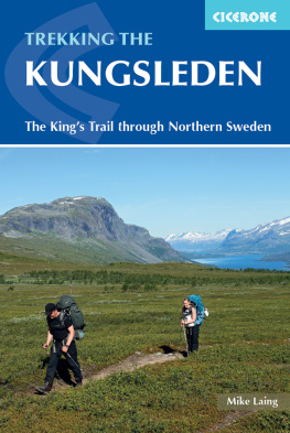
Front cover: Striding out on the open fell above Saltoluokta (Stage 9)
CONTENTS
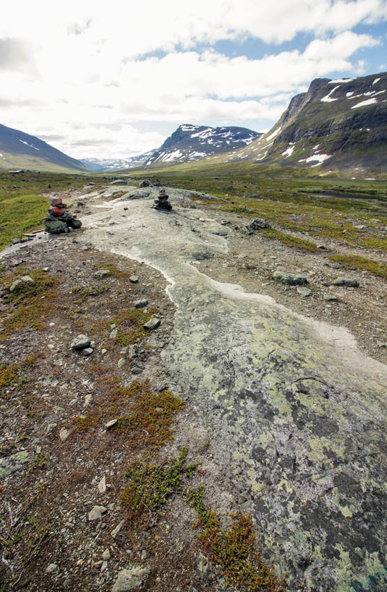
Glacially polished rock (Stage 5)
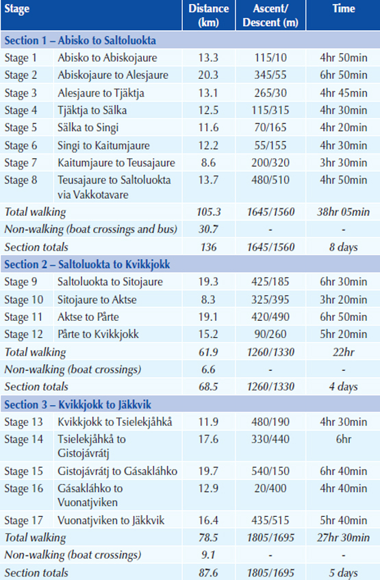
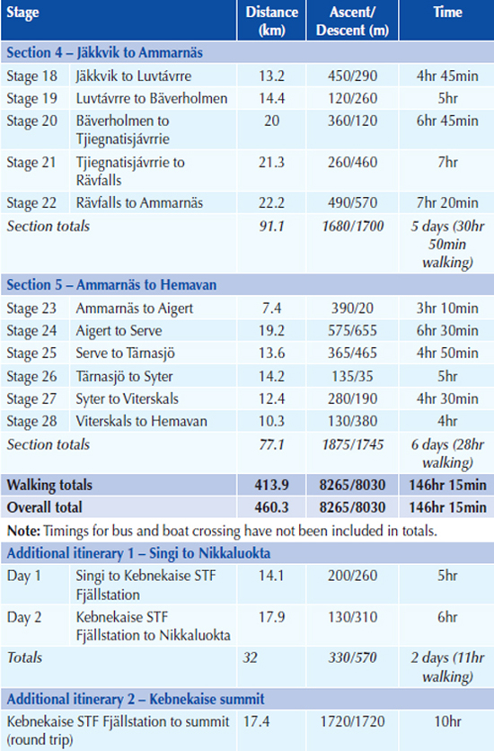
ROUTE SUMMARY TABLE

Crossing one of a number of bridges between Slka and Singi (Stage 5)
INTRODUCTION
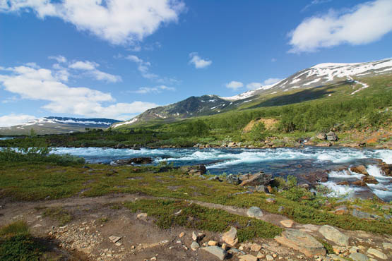
The Kaitumjkka River seen from the south bank (Stage 7)
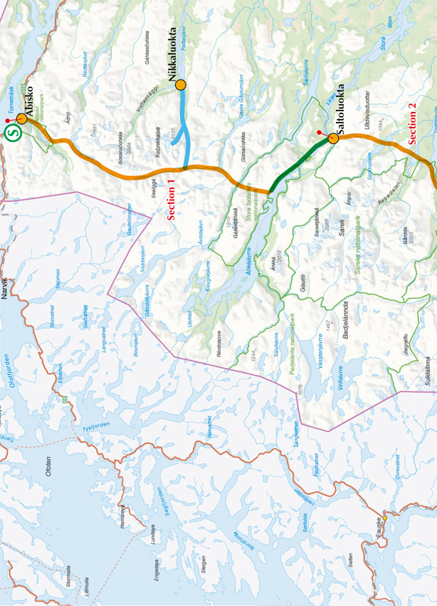
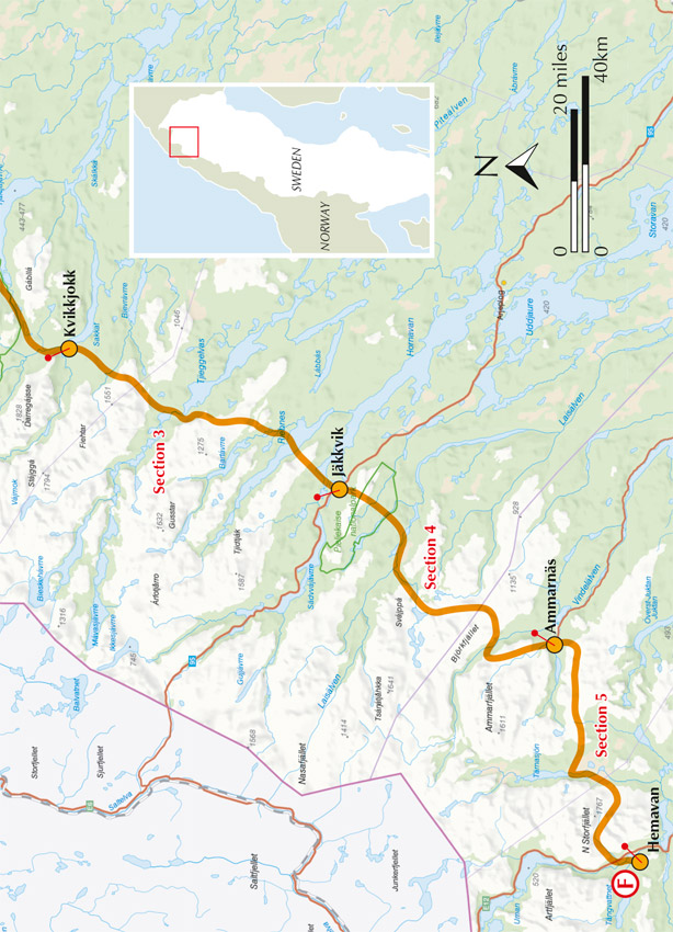
Swedens Kungsleden (or Kings Trail) embodies a diverse and unique walking experience whether it is taken in its entirety or just in part. Since its foundation in the early 20th Century by the Swedish Tourist Association (STF) the trail has grown and developed a section at a time from Abisko southwards to its current terminus in Hemavan, a total distance of 460km. For those visiting Sweden, Lappland and the Arctic for the first time the Kungsleden will be a grand adventure and a step into a new world; for many it will be the start of a long and rich association involving many repeated visits.
The Kungsleden is as varied as the Arctic wilderness is vast, traversing snow-topped mountain ranges, expansive open fell, verdant forests and crossing lakes both large and small. The trail begins by passing through the rugged Lapone Mountains, home to Kebnekaise, Swedens highest peak at 2098m (which can be summitted by means of a detour from the Abisko to Nikkaluokta circuit described in Additional itinerary 2). Like all long-distance trails the Kungsleden seeks the simplest line and in doing so traverses the Tjktjavagge, a 30km glacial valley with magnificent views along its entire length. Further south the landscape softens to embrace open fell and the pristine lakes at Kaitumjaure and Teusajaure. At Aktse the famous hay meadows are perfectly framed by the azure Ljtvrre delta and the sheer chiselled face of Skierrffe. Beyond Kvikkjokk the trail becomes much quieter as it negotiates the empty fells and forest as far as Jkkvik. On leaving Bverholmen the trail climbs onto the Arjeplog Fells, an extensive and tranquil area much favoured by fishermen and naturalists alike. A brief and tantalising taste of Vindellven precedes arrival into Ammarns, home to a beautiful amber coloured wooden church and the famous Potatisbacke (potato hill). On leaving Ammarns, open fells are followed as far as Trnasjn lake after which the Kungsleden finishes as it started, among the mountains. Crossing the perfectly u-shaped Syterskalet valley places you within a day of Hemavan and the finish.
The Kungsleden is a continuous route with five distinct sections, allowing plenty of choice when it comes to how much of the trail you wish, or are able, to undertake. Many walkers limited by time spend a week walking the spectacular 103km from Abisko to Nikkaluokta (Stages 15, followed by Additional itinerary 1) through some of the Kungsledens finest mountain scenery; an itinerary that includes the Tjktjavagge. Those with more time can link multiple sections or even complete the entire trail, an undertaking requiring between four and five unhurried weeks for the average walker.
Despite the remoteness of the terrain, bridges are provided where needed by the Norrbotten and Vsterbotten local councils, as are boardwalks across the roughest and boggiest ground. Three of the Kungsledens five sections are furnished with regular STF huts ( fjllstugor ) which offer a range of services and permit the weight-wary to walk with reduced loads. Most fjllstugor offer saunas which serve to ease aching muscles and reward you for your days efforts. From start to finish the trail is very well marked and signposted making it straightforward to follow.

Swedes in their element
For half its length the Kungsleden lies within the Arctic Circle and consequently a large measure of the summer walking season takes place in 24-hour daylight. This is also Spmi, home of the Smi people whose close relationship with the reindeer has underpinned their existence since the last ice age. The reindeer are mostly absent during the walking season, although the Smi are evidenced by their summer villages, their traditional dwellings ( ktor ), reindeer enclosures ( rengrden ) and remote huts.

