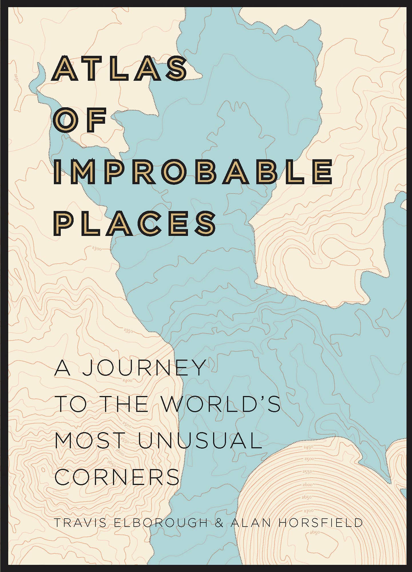
ATLAS OF IMPROBABLE PLACES
A JOURNEY TO THE WORLDS MOST UNUSUAL CORNERS
TRAVIS ELBOROUGH & ALAN HORSFIELD
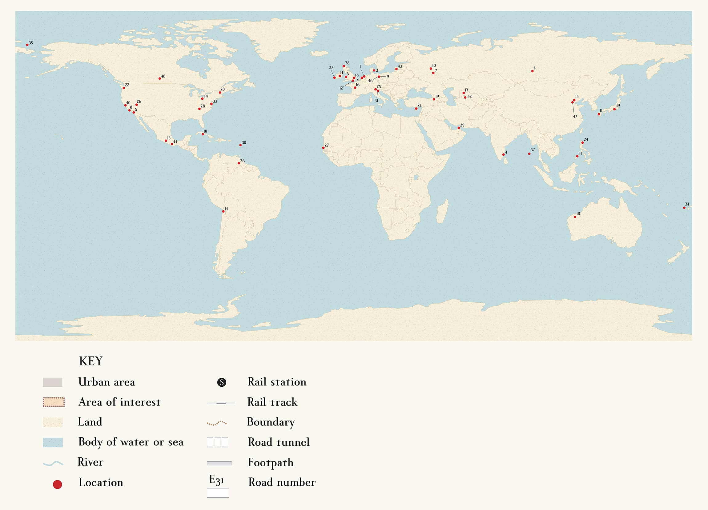
1 FLEVOPOLDER
2 ZHELEZNOGORSK
3 FREE CHRISTIANIA
4 AUROVILLE
5 SLAB CITY
6 PORTMEIRION
7 ZVYOZDNY GORODOK
8 HEARST CASTLE
9 TEUFELSBERG
10 PRESIDIO MODELO
11 BATTLESHIP ISLAND
12 NO MANS LAND FORT
13 THE LOST CITY OF SAN JUAN PARANGARICUTIRO
14 HUMBERSTONE AND SANTA LAURA
15 WONDERLAND
16 ORADOUR-SUR-GLANE
17 MUYNAK
18 WITTENOOM
19 ANI, KARS
20 CONCRETE CITY
21 VAROSHA
22 MARYHILL STONEHENGE
23 SPIJKENISSE
24 KABAYAN
25 SANTURIO MADONNA DELLA CORONA
26 LONDON BRIDGE, LAKE HAVASU
27 THE AFRICAN RENAISSANCE MONUMENT
28 TEN COMMANDMENTS MOUNTAIN
29 THE PALM
30 THE KINGDOM OF REDONDA
31 POVEGLIA ISLAND
32 GREAT BLASKET
33 HOLLAND ISLAND
34 PALMERSTON
35 WRANGEL ISLAND
36 MOUNT RORAIMA
37 ROSS ISLAND
38 HIRTA
39 AOKIGAHARA
40 COLMA
41 LEAP CASTLE
42 DARVAZA CRATER
43 THE HILL OF CROSSES
44 THE ISLAND OF DOLLS
45 THE UNDERGROUND POSTAL RAILWAY
46 COLD WAR SPY TUNNEL
47 BEIJING UNDERGROUND
48 MOOSE JAW
49 CINCINNATI
50 ZKP TAGANSKY, AKA BUNKER 42
51 PUERTO PRINCESA
To my wife Emily, for joining me on the journey
INTRODUCTION
Maps, the great Italian writer Italo Calvino once maintained, presuppose the idea of a narrative because they are conceived on the basis of a journey, an odyssey. The earliest need to fix places on stone, skin or primitive paper was fundamentally linked to travel and the earliest cartographers looked to the sky rather than the earth for their starting points of reference. Today heavenly bodies, arguably, still guide us, as we take directions from GPS systems beaming information from satellites orbiting our planet. But the gulf between the age of the sextant and the wooden sailing ship, when so much of the world remained uncharted territory, and our satellite navigation-enabled present, seems impossibly vast.
To travel back then was often to embark on a journey into the unknown, with the final destination vague or the subject of wild speculation if not outright fiction, and one which the voyager might never reach let alone return from. We are, of course, the lucky beneficiaries of such sometimes suicidal pioneering expeditions. Places that were once the stuff of dreams and improbable to the point of implausibility are as accessible and now almost as familiar to us as our own neighbourhoods. Though that is not without its downsides entirely. Few of us believe the world is flat. But an hour or so on Google Maps or TripAdvisor surveying an increasingly interconnected and corporately globalized planet can definitely make us feel that it is flatter. Or at least rather less fantastical and strange than it was for our ancestors: a case of here be dragons on the far corner of a sketchily drawn map giving way to here be some well-known brands and chain shops flagged upon arrival on your phones app.
It was Calvino again who over forty years ago, in Invisible Cities, presciently invented a fictional metropolis called Trude whose overwhelming characteristic is that it is exactly the same as everywhere else. If on arriving at Trude I had not read the citys name written in big letters, the storys narrator states, I would have thought I was landing at the same airport from which I had taken off. At the end of the tale, his traveller, bored by Trudes similarity with so many other places, begs to leave but is informed they will only arrive at another Trude, absolutely the same, detail by detail. The world is covered by a sole Trude which does not begin and does not end. Only the name of the airport changes.
But claims about the growing, soul-crushing similarity of places can be overstated, as hopefully this volume illustrates. Thankfully, the world continues to be a dizzyingly diverse place. Our appetite for the unusual and the out of the ordinary has, if anything, only been heightened by new technology, the scanning and sharing of fresh information and imagery themselves a spur to further travel, and post-industrialization changing the kinds of places we find intriguing, beautiful or worthy of cursory investigation. When almost every action we perform online is tracked and all things digital attempt to distance us from the body and physical disintegration, its perhaps not so surprising that our fascination with the utterly abandoned, the long unobserved, the decayed and ruined has increased exponentially. That pictures of a weed-infested factory or decaying mansion in Detroit or St Louis, say, will frequently have their greatest currency on Instagram or other social media sites, only reaffirms rather than contradicts a particular contemporary desire to seek out the obscure and the unburnished.
The Atlas of Improbable Places, then, is intended as a compendium of unlikely, curious and plain odd locales. The improbability factor, if you will, of each of these places was that they were distinguished by some element of their architecture, natural geography or present or past state of being. Improbability may have been inherent at the beginning, or thrust upon them later or only accrued in recent times, but these places all have stories to tell us. The map may not be the territory, just as written history is not the sum of any individual place. But ideally we need to read them both to reach a greater understanding of where we are and where we might be going.
DREAM CREATIONS
FLEVOPOLDER
THE REGION RECLAIMED FROM THE SEA
LELYSTAD [NETHERLANDS]
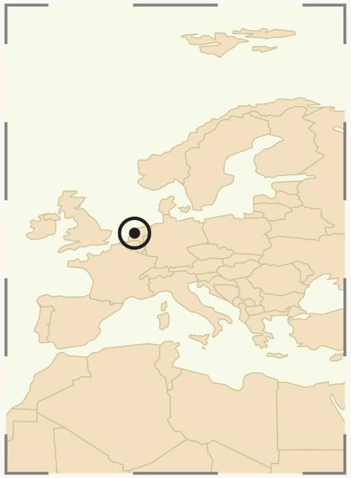
52 30' 0"N
5 28' 0"E
F or nearly 2,000 years, the occupants of what is today the Netherlands have been locked into an almost Sisyphean battle to hold back and reclaim land from the sea. Traces of this struggle can be detected in the remains of ancient terpen, or earth mounds, that still survive in certain parts of the country. Dating from around 500 BC these edifices, along with earthen dykes, served as the most basic bulwark against flooding for the earliest settlers to these often sodden lands. But such defences alone could hardly be expected to halt the advances of a rampaging North Sea, and a series of particularly savage storms in the eleventh and twelfth centuries led to the deaths from drowning of tens of thousands and water permanently claiming huge swathes of the northern coast. One beneficiary of these topographical changes, however, was the estuary town of Amsterdam, which suddenly found itself with a direct route to the ocean and subsequently developed into a major port and finally wound up as the capital city.
Still, the story of this country, over half of which presently lies below sea level, is as much about land gain as loss. God, it is said, may have created the world, but the Dutch gave the world the Netherlands. Around 10 per cent of the whole country is made up of bits that were once under water. And much of the rest of it would be, too, but for an extensive network of canals, dams, drains and dykes that were begun in the Middle Ages. By the fifteenth century, the Dutch had developed a highly sophisticated hydro-engineering system, one that involved using encircling dykes and water-pumping windmills hence their ubiquity in this landscape to drain quite substantial tranches of saturated ground and complete ponds, rivers and lakes. The resulting drained lands, known as


