• Complain

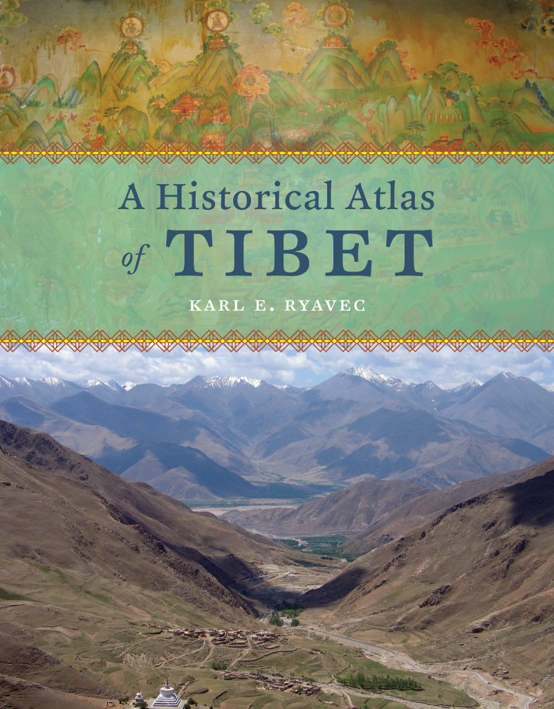
Karl E. Ryavec - A Historical Atlas of Tibet

Here you can read online Karl E. Ryavec - A Historical Atlas of Tibet full text of the book (entire story) in english for free. Download pdf and epub, get meaning, cover and reviews about this ebook. year: 2015, publisher: University of Chicago Press, genre: Home and family. Description of the work, (preface) as well as reviews are available. Best literature library LitArk.com created for fans of good reading and offers a wide selection of genres:

Romance novel Science fiction Adventure Detective Science History Home and family Prose Art Politics Computer Non-fiction Religion Business Children Humor

Choose a favorite category and find really read worthwhile books. Enjoy immersion in the world of imagination, feel the emotions of the characters or learn something new for yourself, make an fascinating discovery.

Karl E. Ryavec A Historical Atlas of Tibet
  • Book:
    A Historical Atlas of Tibet
  • Author:
  • Publisher:
    University of Chicago Press
  • Genre:
  • Year:
    2015
  • Rating:
    5 / 5
  • Favourites:
    Add to favourites
  • Your mark:
    • 100
    • 1
    • 2
    • 3
    • 4
    • 5

A Historical Atlas of Tibet: summary, description and annotation

We offer to read an annotation, description, summary or preface (depends on what the author of the book "A Historical Atlas of Tibet" wrote himself). If you haven't found the necessary information about the book — write in the comments, we will try to find it.

Cradled among the worlds highest mountainsand sheltering one of its most devout religious communitiesTibet is, for many of us, an ultimate destination, a place that touches the heavens, a place only barely in our world, at its very end. In recent decades Western fascination with Tibet has soared, from the rise of Tibetan studies in academia to the rock concerts aimed at supporting its independence to the simple fact that most of usfar from any base campknow exactly what a sherpa is. And yet any sustained look into Tibet as a place, any attempt to find ones way around its high plateaus and through its deep history, will yield this surprising fact: we have barely mapped it. With this atlas, Karl E. Ryavec rights that wrong, sweeping aside the image of Tibet as Shangri-La and putting in its place a comprehensive vision of the region as it really is, a civilization in its own right. And the results are absolutely stunning.
The product of twelve years of research and eight more of mapmaking, A Historical Atlas of Tibet documents cultural and religious sites across the Tibetan Plateau and its bordering regions from the Paleolithic and Neolithic times all the way up to today. It ranges through the five main periods in Tibetan history, offering introductory maps of each followed by details of western, central, and eastern regions. It beautifully visualizes the history of Tibetan Buddhism, tracing its spread throughout Asia, with thousands of temples mapped, both within Tibet and across North China and Mongolia, all the way to Beijing. There are maps of major polities and their territorial administrations, as well as of the kingdoms of Guge and Purang in western Tibet, and of Derge and Nangchen in Kham. There are town plans of Lhasa and maps that focus on history and language, on population, natural resources, and contemporary politics.
Extraordinarily comprehensive and absolutely gorgeous, this overdue volume will be a cornerstone in cartography, Asian studies, Buddhist studies, and in the libraries or on the coffee tables of anyone who has ever felt the draw of the landscapes, people, and cultures of the highest place on Earth.

Karl E. Ryavec: author's other books


Who wrote A Historical Atlas of Tibet? Find out the surname, the name of the author of the book and a list of all author's works by series.

A Historical Atlas of Tibet — read online for free the complete book (whole text) full work

Below is the text of the book, divided by pages. System saving the place of the last page read, allows you to conveniently read the book "A Historical Atlas of Tibet" online for free, without having to search again every time where you left off. Put a bookmark, and you can go to the page where you finished reading at any time.

Light

Font size:

Reset

Interval:

Bookmark:

Make
A Historical Atlas of Tibet A Historical Atlas of tibet KARL E RYAVEC The - photo 1
A Historical Atlas of Tibet
A Historical Atlas of tibet

KARL E. RYAVEC

The University of Chicago Press :: Chicago and London

Karl E. Ryavec is associate professor of world heritage at the University of California, Merced.

The University of Chicago Press, Chicago 60637

The University of Chicago Press, Ltd., London

2015 by The University of Chicago

All maps 2015 Karl E. Ryavec

All rights reserved. Published 2015.

Printed in Canada

24 23 22 21 20 19 18 17 16 15 1 2 3 4 5

ISBN-13: 978-0-226-73244-2(cloth)

ISBN-13: 978-0-226-24394-8(e-book)

DOI: 10.7208/chicago/9780226243948.001.0001

Library of Congress Cataloging-in-Publication Data

Ryavec, Karl E., author.

A historical atlas of Tibet / Karl E. Ryavec.

pages cm

2015 by The University of Chicago.

All maps by Karl E. Ryavec.

Includes bibliographical references and index.

ISBN 978-0-226-73244-2 (cloth : alk. paper) ISBN 978-0-226-24394-8 (e-book) 1. Tibet Autonomous Region (China)Historical geographyMaps. 2. Tibet Autonomous Region (China)HistoryMaps. I. Title

G2308.T5R9 2015

911'.515dc23

2014038399

This paper meets the requirements of ANSI/NISO Z39.481992 (Permanence of Paper).

To my parents

CONTENTS

Tibet and the Tibetan culture region

Tibet and surrounding civilizations

Major regions and natural features of Tibet

Tibetan macroregions

The structure of Tibetan history: Core regions, peripheries, and trade networks circa 1900

The historical Tibetan world: Travel time and main trade patterns circa 1900

Long-distance trade items listed in the Yushu Diaocha Ji (Yushu investigation record), 1919

The Tibetic languages

The Tibetic languages

How to use this atlas: Map coverage and cartographic conventions

Paleolithic and Neolithic cultures on the Tibetan Plateau, circa 30,0002000 BCE

The ancient Tibetan world, circa 2000 BCE to 600 CE

Forts and royal residences listed in Bonpo literary sources

Ancient principalities (rGyal phran) according to circa 9th-century Dunhuang documents

Territorial administration system and important religious sites of the Imperial Period, circa 600842

Territories of the administrative chiefs (mKhos dpon)

Garrisons (Khrom chen po)

The one thousand household districts (sTong sde) of Upper Zhangzhung, Lower Zhangzhung, and Sumpa Horn

The Horn (Ru), Border Subduing (mTha dul), and Frontier (Yang dul) Temples

Central Tibet circa 600842: The imperial territorial administration system

The Eighteen Shares of Power (dBang ris bco brgyad)

The Four Horns of Tibet (Bod ru bzhi)

The one thousand household districts (sTong sde) and administrative districts (Yul dpon tshan / Yul sde) of Central Horn, Right Horn, Left Horn, and Branch Horn

Central Tibet circa 600900: Religious and cultural sites of the Imperial Period

Lhasa town plan

The thirty-seven holy/assembly places of the Bonpo

Central Tibet 650764: Annual sites of the royal court and council

Annual sites of the Tibetan Royal Court (Pho brang) and council (Dun ma)

Chronology of the Tibetan emperors (bTsan po)

Major polities and important religious sites during the aftermath of empire and the Second Diffusion of Buddhism, circa 8421240

The Kagyu schools

Central Tibet circa 9001240: Aftermath of empire and religious sites founded during the Second Diffusion of Buddhism

Lhasa Valley plan

Lhasa town plan

The regional principalities (rJe dpon tshan)

Ngari circa 9001100: The kingdoms of Ngari Khorsum

Religious and cultural sites founded in the core region of the Guge Kingdom, circa 10th14th centuries

The twenty-one minor foundations of Rinchen Zangpo

Chronology of the kings of Guge, Part 1

Religious and cultural sites founded in Purang and the Kailash region, circa 10th17th centuries

Ngari circa 11001250: Guge divided and the rise of Yatse

Amdo circa 9001240: The Tsongkha Kingdom, and religious sites founded during the Second Diffusion of Buddhism

Major polities and important religious sites of the Mongol Empire Period, circa 12401354

Mongol administrative system for Tibet

Central Tibet circa 12401354: Symbolic Sakya rule and religious sites founded during the Mongol Empire Period

The ten thousand household districts (Khri skor / Wanhu)

Ngari circa 12501365: Yatse-Gungtang rivalry during the Mongol Empire Period

Amdo circa 12401368: The Mongol conquest, and religious sites founded during the Mongol Empire Period

Important Tibeto-Mongol Buddhist monasteries founded during the 12th to 16th centuries

Important Tibetan Buddhist monasteries of Beijing founded during the Yuan and Ming Periods, circa 13th16th centuries

Major polities and important religious sites of the Pakmodrupa Period, circa 13541642

Chinese Ming Dynasty titles bestowed on important Tibetan religious hierarchs

Birthplaces of the First through Fifth Dalai Lamas

Birthplaces of the First through Fourth Panchen Lamas

Central Tibet circa 13541642: Rival powers and religious sites founded during the Pakmodrupa Period

Lhasa Valley plan

Lhasa town plan

Fortresses (rDzong) established circa 135060 by the Pakmodrupa

Principal fiefs and estates of the Pakmodrupa, circa 1300s

Ngari circa 13651630: The resurgence of Guge

Religious and cultural sites in the core region of the Guge Kingdom, circa 15th17th centuries

Tsaparang Fort plan

Toling Monastery plan

Chronology of the kings of Guge, Part 2

Amdo circa 13681644: Local monastic powers in relation to Chinas Ming Dynasty

Major polities of the Ganden Podrang Period, circa 16421900

Important religious and cultural sites of the Ganden Podrang Period, circa 16421951

Main annual Tibetan trade fairs

Birthplaces of the Sixth through Fourteenth Dalai Lamas

Birthplaces of the Fifth through Eleventh Panchen Lamas

Central Tibet circa 16421951: Religious and cultural sites of the Ganden Podrang Period

Lhasa Valley plan

Lhasa town plan

Fortresses (rDzong) of the Ganden Podrang governments territorial administration system circa 1830

Fortresses and estates supervised by the Tashi Lhunpo Monastic Corporation (bLa brang) until 1923

Frontiers and forts of the Ganden Podrang Period, circa 19001951

Fortresses (rDzong) and estates (gZhis ka) staffed by lay or ecclesiastic governors

Boundaries of the Simla Convention signed by Great Britain and Tibet in 1914

Central Tibet circa 19121951: The territorial administration system of the Ganden Podrang government

Fortresses (rDzong) and estates (gZhis ka) staffed by lay or ecclesiastic governors

Ngari circa 16301959: Incorporation into Tibets Ganden Podrang administrative system

Amdo circa 16441911: Local monastic powers in relation to Chinas Qing Dynasty

Kham circa 16421911: The Khampa polities in relation to Central Tibet and China

Main polities of Eastern Kham and Gyelrong

The Thirty-Nine Hor Tribes

The Derge Kingdom: Territorial administration system, circa 16301909

Forts and palaces of the Derge Kingdom

The Nangchen Kingdom: Territorial administration system, circa 17251951

The one hundred household districts (Be hu / Baihu)

The twenty-five tribes of Yushu

Next page
Light

Font size:

Reset

Interval:

Bookmark:

Make

Similar books «A Historical Atlas of Tibet»

Look at similar books to A Historical Atlas of Tibet. We have selected literature similar in name and meaning in the hope of providing readers with more options to find new, interesting, not yet read works.


Reviews about «A Historical Atlas of Tibet»

Discussion, reviews of the book A Historical Atlas of Tibet and just readers' own opinions. Leave your comments, write what you think about the work, its meaning or the main characters. Specify what exactly you liked and what you didn't like, and why you think so.