Firast published 1998
This edition published 2010
This electronic edition published 2012
Amberley Publishing
The Hill, Stroud, Gloucestershire GL5 4EP
www.amberley-books.com
Copyright Guy de la Bdoyre 2010, 2012
The right of Guy de la Bdoyre to be identified as the Author of this work has been asserted in accordance with the Copyrights, Designs and Patents Act 1988.
All rights reserved. No part of this book may be reprinted or reproduced or utilised in any form or by any electronic, mechanical or other means, now known or hereafter invented, including photocopying and recording, or in any information storage or retrieval system, without the permission in writing from the Publishers.
British Library Cataloguing in Publication Data.
A catalogue record for this book is available from the British Library.
ISBN 978-1-84868-940-4 (PRINT)
ISBN 978-1-4456-1213-3 (E-book)
Contents
Maps
N.B. Maps are sketch-maps and are not to scale.
They are designed for guidance only.
Foreword
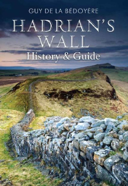
This book was originally written to provide a one-stop guide to the history and archaeology of Hadrians Wall. I first visited the Wall in 1968; I was transfixed by this astonishing monument and the civilization that created it, and I have continued to visit it many times since. The Wall can be see in so many ways: a symbol of Roman imperialist oppression, an example of the Roman worlds ability to create order in the chaos of the natural world and thus anticipate our own efforts to create a sense of security, a device to hold back the barbarian hordes or alternatively to hold back those without the Empire who were desperate to participate in its benefits. Its psychological impact as a division between England and Scotland is just as powerful even if it scarcely corresponds at all with the real national boundaries.
Perhaps the most exciting development has been the discovery of the Staffordshire Moorlands cup. This small enamelled bronze vessel was found by a metal detector user in the West Midlands in 2003 and it names several of the Wall forts. Although it is not the first such vessel to be found, this Roman souvenir of the Wall system is the first to name the frontier for us. It was called the Aelian Wall, named after the man whose idea it was, Publius Aelius Hadrianus.
Since I first wrote this book archaeology and our heritage have become ever more popular. Today tens of thousands of visitors brave northern Englands gales and rains to wonder at the remains of Hadrians system, whether in the forts at Housesteads and Birdoswald or the fragments scattered through Newcastle and its suburbs. As ever nothing in this book should be taken to suggest that any of the features are automatically accessible unless explicitly stated at the locations. Fortunately this is usually obvious thanks to English Heritage or footpath signs. Inevitably phone numbers and other details are bound to change in time. The reader should check for current details at the time any visit is planned as a precaution.
Guy de la Bdoyre
Welby, Lincolnshire 2010
How to use this book
This book is designed for visitors who have access to transport of any sort, and intend to visit Hadrians Wall on a single day, or several different days. Lying mostly between Newcastle and Carlisle, the Wall is relatively easily visited by car, motorcycle, bicycle, and public transport. Both Newcastle and Carlisle are on main-line railway routes from the south and north, and are connected by a cross-country route with stations at Hexham, Haydon Bridge, Bardon Mill, Haltwhistle, and Brampton. In the summer months local buses run from Hexham, Haltwhistle, and Carlisle stations to the Wall.
The division into chapters draws together parts of the Wall which can be easily seen in a short day, two chapters in a single long day. Much will depend on the time of year and the weather. In summer, long days on the Wall can be particularly rewarding, but even in sunny conditions the strength of the wind can be rather debilitating after several hours. The book is designed to be equally useful for visitors walking the Wall from one end to the other. The text is intended to be practical and straightforward while on location, but reading in advance should prove profitable. Sections of the Wall which are no longer visible or accessible are generally outside the scope of this book, unless they are of special interest and relevant to understanding the Wall system.
For readers who wish to understand the archaeology and history of the Wall in greater depth, an appendix of Sources is provided; this details the principal literary references to the Wall and the more important Roman monumental inscriptions. A Glossary also covers some of the more commonly-used technical and Roman terms which crop up.
Sites
Major Wall sites are indicated in bold type, for example HOUSESTEADS (principal forts, and museums) and Banks East Turret (Wall features such as milecastles and turrets). These are either museums, or locations where remains are properly signposted from the main road, and usually have designated parking facilities. Full details of access are provided under the heading. Other features are indicated by capitals, for example LIMESTONE CORNER. These are places often of some interest, but which are not instantly or easily accessible.
Finds from the various sites have generally been removed to one of three museums: The Museum of Antiquities in Newcastle upon Tyne, Chesters Museum, and Tullie House Museum in Carlisle. In the text these are referred to as Newcastle, Chesters, and Carlisle respectively. Brief descriptions are given where appropriate in the route along the Wall. Most other finds are deposited at Housesteads site museum, Vindolanda site museum, Carvoran Roman Army Museum, South Shields Arbeia Roman Fort Museum, and in London at the British Museum.
Although the Wall can largely be walked for free, the forts and museums mostly carry admission charges. One cost-effective method of covering the cost is to join English Heritage as a member (contact their Customer Services Department on 0870 3331182, or visit www.english-heritage.org.uk). This is good value for families, and will take care of Chesters, Housesteads, and Birdoswald. However, this solution does not cover Vindolanda, Carvoran Roman Army Museum, and Tullie House in Carlisle. Wallsend, Newcastle, and South Shields are free. Not everywhere is open all year but the major sites at Housesteads, Corbridge, and Chesters are.
Maps
Ordnance Survey maps are best for exploring the Wall. Throughout the text full grid references are given. A small number of simple sketch maps (not to scale) are included in this book, designed only for guidance. The 1989 edition of the Ordnance Surveys Historical Map and Guide to Hadrians Wall is quite handy for general information but difficult to use. The 1972 version is easier to read and much more useful. More practical on the whole are the standard 1:50 000 Series maps. Numbers 85-88 cover the Wall area with 86 and 87 relevant to the central sector (including a large overlap) where most of the important Wall sites are. The Pathfinder 1:25 000 Series maps are the best but their cost and limited area coverage make them an expensive option. Pathfinder 546 Haltwhistle & Gilsland, however, covers all the way from Housesteads to Birdoswald. For the Newcastle area the Geographers A-Z Map Companys AZ street atlas for the area is indispensable and includes a map of the Metro network on the back cover.
Equipment and clothing
Land management along the Wall means that designated sites are equipped with maintained footpaths and stiles over field walls and fences. However, the Wall crosses spectacular stretches of up-country and there are some places, especially in the central sector, where small children and those unsure on their feet may have difficulty. Wet-weather clothing is essential, as is a good pair of walking shoes.
Next page
